The Berço
Quiet river valleys, weathered mining districts, and older ways of life that continue largely unchanged.
North and northwest of Diamantina, the Espinhaço turns inward. The terrain becomes more varied, routes narrow and fade, and movement follows the traces of those who have lived and worked here for generations.
Trails link small communities—quilombola villages, former mining settlements, and rural outposts shaped by both isolation and continuity. Many of these paths predate modern travel, and in places, they remain part of daily life.
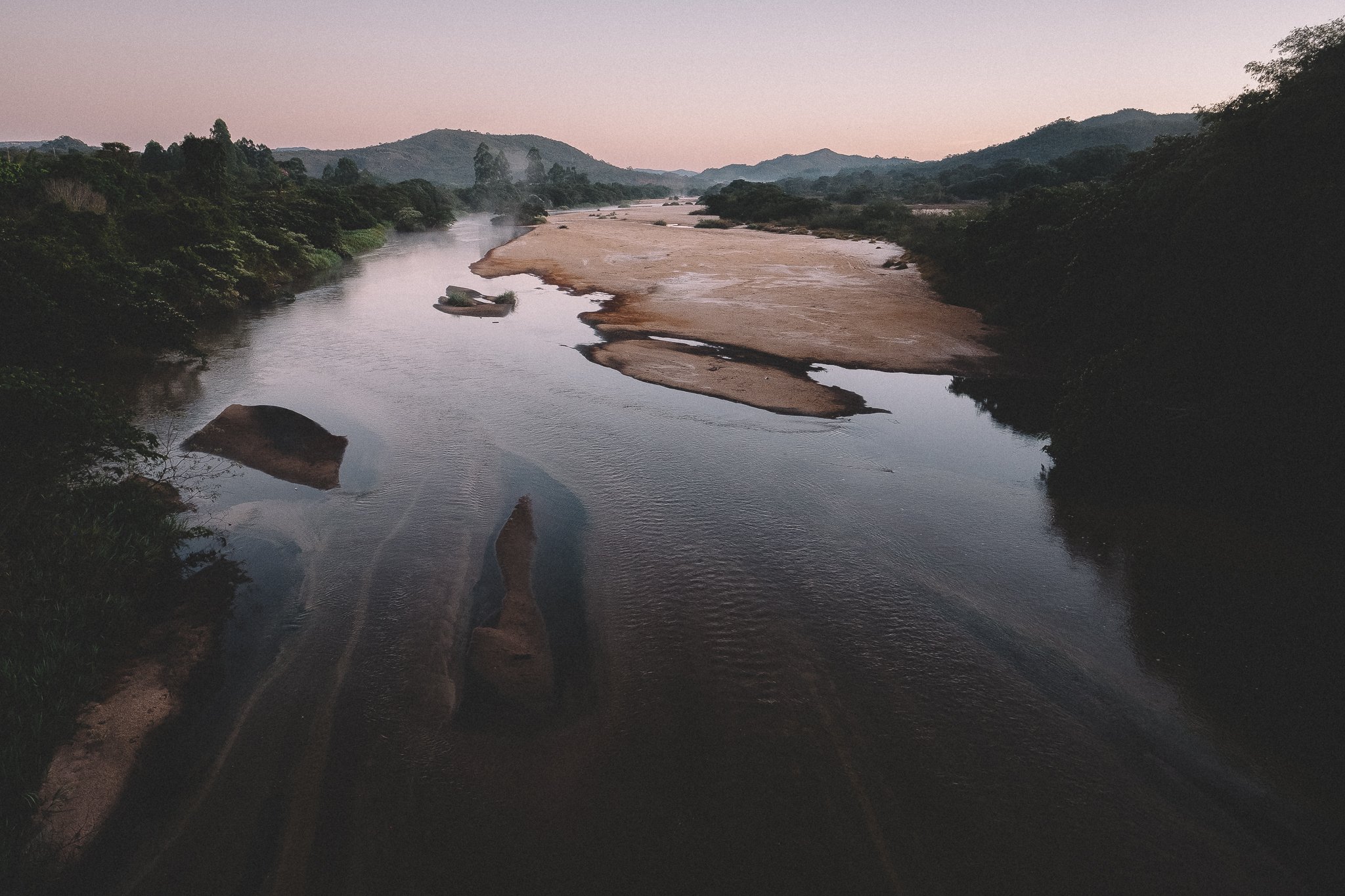
The landscape itself reflects that history. River valleys cut through dense forest and high savannah fields, with white sand banks, cola-colored water, and stretches of preserved terrain that feel less discovered than remembered.
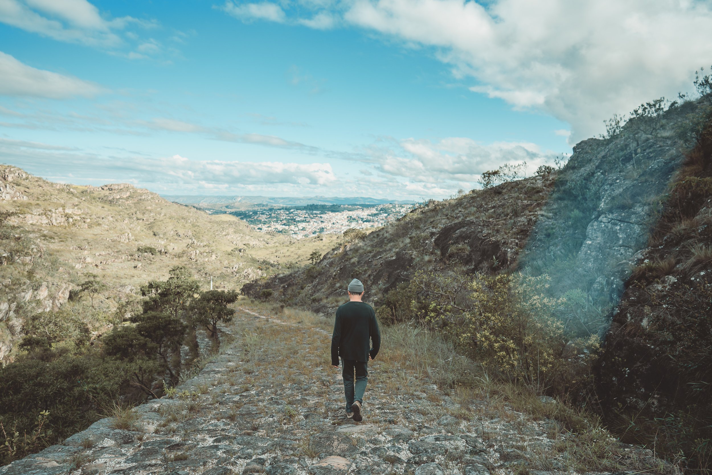
The Berço is our circuit through this part of the range—a place where travel slows, not because the terrain demands it, but because the ground holds more than one layer of time.
Rio Preto (April)
At a Glance
The Berço encompasses the northern and northwestern reaches of the Espinhaço Meridional, extending outward from Diamantina into a network of high plateaus, river valleys, and former mining districts that remain lightly traveled today. It includes the southernmost reaches of Sempre Vivas National Park, Biribiri State Park, and a wide range of rural communities spread across the surrounding landscape.
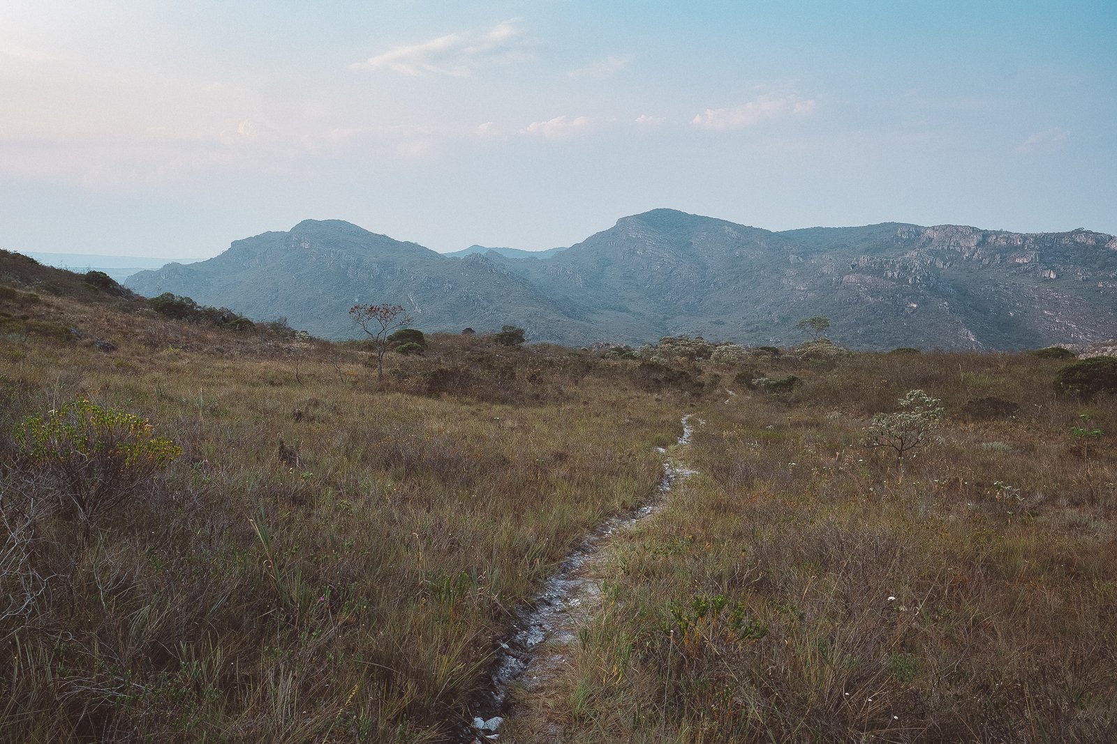
The terrain is varied and often demanding. Trails follow old mining routes, mule paths, and local footpaths, moving between high savannah in its many forms, forested valleys, riverbeds, and stretches of overgrown ground that can be difficult to read. Occasionally, dirt roads provide the way forward. In many cases, these routes are no longer maintained, and movement requires steady attention. On higher ground, poacher and flower-picker trails still move quietly through the fields.
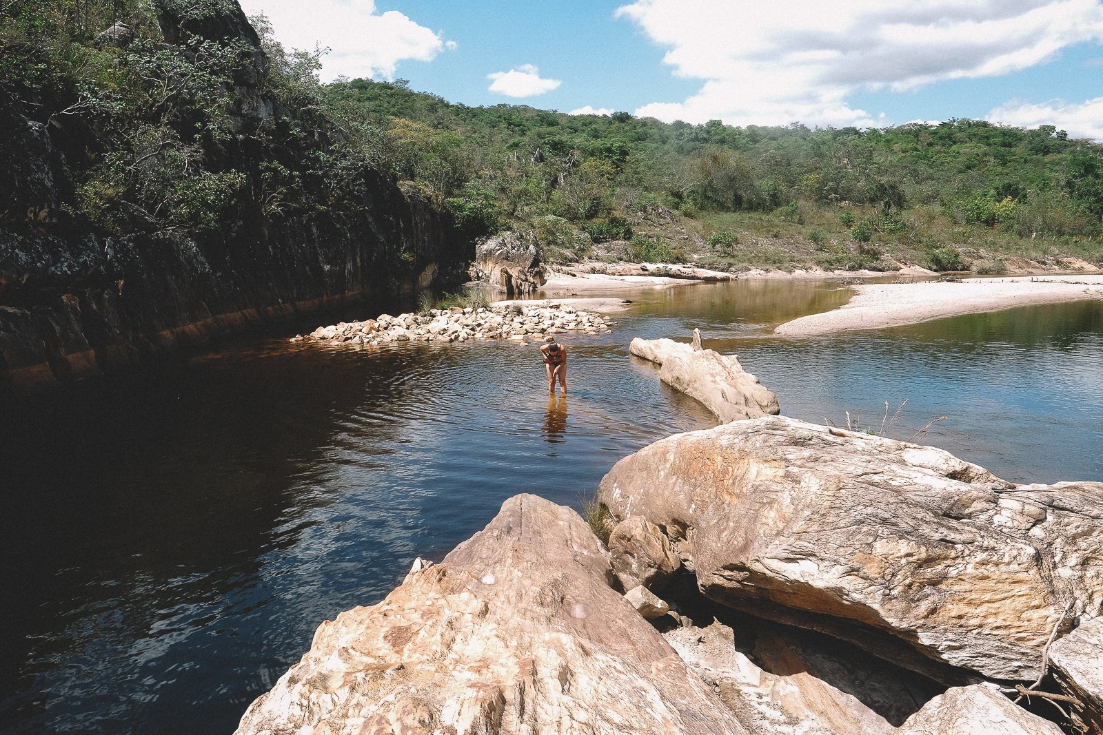
Water is present throughout the region. Rivers and streams cut through the valleys, with white sand banks, shaded swimming holes, and waterfalls appearing across the landscape, often just off the main routes. In many places, these waterways were once central to diamond extraction, and their traces remain visible today.
The region’s history remains close to the surface. Former mining towns, many now diminished, sit alongside quilombola villages whose presence dates back generations. Riverbanks and old quarries still bear the marks of extraction, while slave-built stone roads and old tropeiro routes remain intact in places, including sections of the Caminho dos Escravos that continue to connect the backcountry to Diamantina.
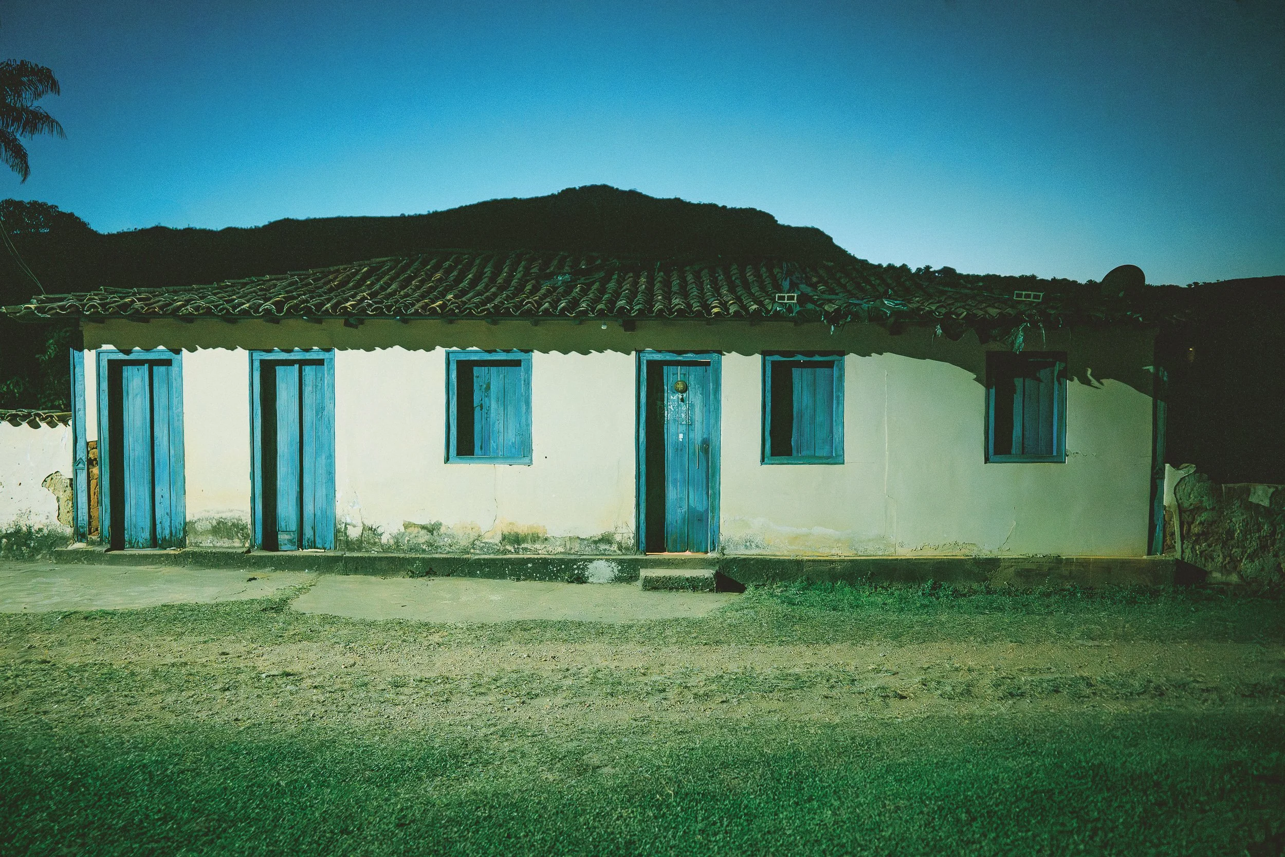
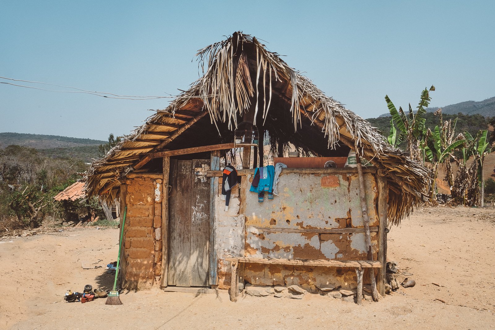
Life in the Berço moves at a slower pace. Villages are small, commerce is limited, and much of daily life takes place out of view—within homes, backyard plots, and the fields beyond town. Accommodations reflect that reality, with homestays and backcountry campsites forming the majority, alongside the occasional small inn.
Though it can be traveled on its own, the Berço is often reached as part of a longer journey through the Espinhaço, where it becomes a more inward stretch of the crossing.
Who This Circuit Is For
The Berço tends to suit travelers who want to go deeper into the story of the range, toward places well beyond the usual routes, where both the landscape and communities feel largely untouched by outside attention.
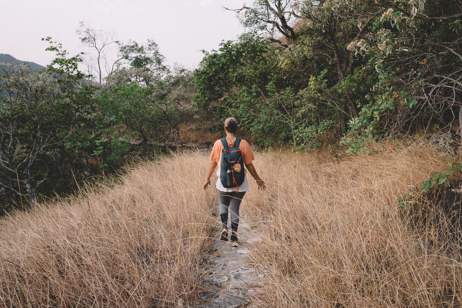
While much of the circuit can be reached by vehicle, it’s ideally experienced on foot—with certain stretches well suited for horseback. What matters most here isn’t how the ground is covered, but how closely it’s experienced.
On the trail, routes pass through a mix of high campo, forest, and old mining ground that has largely returned to itself—overgrown, undisturbed, and, at times, difficult to read. Even moderate days can require focus, and longer stretches ask for steady presence across uneven terrain.
In villages, the pace downshifts considerably. Small mining towns and quilombola communities sit alongside the landscape, with little in the way of commerce and few signs of outside investment. Life unfolds on front steps, in the street, and in the spaces between homes, shaped more by continuity than by change.
Tourism remains minimal in this part of the Espinhaço. Infrastructure is limited, and outside attention is rare. Life continues on its own terms, without much need for anything beyond what’s already there. People are welcoming in an unforced way, and daily routines carry on at their own pace.
For those seeking open highland trails or lively small town evenings, the Berço can be more demanding than it first appears. The terrain requires attention, and the region asks for a more deliberate way of moving through it.
For others, this is exactly the draw. The Berço suits travelers who are comfortable going beyond the usual routes, who need little along the way, and who value discovery in its simplest form: through the landscape itself, the people encountered, and the sense of having spent time in a place that remains, in many ways, its own.

The old school trail (July)
Trails & Routes — Draft (Berço)
Routes in the Berço are built from what remains.
Old mining roads, mule paths, and locally used footpaths connect the region, crossing between high savannah, forested valleys, and stretches of ground that have largely returned to themselves. In many places, these routes are no longer maintained. Trails fade, reappear, and shift with the terrain, and moving through them requires steady attention.
Some of the most intact routes are those that were built to last. Sections of the Caminho dos Escravos still hold their form—stone laid carefully across steep ground, linking the backcountry to Diamantina much as they once did. Elsewhere, older paths continue as part of daily life, used by residents moving between towns, fields, and neighboring communities.
Not all movement here follows a single line. Routes branch, reconnect, and occasionally disappear altogether, particularly in areas where the land has been left to grow back. In these stretches, navigation is less about following a trail than recognizing where one once passed.
The result is a network that is both connected and irregular—one that reflects how the region was used, rather than how it might be designed today.


vale do Rio Preto (April)
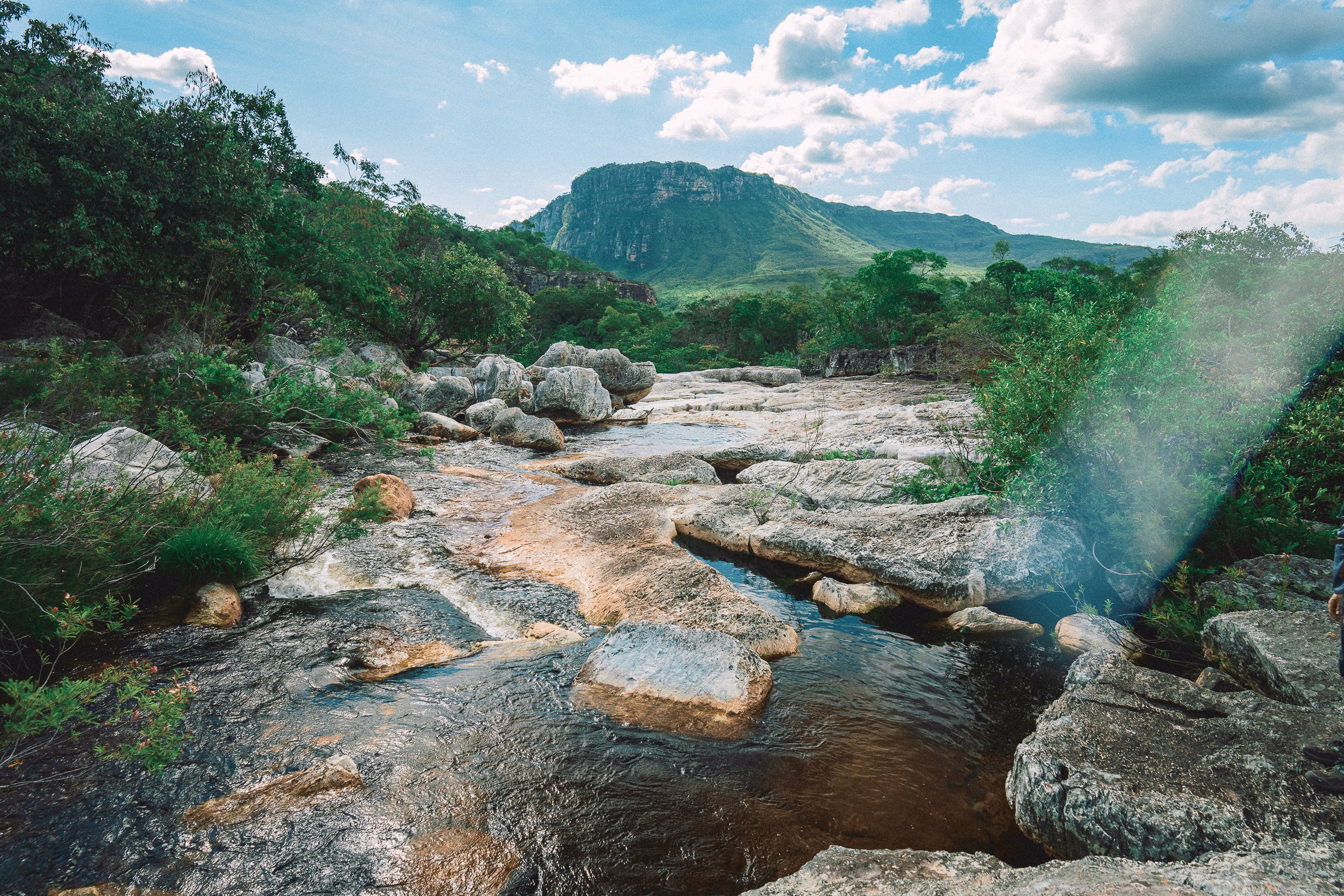
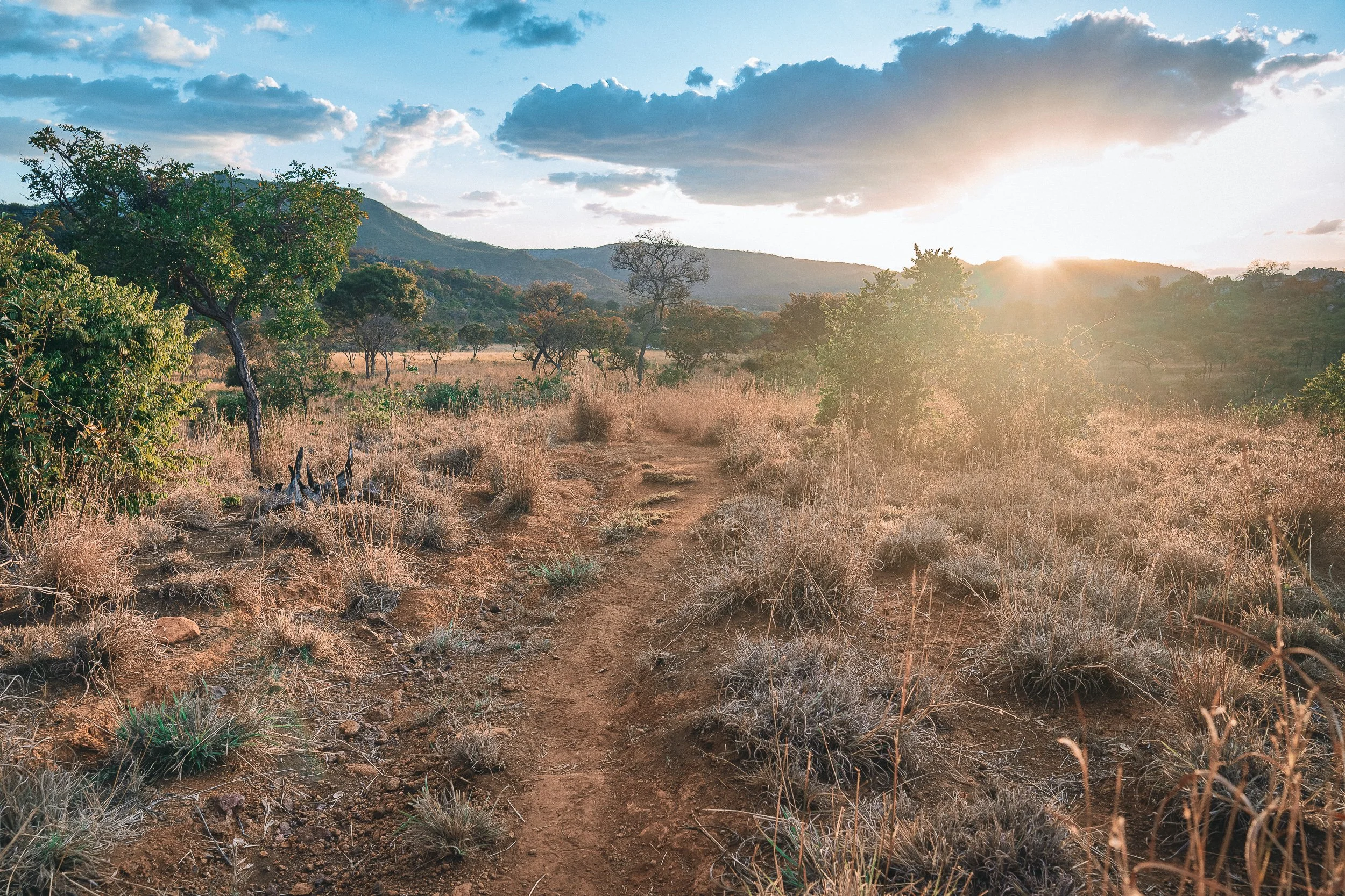
Highlight: Trekking & riding the Vale do Rio Preto
Whenever folks ask us about our favorite trails in the Espinhaço (a fun, but exceedingly difficult exercise), this one comes to mind. A long, wild, and lost carousel of Tolkienesque wetlands, sandy peaks, and flowery highlands that lingers on the mind as more of a feeling of exhilaration & enchantment than an actual (National Park) trail.
Go Outside Magazine agrees, recently naming it one of the 5 most beautiful treks in Brazil (alongside world-famous treks in Mount Roraima & Chapada Diamantina).
The trail can be done in a single long, arduous day, but is best experienced as an (also arduous) 2 or even 3-day crossing, allowing us to camp & spend evenings along the river’s white sand banks.
The Vale do Rio Preto isn’t just one of our favorite trails in the Espinhaço, it’s one of our favorite places. Here’s hoping you find time to experience it during your trip.

Trail Conditions, April

Final Climb, April

Water Crossing, October

Water Crossing, April
Biribiri, August
Highlight: Biribirí State Park
Located just a stone’s throw (and a wild hair) away from 50,000 lively residents, with 42,000 acres of lush cerrado, dozens of miles of well-kept trails, a pair of highly Instagrammable (and swimmable) waterfalls, and a historic textile mill-turned-gated community of the same name, it’s no wonder that Biribiri State Park is the most visited conservation unit in the Espinhaço.
While its location adjacent to Diamantina can make the Park (& its pub) a bit of a hotspot for locals during weekends & holidays, the vast majority of visitors tend to stick to the road & roadside waterfalls, meaning we often have the Park’s network of gorgeous trails to ourselves.
Historic yet modern, urban yet rural, rustic yet comfortable, and surrounded by agua, serra, and cerrado, Biribiri’s vila makes for an incredibly natural segue back to civilization (i.e. Diamantina) after any journey in the Espinhaço backcountry.

The Historic vila In October

Poço Verde in September

Serra dos Cristais in September

Finger Foods & Craft Brews, Biribiri
Caminho dos Escravos IN April
Highlight: Caminho dos Escravos
Many of Brazil’s colonial-era roads—and certainly the most visually arresting ones—were built by slaves, and many of them continue to be referred to as caminhos dos escravos (literally, “ways of the slaves”). In this part of the Espinhaço, however, there is really only one “Caminho dos Escravos”: an impressive 20-km stone cascade that runs north/south between Diamantina & the colonial-era mining district of Mendanha (pop. 639).
As notorious for its steep trajectory as it is for its checkered history (slave-drivers, bandits, and miners comprised most of its foot traffic), the Caminho stands as a stark reminder of what Brazil was—and how it got there—and features numerous stretches of remarkably well-preserved and restored roadway.
There are a variety of ways to integrate the Caminho into regional treks, but we most often find ourselves on it during our return trips to civilization (Diamantina) from long backcountry jaunts. It’s difficult to imagine a more profound or perfect final step for a journey in this part of the world.
Pau-A-Pique hoUSE, Quarteis do Indaia (September)
Pau-A-Pique hoUSE, Quarteis do Indaia (September)
Pau-A-Pique hoUSE, Quarteis do Indaia (September)
Highlight: Quilombola Communities
The discovery of diamonds in the Serra do Espinhaço directly and dramatically changed the fortunes of not only Europe, but of Africa. Quilombos—semi-autonomous backcountry communities founded by former slaves prior to the 19th century—bear witness.
The Jequitinhona River Valley administrative district (of which Diamantina is the capital) is home to more than 80 official quilombo communities (and many more unofficial ones), dozens of which dot the Espinhaço. Bucolic, unpretentious, and near-universally backdropped by stunning scenery (not coincidentally: the early founders were often rural workers on remote ranches, or runaways who sought to move as far from civilized areas as possible), they provide an unforgettable glimpse into the diverse cultural landscape of the Espinhaço and Brazil, at large.
Several of our favorite quilombola communities (official & unofficial) are located in the Berço. Should we have time to visit them during your trip, we promise an unforgettable experience.
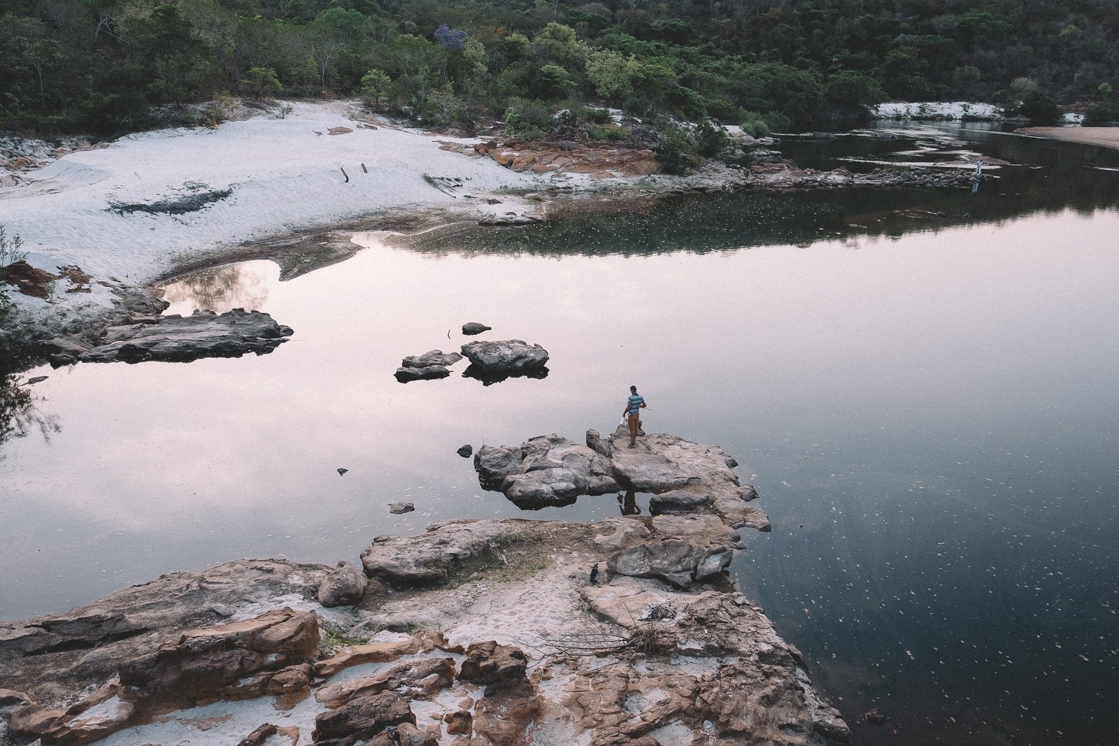
Swimming Hole (October)
The Berço: Rivers, Beaches, WAterfalls & Swimming Holes
Centuries of mining for diamonds along the waterways north of Diamantina have resulted in some of the Espinhaço’s most profoundly beautiful scenes. Exuberant Atlantic Rainforest, shimmering white sand beaches, cola-colored rivers, and pristine cascades offer plenty of reprieve during long days on the trail here…
Jequitinhonha River, July

Swimming Hole, September

Lagoon, January
Jequitinhonha River, August

CampSite, Vale do Rio Preto (April)
The BErço: WHere We Sleep
In our minds, the most enriching accommodations are paradoxical in their offerings, providing us with both a safe haven from the strange world outside our door and an intimate glimpse into that very world.
In the region north of Diamantina, specifically, we often sleep in a diverse array of accommodations, from intimate homestays in colonial-era mining towns and quilombola villages (hinterland communities settled by former slaves) to wilderness campsites along the Rio Preto; a savannah-enshrouded rock shelter; a former elementary school; and even a chic inn located in a historic textile mill.
If you’ve read this far, we think you’ll love it.


