
The Serra
Soaring peaks, white-sand waterfalls, historic trails, and some of the savannah’s clearest expressions of campos rupestres.
The Serra is our circuit through the southeastern portion of the Espinhaço Meridional—a region of high ridgelines, open plateaus, and deeply cut valleys where trails and dirt roads have linked highland villages for generations.
It’s the circuit we return to most often, and the one that brings the range into view right away.

The SErra (January)
At a Glance
The Serra is often where people begin in the Espinhaço. It’s the circuit we return to most often for a reason, linking little-traveled historic routes and wide-open mountain views with small highland communities.
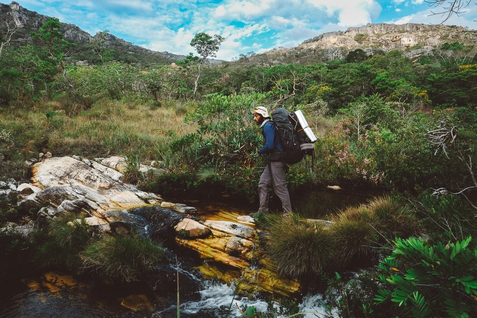
The terrain is mountainous but navigable, with a dense network of historic trails, dirt roads, and footpaths linking ridgelines, valleys, and villages.
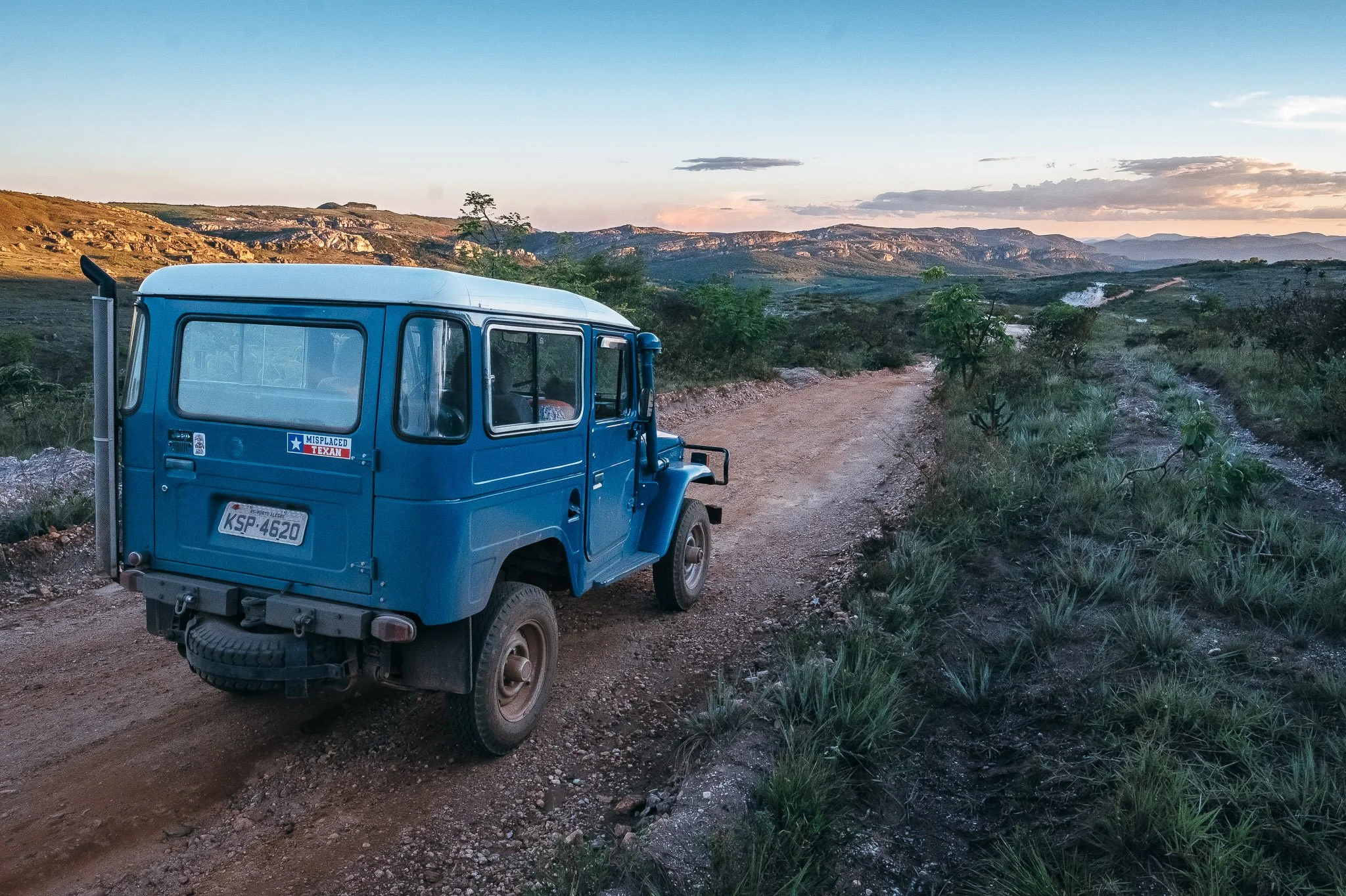
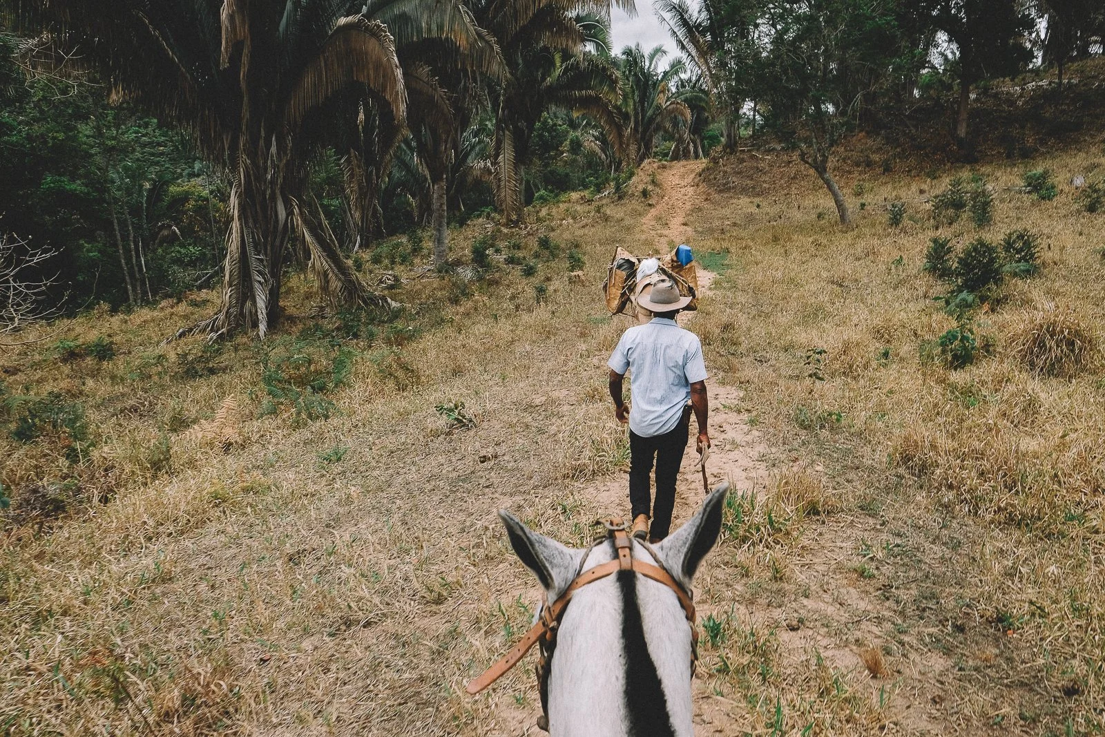
Travel here follows the ground:
· long stretches of trail and little-used dirt roads connecting valleys and ridgelines
· routes that lend themselves to riding across plateaus and backcountry terrain
· overland routes broken up by time on foot, with stops at waterfalls, villages, and detours off the road
Places to stay follow that same range—homestays, pousadas, wilderness refuges, and more refined stops—allowing for continuity without breaking the line of travel.
The Serra sees more regional visitation than other parts of the Espinhaço, though most trails remain empty. Its proximity to Diamantina and the presence of established parks make it a natural place to begin.
For a first journey into the Espinhaço, it often is.
For a longer one, it becomes the foundation.
Descending Itambé (November)
Who This Circuit Is Best For
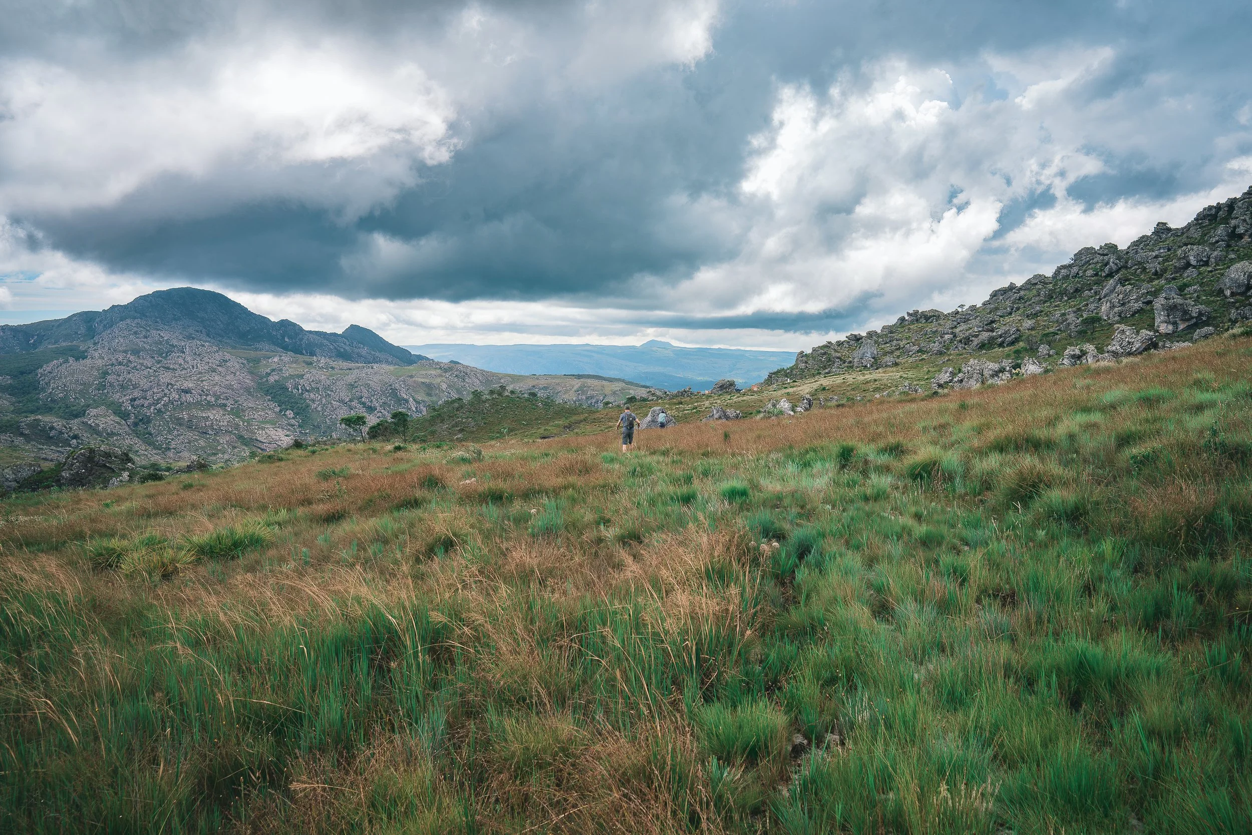
The Serra tends to suit those who want to move steadily through the landscape, covering real ground, with a sense of progression from one valley to the next.
The southeastern portion of the Espinhaço is among the most welcoming parts of the range, but the effort is real. Trail days are often long and vertical, and even shorter stretches carry into the next morning.
What makes this circuit distinct is the region it holds together. Peaks, waterfalls, campos rupestres and Atlantic Forest, historic trails, and small highland villages all sit within the same line of travel.
Days often end in those villages, where time off the trail settles into meals, conversation, rest, and evenings that stretch out.
At the same time, the presence of roads, horses, and nearby communities allows for flexibility, and we can adjust as needed without breaking the continuity of the route.
Those looking for something less demanding—or more remote—often land elsewhere in the range.
Trekking near Pindaíba (September)
Road to Capivari (June)

Water Crossing, Bica d’Agua (September)
Riding near Santo’s house (April)

Chapada do Couto,
Rio Preto (April)
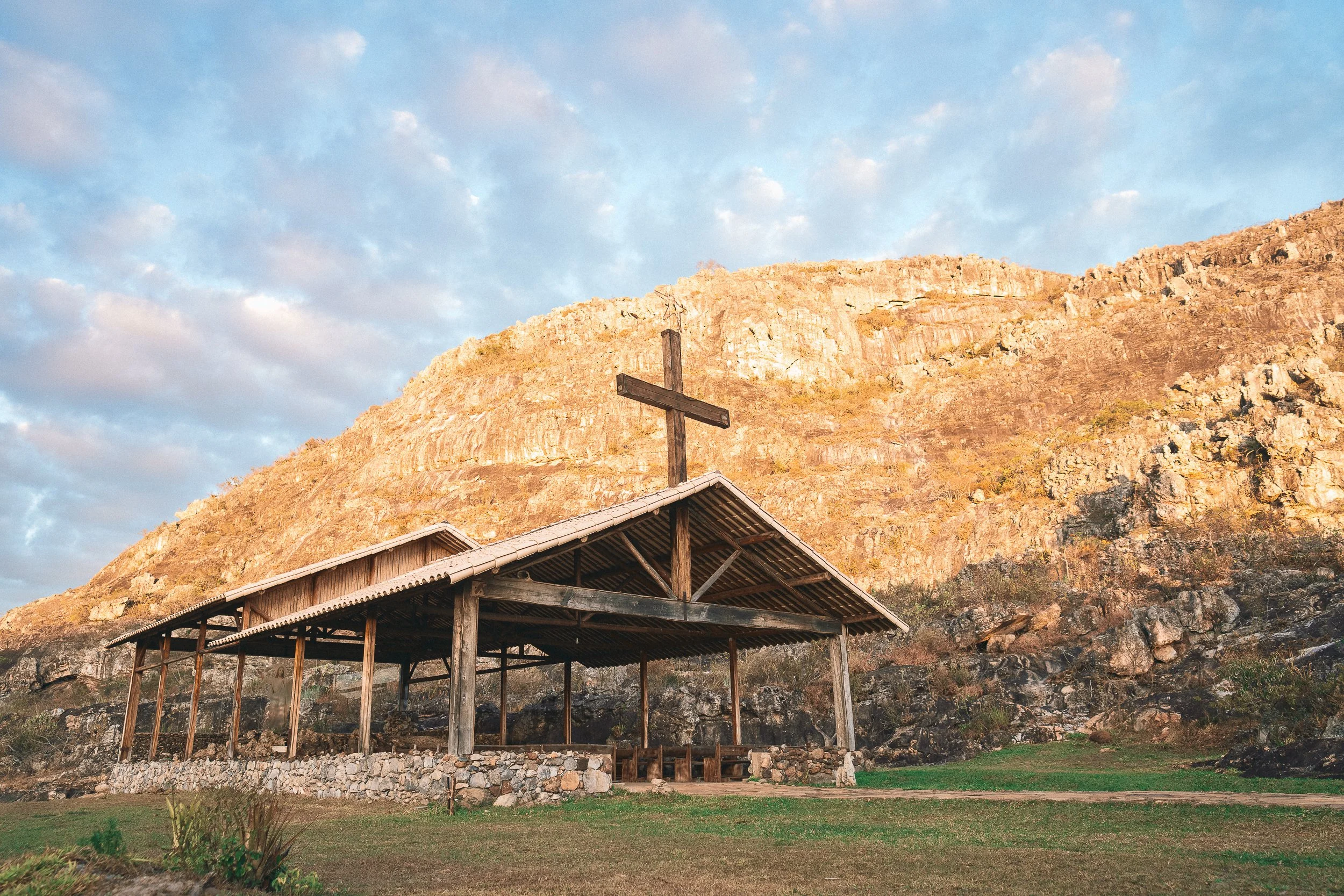
Protected Landscapes
The Serra is home to some of the most established conservation areas in the Espinhaço.
Itambé State Park, Rio Preto State Park, and the surrounding protected areas form a patchwork of preserved terrain—high plateaus, river systems, and steep escarpments that define the region on the ground.
During crossings, these areas become part of a larger landscape, connected by trails, roads, and communities that extend well beyond their boundaries.
Continuity comes naturally in this part of the range. As we move across it, we’re never confined to a single park.
Rio Preto State Park (April)
ITambé State Park (July)
The road to Mozart’s House,
Chapada do Couto (October)
Historic Trails
The Espinhaço is held together by trails, but in the Serra they’re often front and center—both connective and worth seeking out in their own right.
They run between everything in this part of the range—villages, peaks, rivers, and former mining sites—linking the region into a continuous, walkable system. In few other parts of the Espinhaço do these connections remain as intact or as storied.
Many of these paths predate modern travel. Sections of the Estrada Real still carry you out of Diamantina, giving way to a vast network of narrower footpaths that continue toward the surrounding mining districts and beyond. Former tropeiro routes, mining trails, and local paths used for generations branch out and interconnect, often without interruption.
Along the way, their histories resurface. Trails documented by European naturalists in the 18th century pass through rock shelters once used by Indigenous peoples, cross mining sites that have since become river pools, and connect communities that still rely on them today. In some places, these routes remain part of daily life, used by families divided across valleys.
The network is dense enough that routes can be built and rebuilt as needed. Movement can stay high on the ridgelines, drop into river valleys, or pass between villages without ever losing the thread.
At times, the trail itself becomes the reason to keep going.
Tropeiro Trail, Curralinho (September)
Footpath near Diamantina (July)
Trail to Covão (September)
Trail to Santo’s house (July)

Itambé (April)
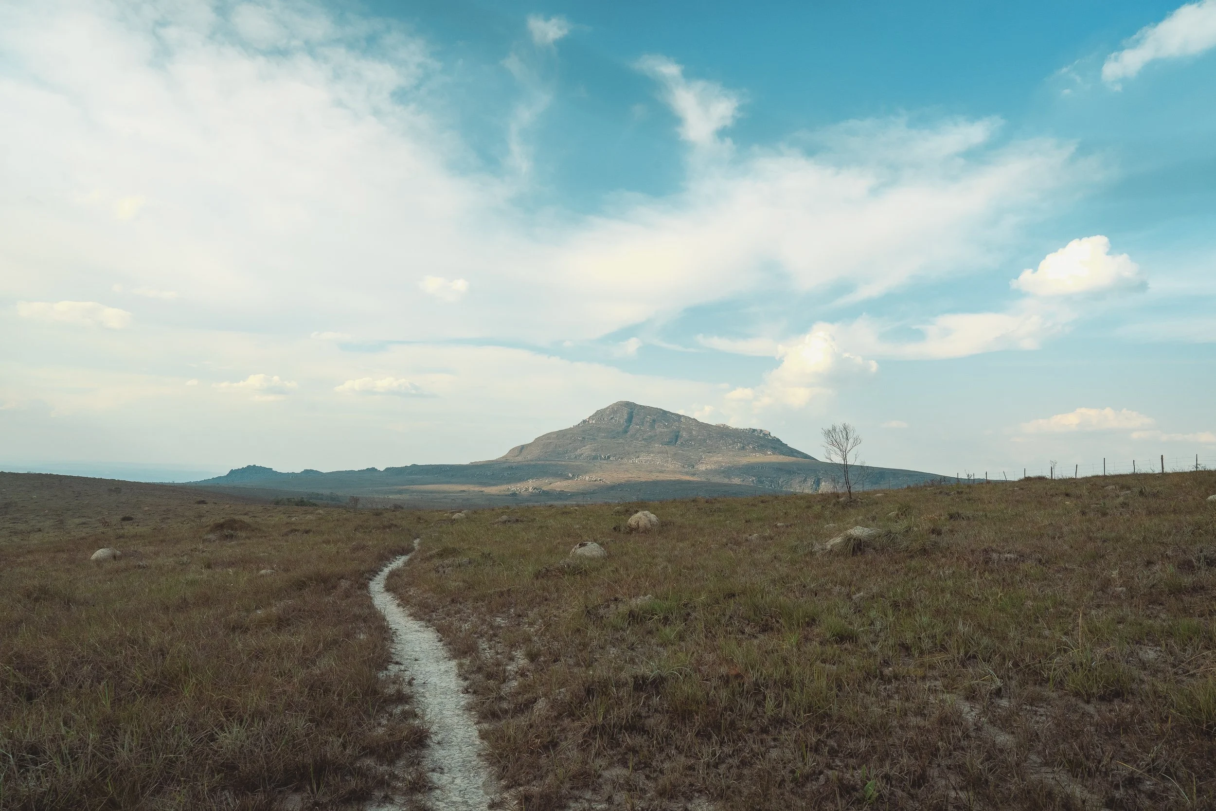
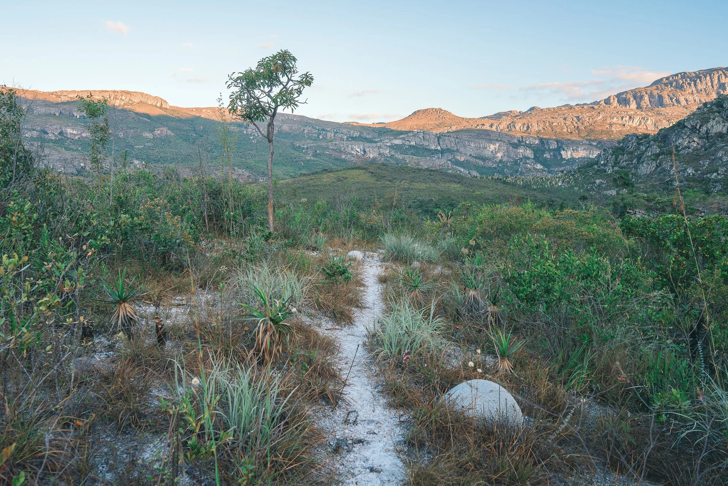
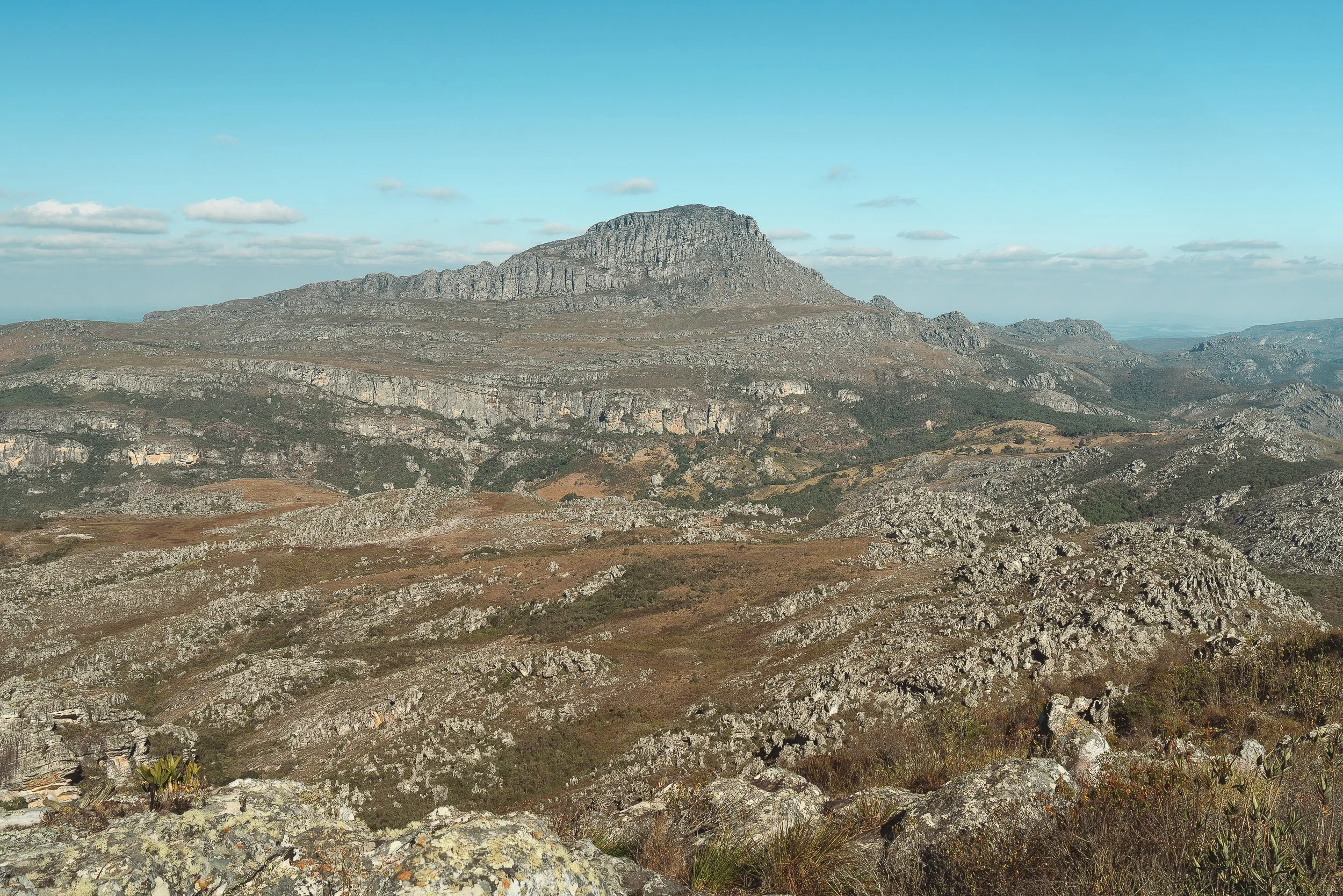
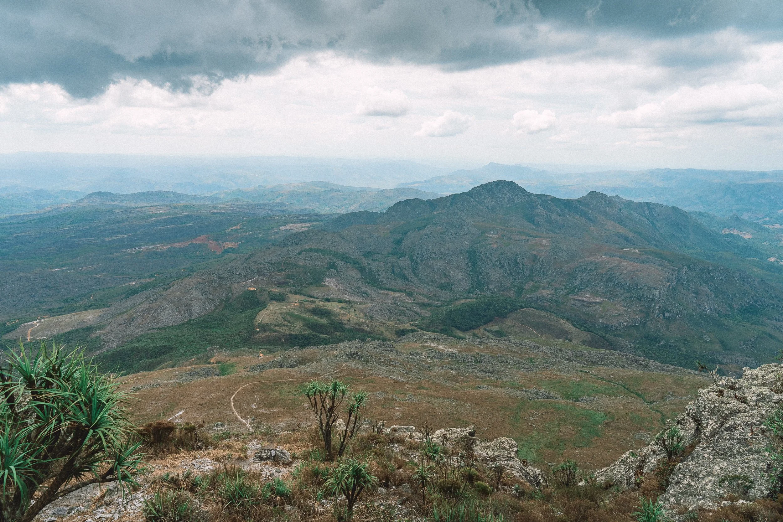
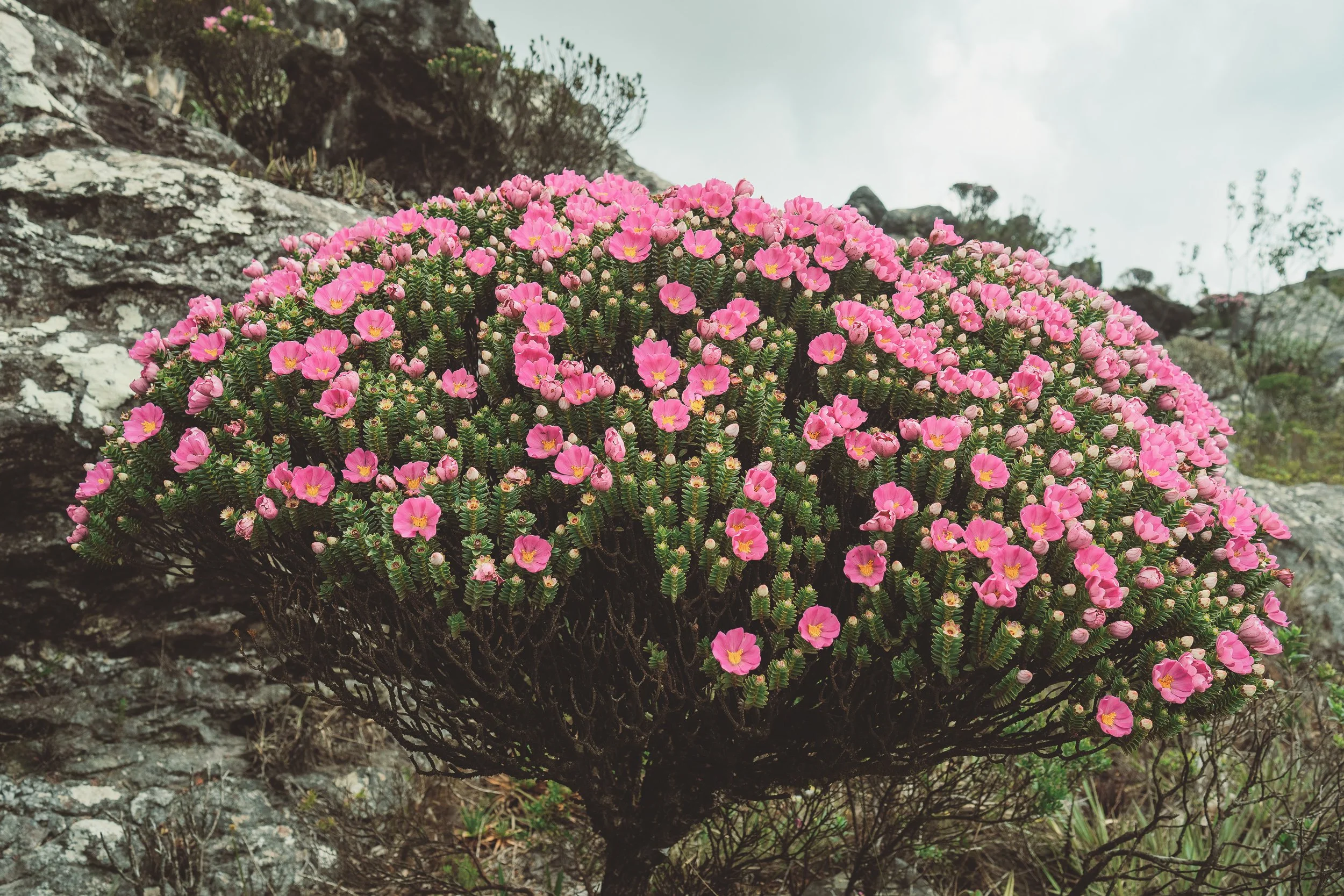
Soaring Peaks
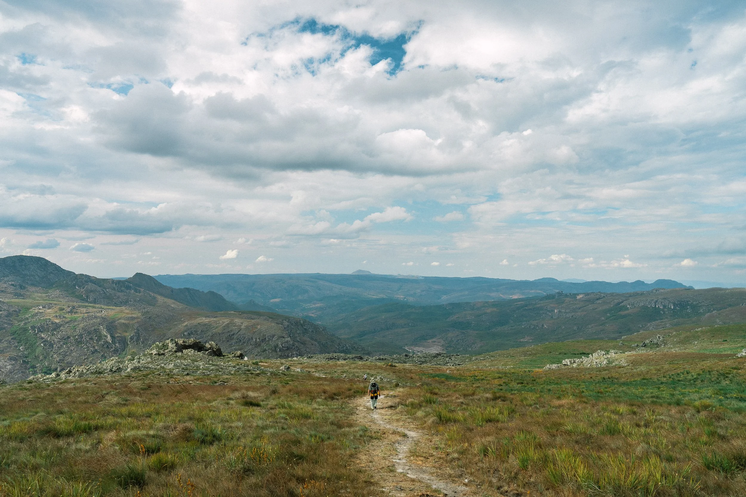
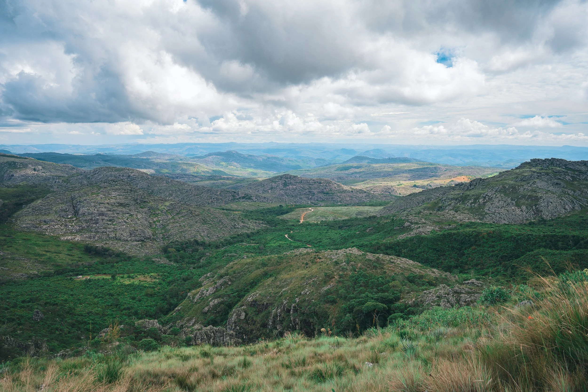
The Serra is the Espinhaço at its highest.
Peaks dominate this part of the range, shaping both the skyline and the ground below. Movement here is rarely level—valleys give way to ridges, ridges to summits, and the line of travel is almost always up or down.
Pico do Itambé anchors the region. Visible from across the Espinhaço, it rises well above the surrounding terrain, marking a hard line between river basins and a softer one between Atlantic Forest to Cerrado. Reaching it is an hours-long, vertical climb, accompanied by wide views and exuberant campos rupestres.
Further north, Pico Dois Irmãos rises gradually from the Chapada do Couto. Here, the approach stretches into a winding, day-long journey through river valleys and high fields, followed by a brief ascent.
Dozens of other peaks shape the skyline, some harder to reach than others.
Summiting them or not, movement through this part of the range means living with elevation—long climbs, long descents, and a landscape that reveals itself piece by piece.

Pico do Raio (July)
Itambé (July)

Dois Irmãos (July)
Serra da Bicha (October)
Cachoeira do Tempo Perdido (July)
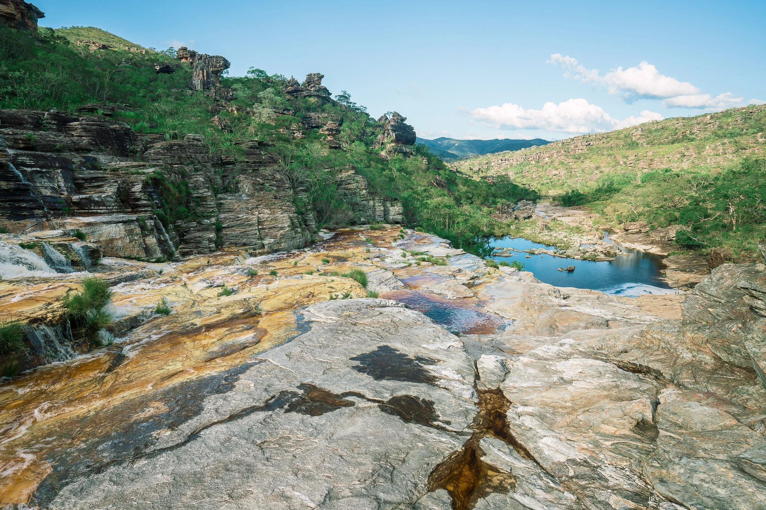
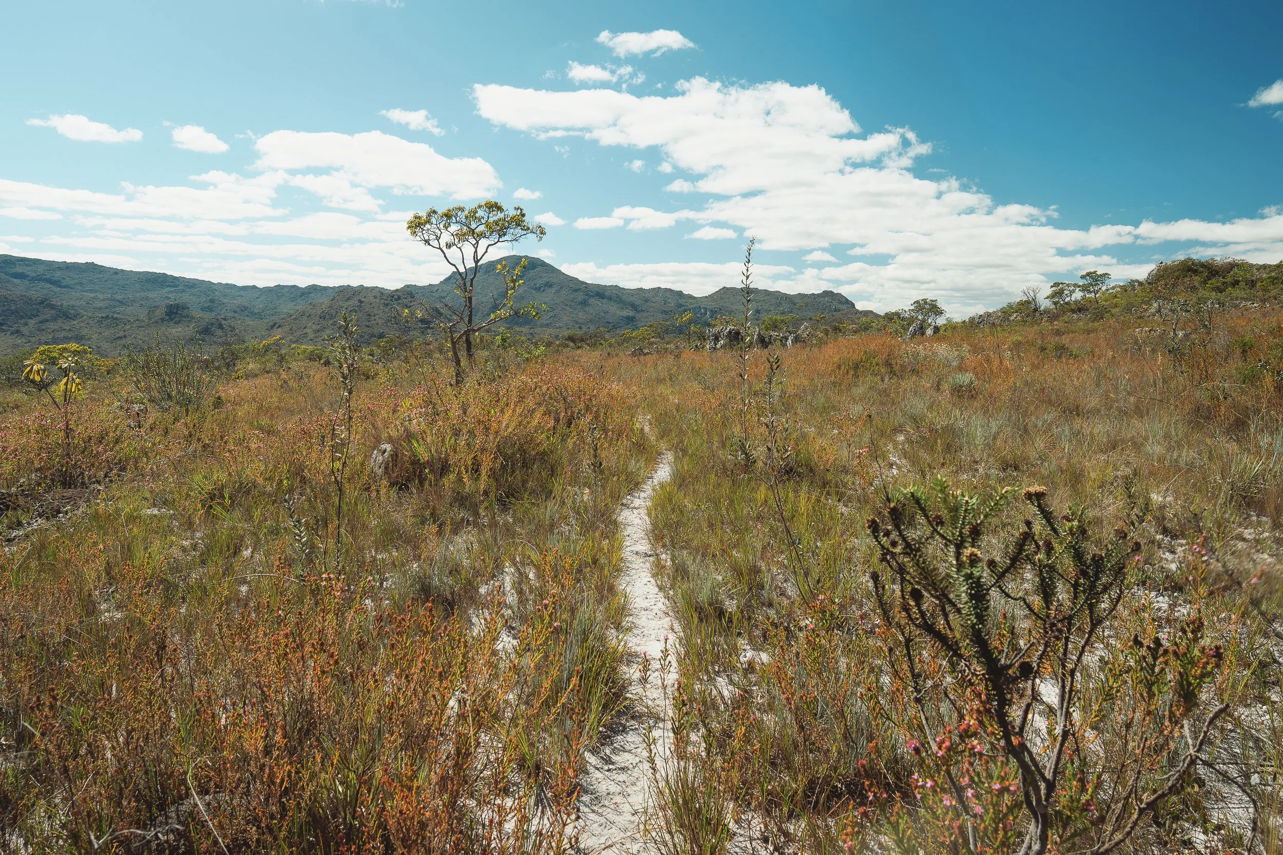
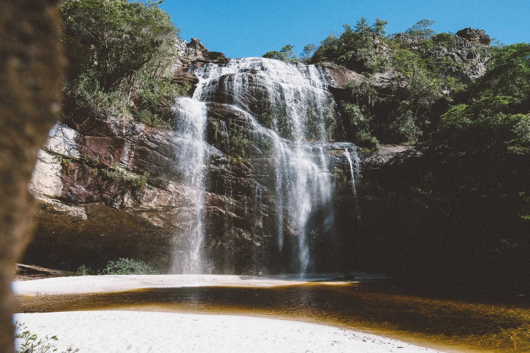
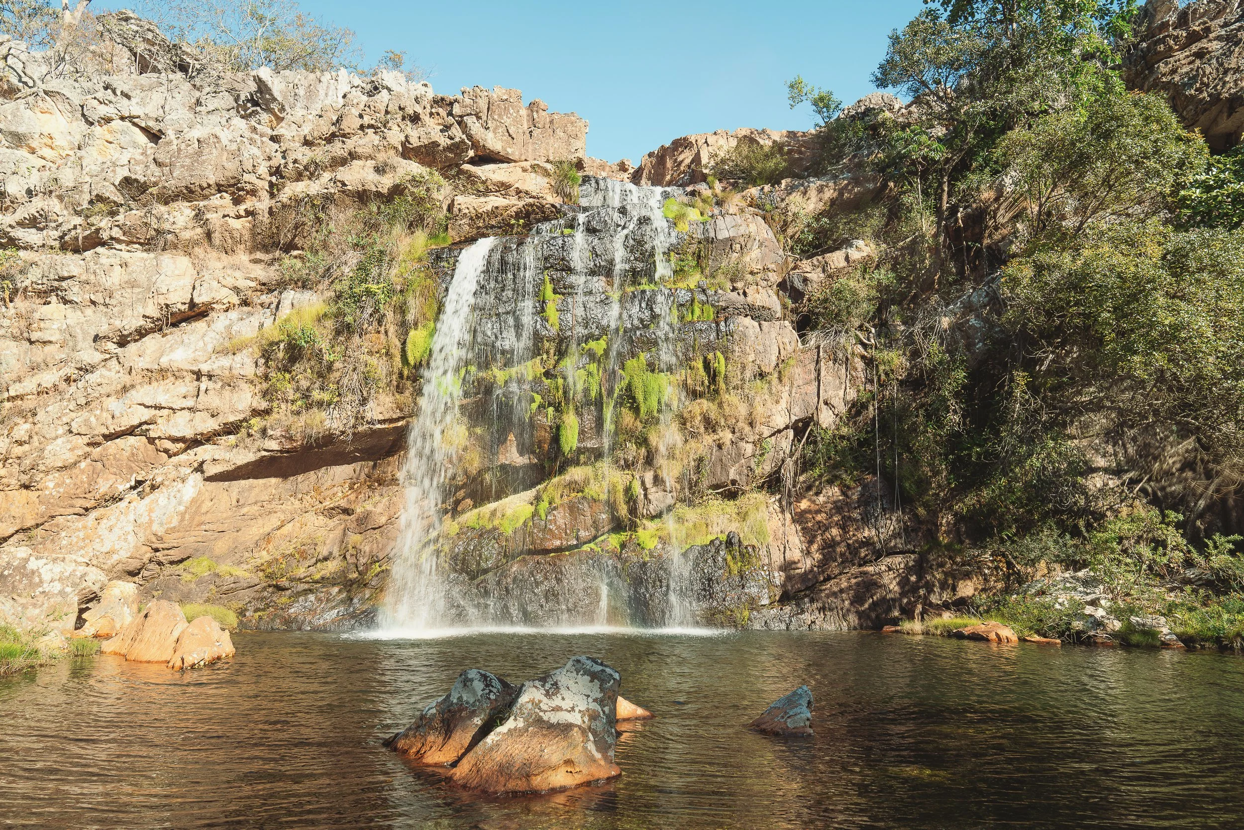
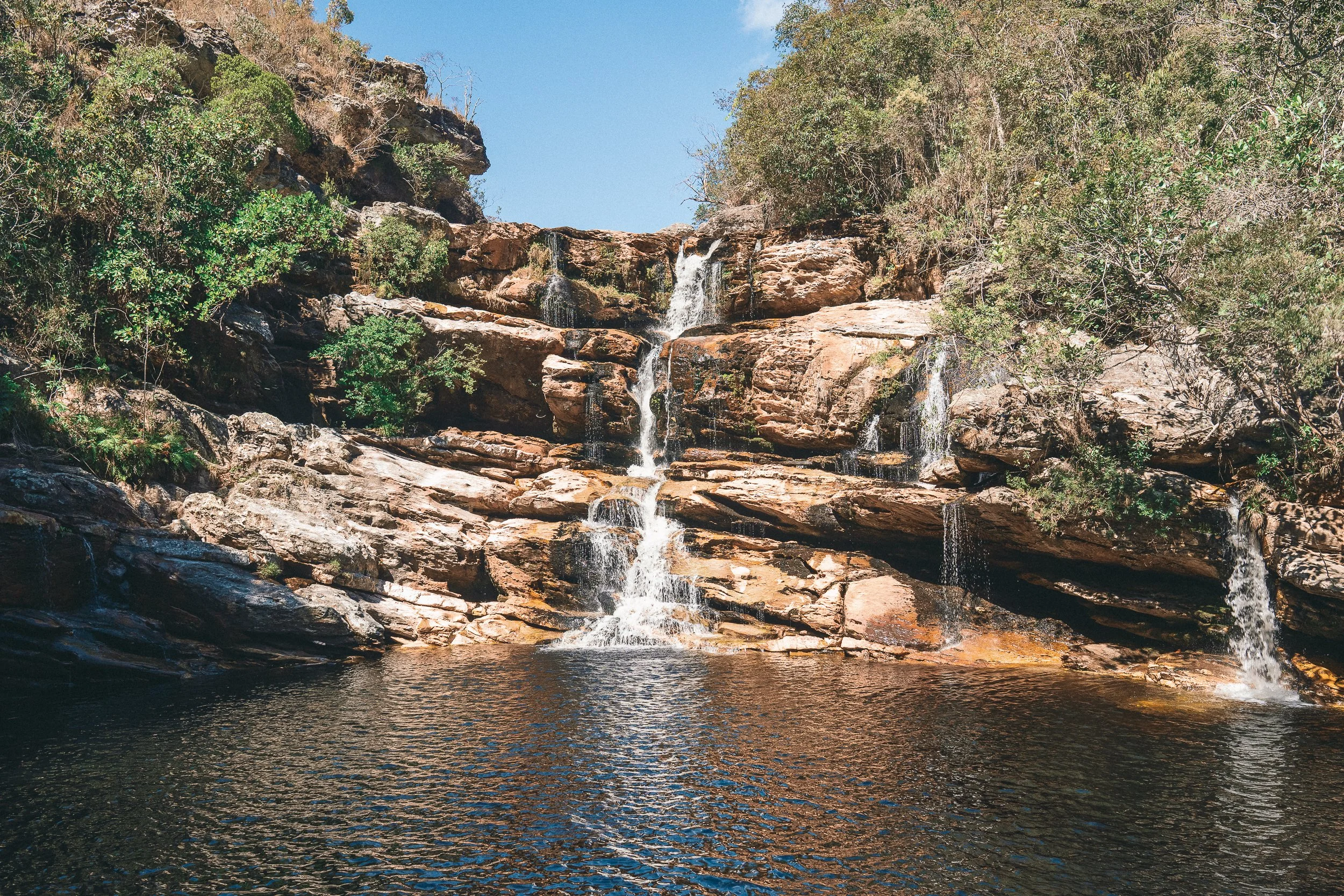
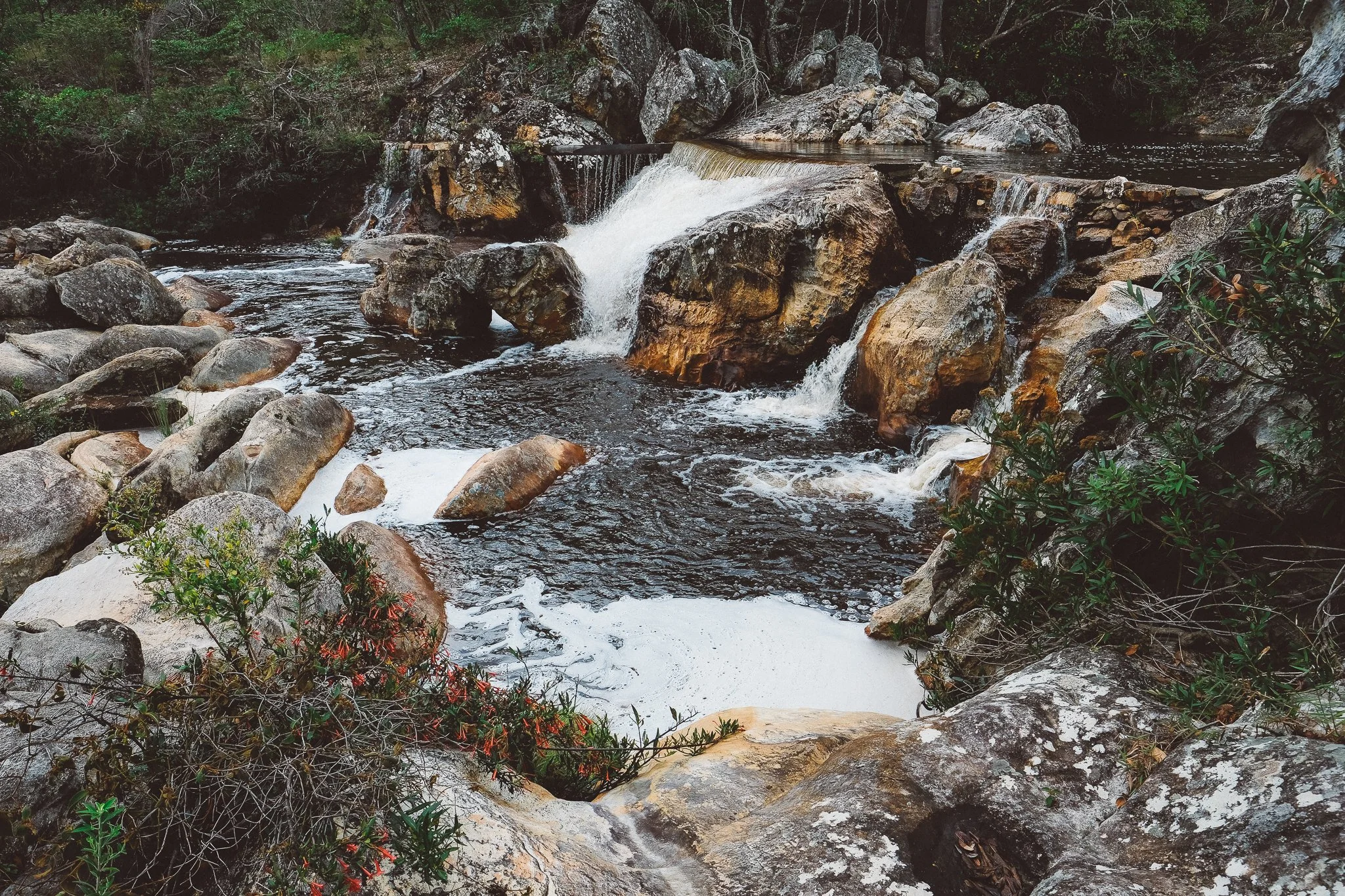
White-Sand Waterfalls
Cachoeiras are present throughout the Espinhaço, but especially prevalent in this part of the range—a pattern shaped by both geology and generations of human activity.
Waterways run over white sand and exposed quartzite, creating long, shallow stretches that feel more like beaches than riverbanks—a byproduct of centuries of mining.
The character of the falls shifts across the region. In the northern reaches of the circuit, they tend to be broad and structured, spilling over layered rock into deeper pools. In the east, near Santo Antônio do Itambé, they gather volume and drop through thicker pockets of Atlantic Forest. Closer to the center of the circuit, the water slows and spreads, forming the white-sand cascades that define this part of the range.
Near villages, the falls become part of daily life. Often, they sit just beyond the last houses, where they’re used regularly and folded into the rhythm of town.
The water in the highlands is cold. After a long stretch on the trail, it doesn’t go unused.
Cachoeira dos Remédios (July)

Cachoeira da Fumaça (January)
Cachoeira dos Carrapatos (July)
Grota Seca (November)

Praça do Rosario, São Gonçalo do Rio das Pedras (April)
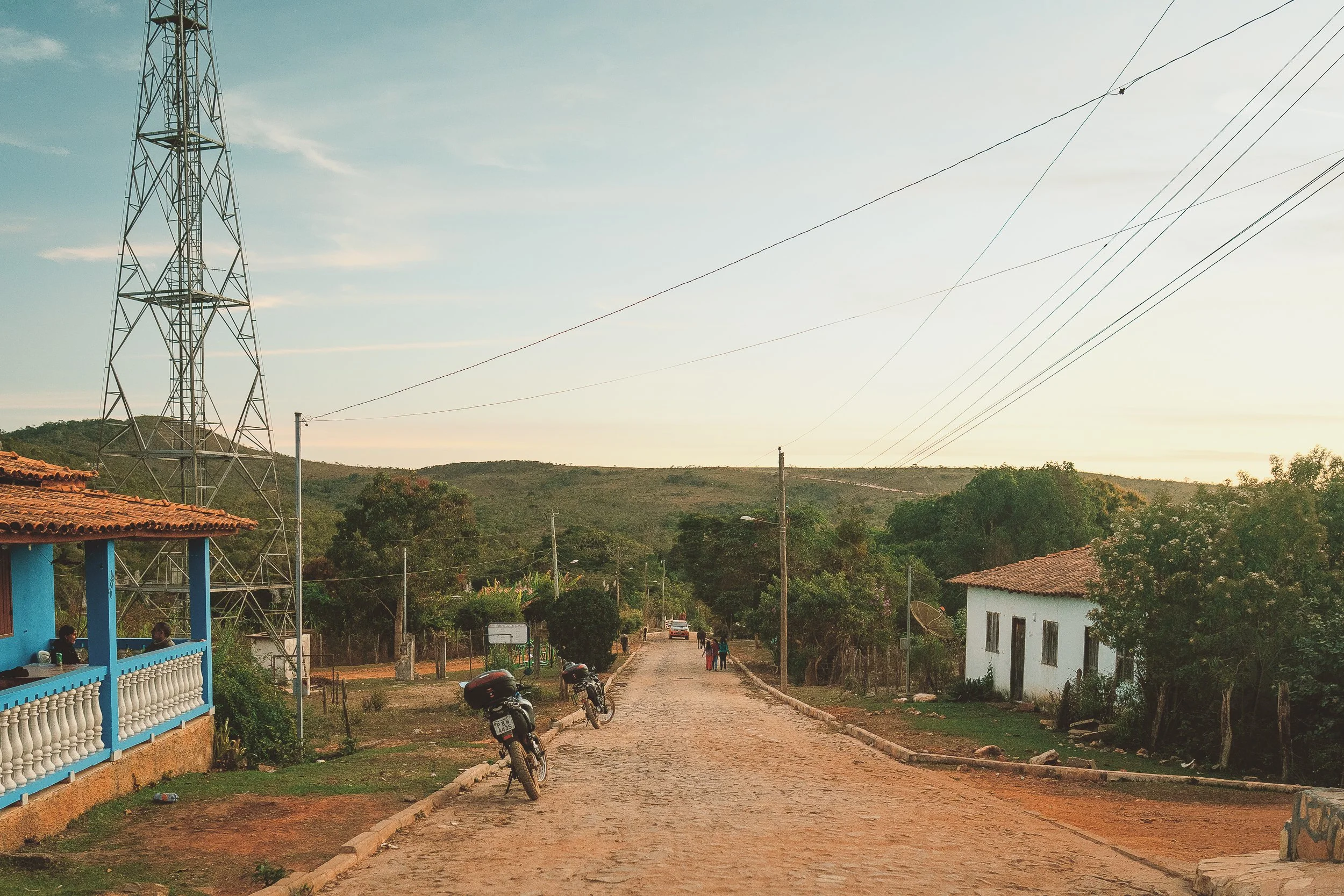
Highland Villages
The Serra is defined as much by its communities as by its terrain.
A series of former mining districts and quilombola villages sits across the landscape, offering natural endpoints between stretches of trail and road. Communities are small, unrestored, and lived in, each with its own pace, history, and relationship to the surrounding mountains and valleys.
Many of these settlements trace back to the Estrada Real, the route that once connected Diamantina to the coast. Just east of the city, Curralinho—still one of the more active towns in the immediate area—was once a gathering point for tropeiros moving along those paths, while São Gonçalo do Rio das Pedras, a former diamond district, has since turned toward healing, plants, and rest. Once a sentry post, Milho Verde is now the closest the Espinhaço comes to a tourist town, shaped as much by weekenders as by residents.
In the valleys below, small agrarian and quilombola villages—many largely emptied of younger generations—took root to supply the highlands. In Santo Antônio do Itambé, agriculture remains a way of life, though at a smaller scale. In Mata dos Crioulos, few families remain, and the land is returning to itself.
Other communities in this part of the range are less visible, but no less part of the whole. Capão Maravilha, Angu Duru, Fazenda Santa Cruz, and others each played an important role during the region’s heyday, but have since faded into the landscape.
Crossing the Serra often means passing through these places in sequence, never for long, but enough to feel the continuity between them.
Street scene, Capivari (July)
Church near Curralinho (July)

Elisa’s House, Curralinho

Capão, São Gonçalo (November)

Descending into Mata dos Crioulos (April)
Between Biomes
The transition from Atlantic Forest to Cerrado occurs gradually across the Espinhaço, but the southeastern portion of the range is where it’s felt most clearly on the ground.
Moving east to west along the circuit, the vegetation changes in stages. Dense Atlantic Forest gives way first to thinner stands, then to pockets and corridors that follow watercourses and sheltered valleys. As it recedes, the Cerrado becomes more present, sometimes open and exposed, other times shaded and wooded.
In places, the two occupy the same space: forest mosaics with indaiá palms and monjolos, gallery forests tracing rivers with campo sujo opening just beyond them.
By the time the route descends into the lowlands in the west, the last traces of Atlantic Forest have fallen away.
Atop the Serra’s highest ridgelines, the transition between biomes is visible at a glance. Elsewhere, it comes more gradually, as the circuit passes between river valleys, high plateaus, and the edges between them.
Few places in Brazil illustrate the overlap between forest and savannah so clearly. Fewer still offer such an arresting view.
lavoisiera, Pico do Itambé (November)
Pockets of Atlantic forest (April)
A 12-day crossing of this circuit forms the basis of our Serra Expedition.