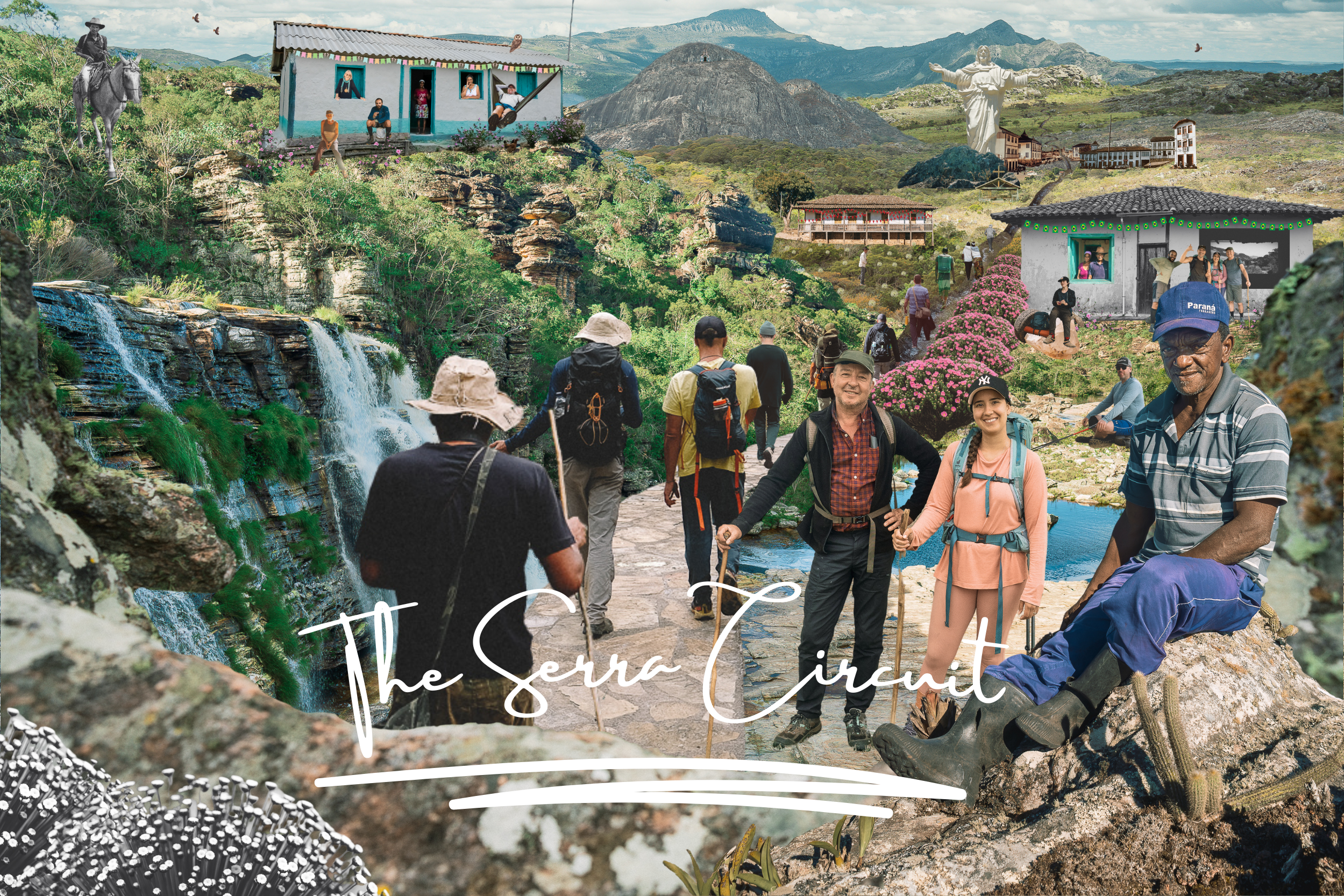
Soaring peaks & white-sand-beach waterfalls.
Campos rupestres, mountain rivers, and highland villages linked by dirt roads and footpaths.
An expedition built around motion, beauty, and life in the range.

At a Glance
The gateway to the Espinhaço
-
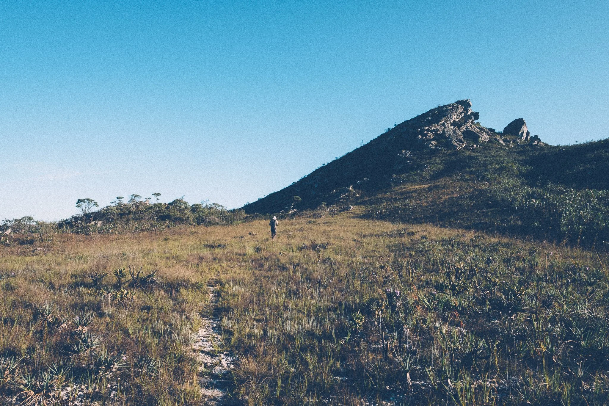
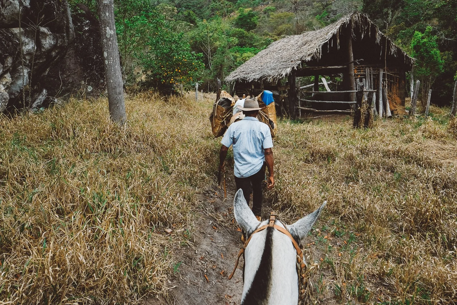
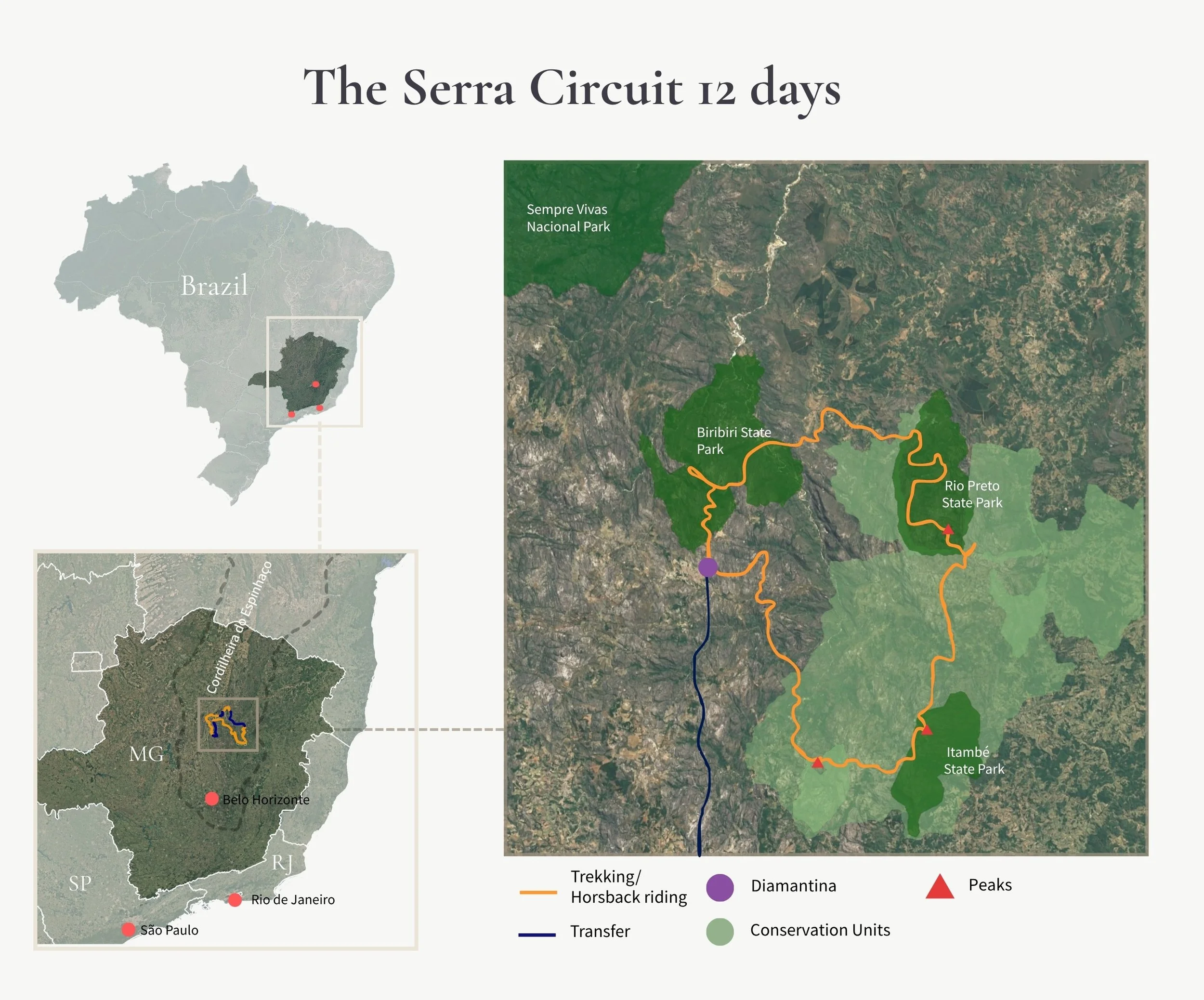
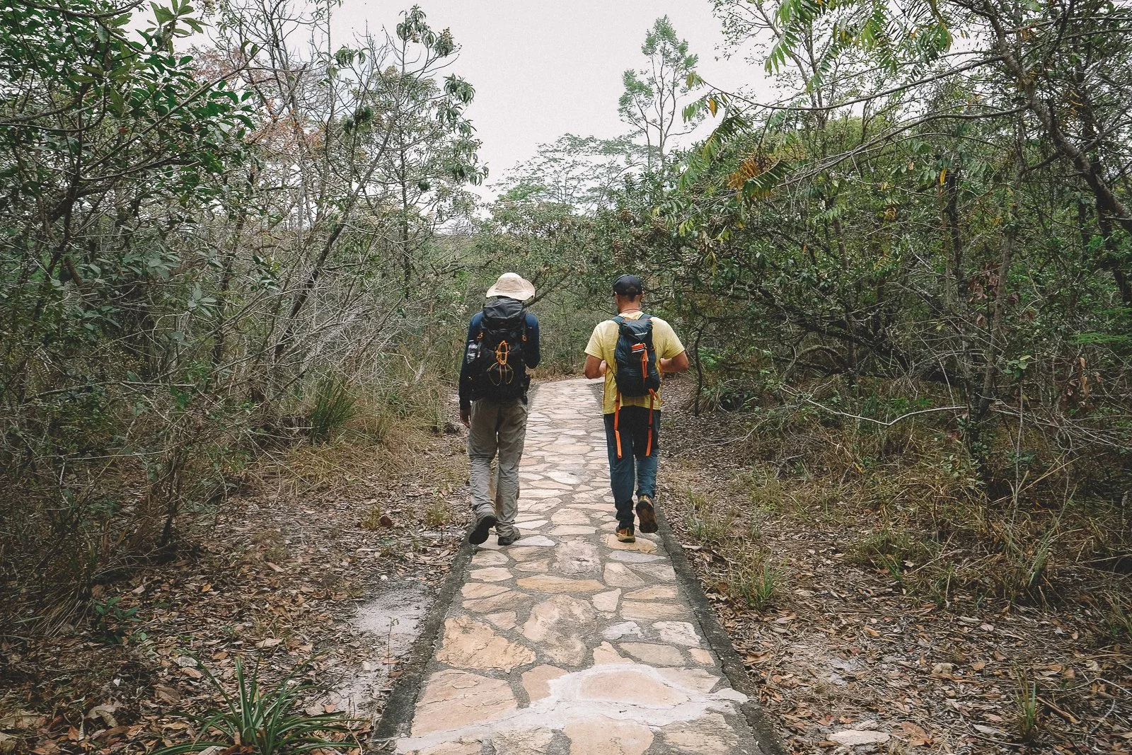
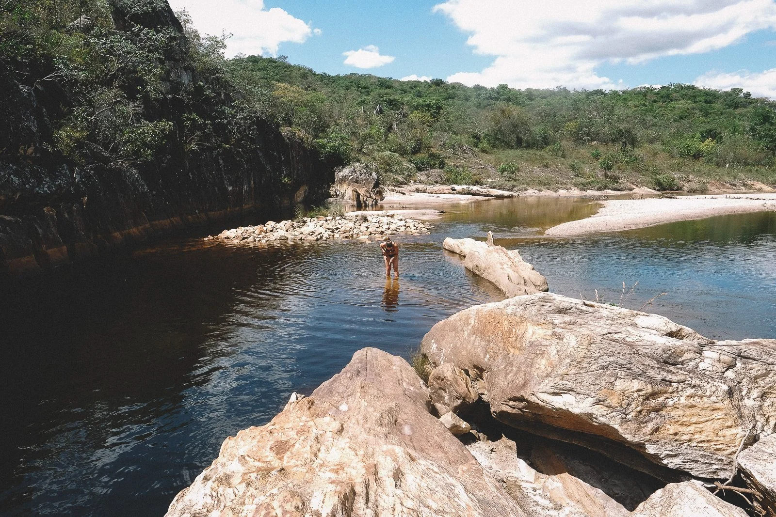
A 12-day trekking loop for 2–8 travelers through the southeastern highlands of the Espinhaço: peaks and valleys, plateaus and canyons, waterfalls, campos rupestres, colonial towns, and small quilombola villages linked by historic trails and little-traveled dirt roads.
The Serra Circuit is our clearest introduction to life in the range: physically demanding, visually spectacular, and full of time spent with the people, landscapes, and histories that define the highlands
-
Spa mornings. Curated tourism. Continuous connectivity. Other travelers on the trail.
The Serra Circuit moves through protected landscapes and living communities where comfort is often simple and the terrain is very real.
Trails are steep in this part of the range. Weather shifts quickly in the highlands, and we rarely have cell service on the trail.
Outside the larger towns, infrastructure is limited, and you’re unlikely to encounter other travelers on the trail.
This is an expedition built to embrace the range and its ways of life, not to stay insulated from it.
-
12 days / 11 nights
-
2–8 travelers, guided by Elisa and I alongside a core crew and a rotating cast of collaborators from across the range.
Meet the Crew → -
High. This is our shortest Expedition, but as it’s set entirely in the highlands, it’s also the steepest on a day-to-day basis.
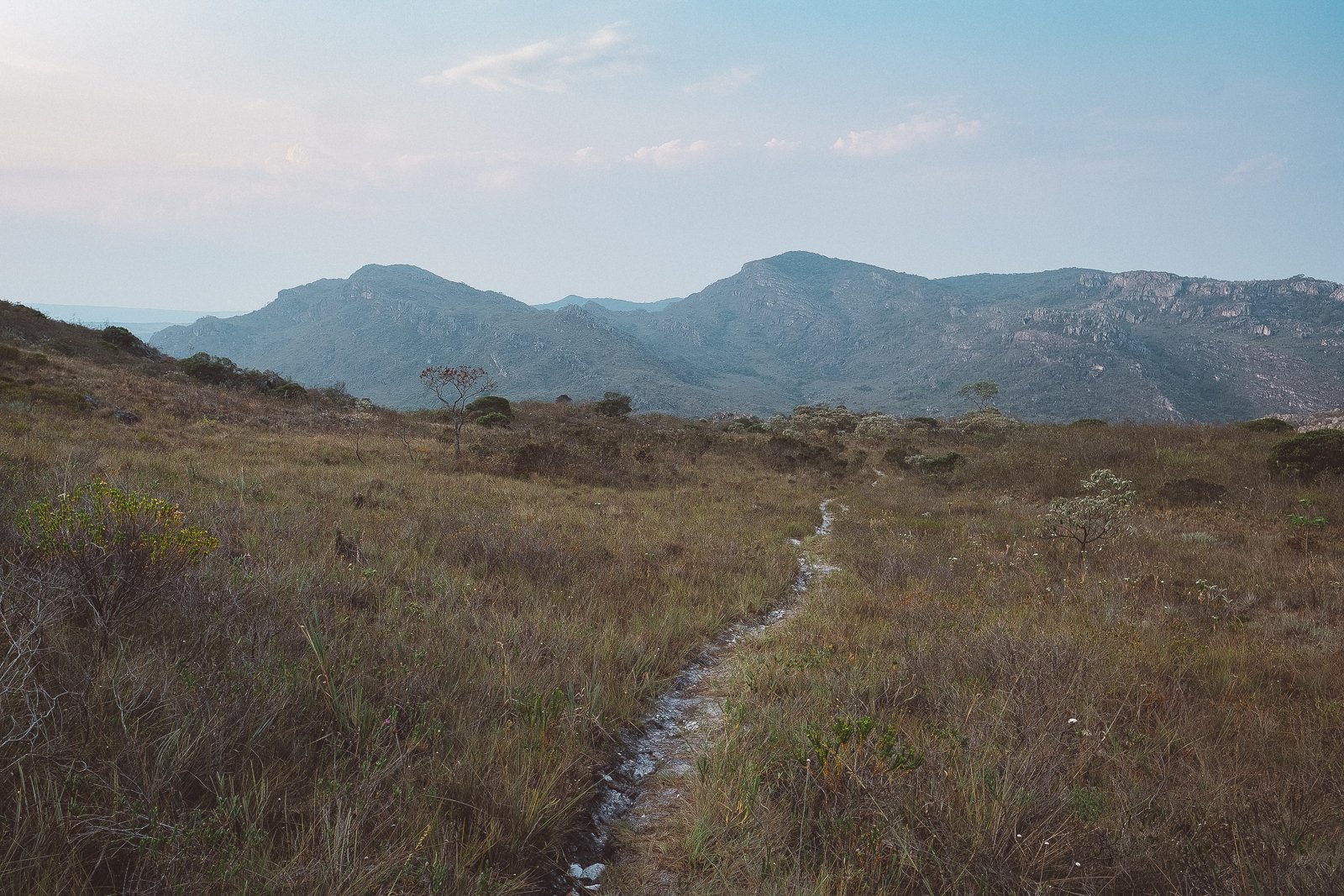
Trail days typically involve 20–25 kilometers on foot and an average of 1500 meters of cumulative elevation gain and loss across varied mountain terrain.
Footing ranges from well-worn trail and dirt road to slickrock, mud, and stone paths. Summit days involve long, steep, rocky ascents and descents, and there will be stretches where you may need to use your hands to stabilize or pull yourself up.
Creek and river crossings are a near-daily occurence in this part of the range—there are times when you’ll need to pull your boots off, put them on, and pull them right back off again to continue on the trail—as are sections of boggy highland ground, and weather and trail conditions can change quickly in the mountains.
That said, outside of summit days, the overall rhythm of the Expedition remains steady and gradual rather than relentless. Most reasonably fit, resilient travelers do well here, especially those comfortable spending long days on foot.
-
Cerrado(Brazilian savannah)
Mata Atlântica (Atlantic rainforest)This expedition moves through one of Brazil’s richest ecological transition zones, where high-altitude savannah meets remnants of Atlantic forest. The overlap shapes both the terrain and the culture of the highlands.
-
May 20 - May 31, 2026
Limited places availableMay 19 – May 30, 2027
Dates subject to slight adjustment.If you’re thinking ahead, we’re happy to talk.
-
Travelers who want a serious, immersive introduction to the natural beauty, quiet hospitality, and cultural depth of the Espinhaço, and are willing to earn it on foot.
You do not need to be a veteran trekker, but you should be comfortable walking long days across varied terrain and embracing changing conditions. Steady fitness, resilience, and curiosity matter more than speed.
If this trip feels like you, we’re happy to talk it through.
Peaks, prosa, and the path between.
20 scenes along the trail →
-
![Trekking near Itambé State Park, Serra do Espinhaço]()
The Mosaic
A vast protected landscape, and the stage for everything to come
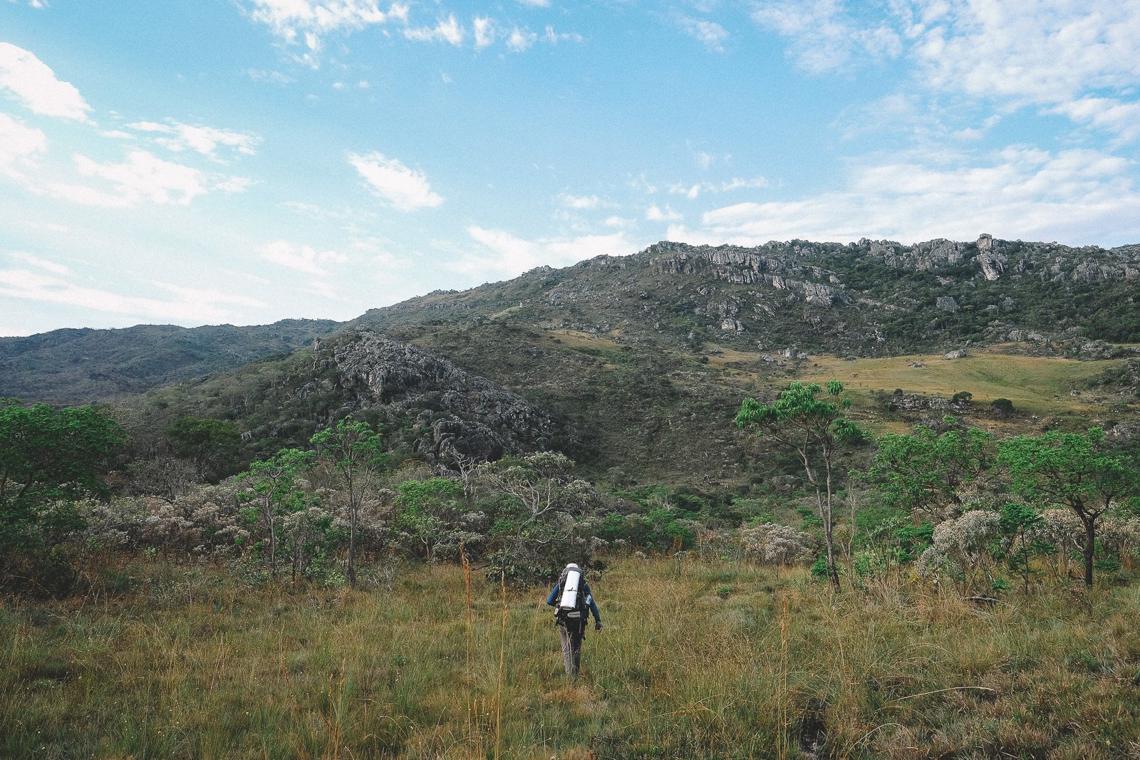
The Serra do Espinhaço Meridional harbors a vast patchwork of protected land: nineteen conservation units and buffer zones spanning nearly five million acres of Cerrado and Atlantic Forest.
Collectively they form the Mosaic of the Espinhaço, home to one of the highest concentrations of plant endemism on Earth and one of Brazil’s least-visited protected landscapes.
For travelers drawn to untouched wilderness, unfiltered culture, and the rare pleasure of moving through a place without tourism infrastructure, this is where the story begins.
-
![Sempre-vivas wildflower in bloom, Serra do Espinhaço]()
The Garden
More life than land. More urgency than time.
The Espinhaço accounts for less than one percent of Brazil’s territory, yet harbors over seven percent of its species—with more than three thousand found nowhere else.
The ecosystem behind that concentration is the Campos Rupestres: a rocky, flower-strewn expression of the Cerrado so distinct it may eventually be recognized as Brazil’s newest biome.
The range also cradles the westernmost remnants of the Atlantic Forest, making it one of the few places where two critically endangered biomes meet.
It’s a landscape as fragile as it is rugged. Much of the range sits atop quartzite and ironstone, coveted by the mining industry and slow to recover from disturbance.
It’s a privilege to experience it, as it is right now.
-
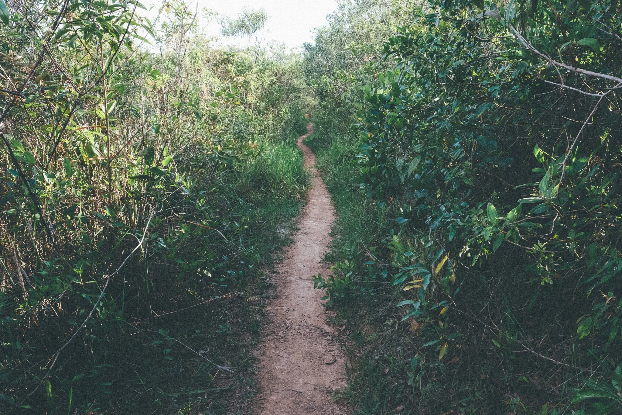
![Trail in Angu Duru, Serra do Espinhaço]()
Empty Historic Trails
Where the past still shows the way
Getting from point A to point B has always been an adventure in the Espinhaço.
The region is threaded with a network of historic paths: colonial stone roads built by enslaved Africans, trade routes carved by mule-driving tropeiros, and smuggler trails later followed by European naturalists.
We’ve spent years exploring these routes, mapping their course, documenting their histories, and stitching together what still remains.
Many of the trails haven’t seen sustained travel in decades. Walking them today feels less like following a path than rediscovering one.
-
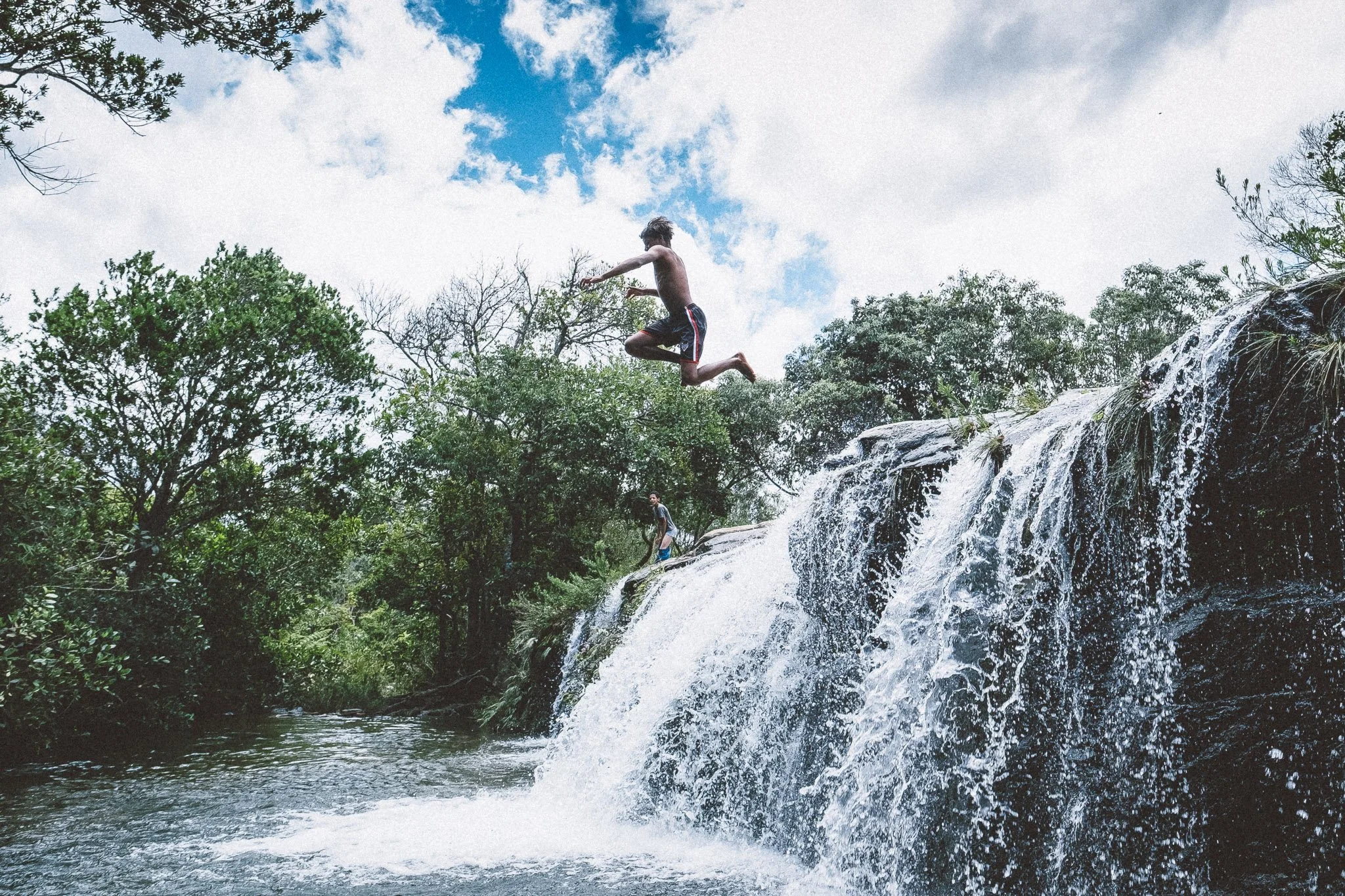
![Cachoeira dos Crioulos, Rio Preto State Park]()
Waterfalls
The Espinhaço’s answer to sun, sea, and sand
Take it from us: attempting to count the waterfalls of the Espinhaço is an exercise in futility.
Just as futile is trying to spend more than a day or two on the trail without bathing in one.
Hundreds of falls spill across the range, feeding the rivers that sustain the interior of Brazil.
We’ll pass nearly a dozen falls during the Expedition, from soothing cola-colored cascades to white-sand masterpieces.
Ice-cold has never felt so good.
-
![Street scene at night in Diamantina, Minas Gerais]()
The City of Diamonds
A colonial gem hidden in plain sight
UNESCO World Heritage city. Terminus of the Estrada Real. Former diamond capital of the world.
Diamantina somehow manages to be all of these things at once while remaining largely unvisited, even by Brazilians.
Música Popular Brasileira drifts through stone alleyways, tropeiro fills plates, and the view out the window could pass for something painted two centuries ago.
At times, Diamantina feels strangely untouched for a place of such beauty and history.
There’s no more fitting place to begin or end a journey in the range. We’ll have a chance to do just that on Days 1 and 12.
-
![College students in Milho Verde, Serra do Espinhaço]()
Mineiros
Prosa, carinho, and cafézinho
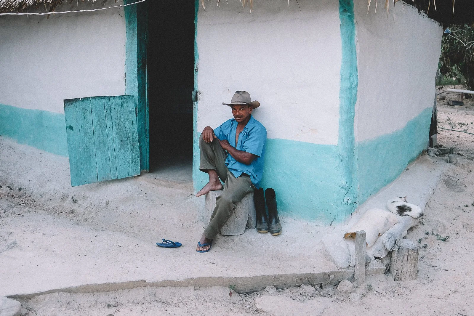
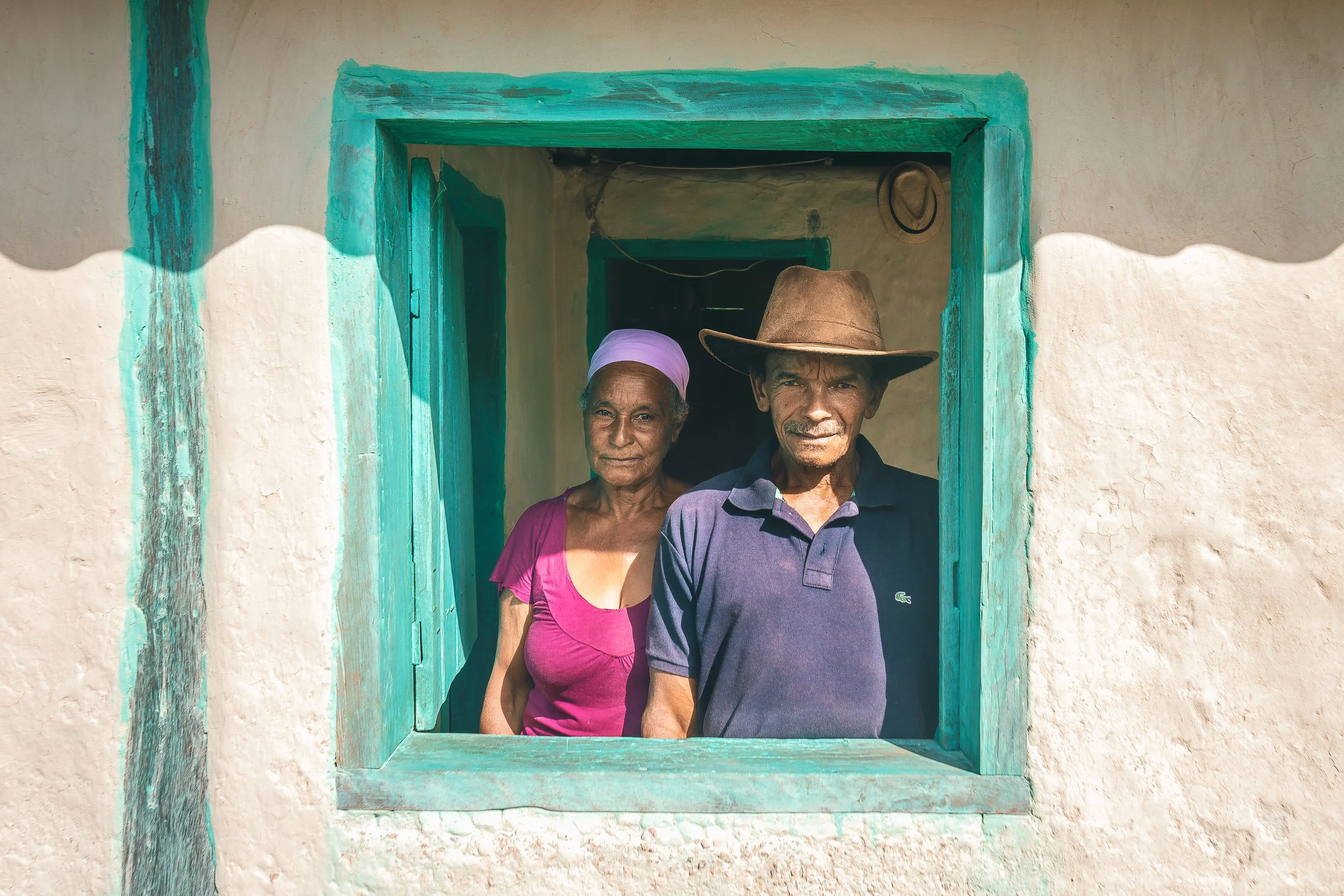
Minas Gerais is Brazil’s heartland, and mineiros (the state’s residents) are its natural hosts.
Easy-going, down-to-earth, famously chatty, and never far from a good cup of coffee or cachaça, they set the tone for life here.
The Espinhaço is still-visited enough that the people you’ll meet here will likely be mineiros: farmers, flower pickers, entrepreneurs, cowboys, homestay hosts, and kids on their way to or from school.
It’s hard to find a more welcoming group anywhere in Brazil.
-
![Crossing the Riberão Soberbo in Mata dos Crioulos, Serra do Espinhaço]()
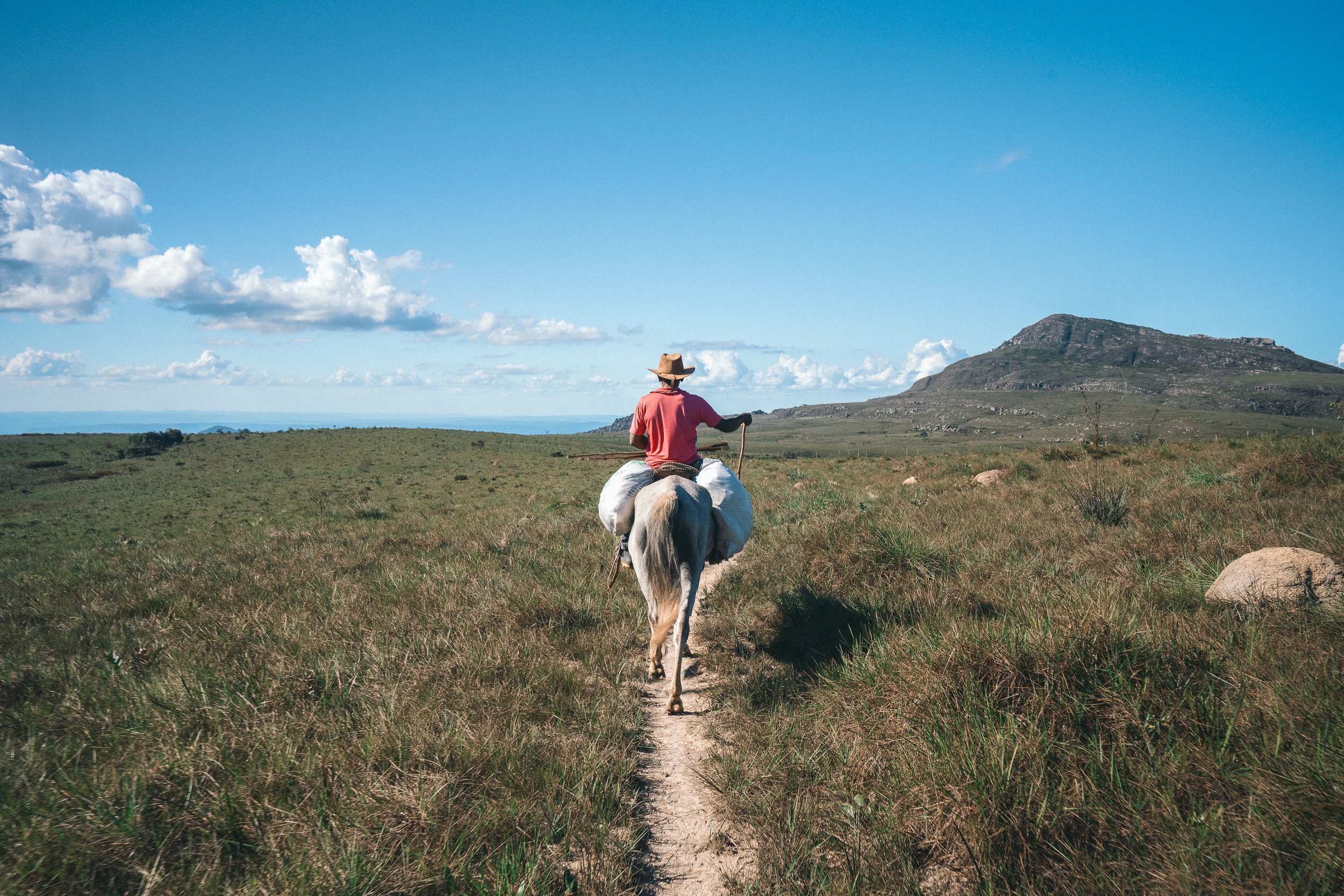
Riding through the Hinterlands
A centuries-old way of moving through the range
If you’ve ever imagined riding through the hills, rivers, and rocky passes of Brazil’s interior, this is the place for it.
Many of the Espinhaço’s longest crossings were carved by hoof long before they were walked. Even today, horseback remains one of the most natural ways to move through the landscape.
Our traverse of the steep and spectacular Mato dos Crioulos on Day 6 can be done either on foot or by saddle. Inexperienced riders are welcome, but should you prefer to walk, pack animals can carry the weight.
Either way, you’ll be tracing the same routes once traveled by tropeiros and cattle drivers moving through the highlands centuries ago.
-
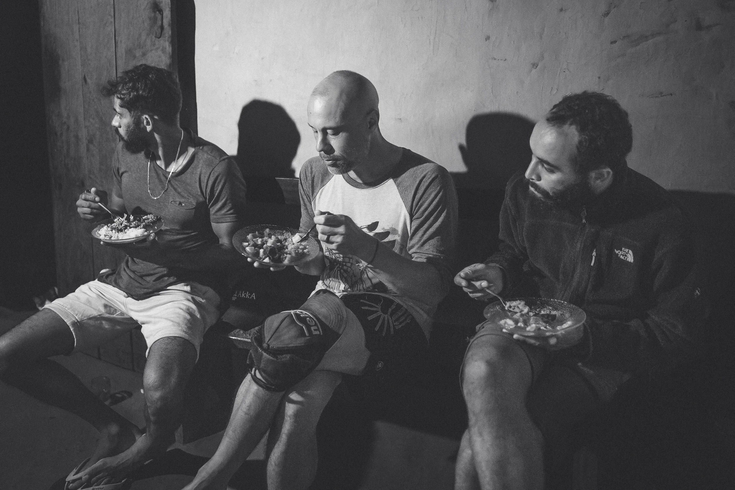
![Typical lunch in Minas Gerais, Brazil]()
Comida Mineira
Calories for the trail. Food for the soul.
Tropeiro. Torresmo. Frango com quiabo.
If you’re unfamiliar with comida mineira, you will be by the end of the expedition—and Brazilians everywhere will be jealous.There’s nothing like arriving to a hot plate of homemade, heartland comfort food at the end of a long day. Throw in a few ice-cold beers and the occasional cachaçinha and you’ll understand why nobody leaves Minas complaining about the food.
Weight-loss goals may suffer.
We consider that part of the experience.Bom apetite.
-
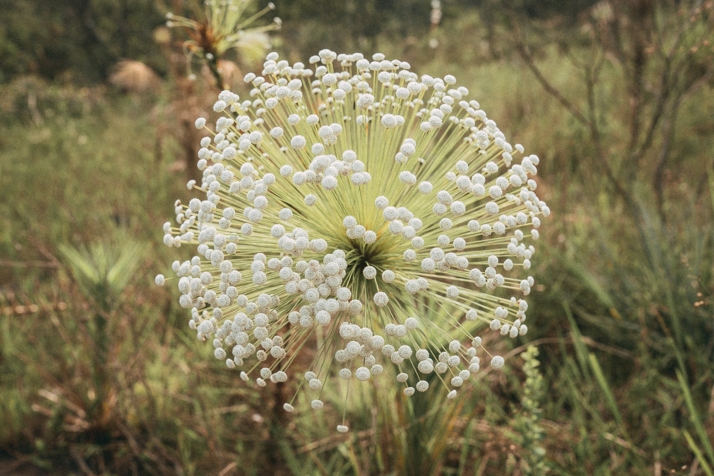
![A flower-picker holds a bouqet of freshly picked sempre-viva flowers in Galheiros, Serra do Espinhaço]()
A Way of Life
Delicate, enduring, and impossible to ignore
The namesake flower of Sempre Vivas National Park is as woven into the identity of the Espinhaço as the diamonds that once sustained it.
The range contains one of the greatest concentrations of sempre-vivas anywhere on Earth, including many species found nowhere else. Their delicate blooms appear throughout the highlands, from windswept campos rupestres to high plateaus where residents still gather them each season.
Harvesting them has sustained families here for generations, a tradition recognized by UNESCO and the FAO as a Globally Important Agricultural Heritage System.
We leave the flower-picking to those who know it best, but we'll pass plenty along the trail: button-sized blooms, starbursts, and tall stalks crowned with white globes rising above the grass.
Once you start noticing them, you won't unsee them.
On the hardest days, they still have a way of lifting the spirit.
-
![The Praça do Rosário in São Gonçalo do Rio das Pedras, Minas Gerais]()
Magical São Gonçalo
A place so special we call it home
Even in a region full of charming colonial-era towns, São Gonçalo do Rio das Pedras feels distinct.
The former mining district sits high in the mountains between waterfalls, trails, and open highland country, with stone streets, quiet corners, and a pace of life still deeply tied to the range around it, despite the occasional cosmopolitan undertone.
We arrive after dark on Day 3, usually tired, dusty, and hungry from a long day on foot. A hot plate of comida mineira and a cold beer at the local pub tend to restore morale quickly.
São Gonçalo has a way of making people want to stay longer than planned.
-
![Pico do Itambé, as seen from Pico do Raio, Serra do Espinhaço]()
Pico do Itambé
A mountain. A monument. A milestone.
The region’s undisputed icon, Pico do Itambé (2,052 m), watches over the range like a citadel, living up to its billing as “the roof of the Espinhaço.”
Rising more than a thousand meters above the surrounding peaks, it marks a hard divide between the Jequitinhonha and Doce river basins, and a softer one between the Atlantic Forest and the Cerrado.
Reaching the summit after a sustained climb (Day 5) is one of the most satisfying moments to be had anywhere in the Espinhaço.
-
![Santo's mother's home in Bica d'Agua, Serra do Espinhaço]()
A Valley of Memories
Forest, water, and time
Stretching between the foot of Pico do Itambé and the high grasslands of Rio Preto State Park, Bica d’Água is one of the most resplendent valleys in the Espinhaço.
Pastureland, Atlantic Forest, waterfalls, streams, and towering stands of indaiá palms create a landscape that feels remarkably abundant after the exposed highlands above it.
Once inhabited by hundreds, the valley today is home to only a handful of residents. The old footpaths remain, winding between homesteads that now sit far apart in the silence.
We’ll spend the night here with Santo and Dona Maria (Day 5) before continuing our crossing toward Rio Preto (Day 6). Few places feel more closely tied to the story of the range.
-
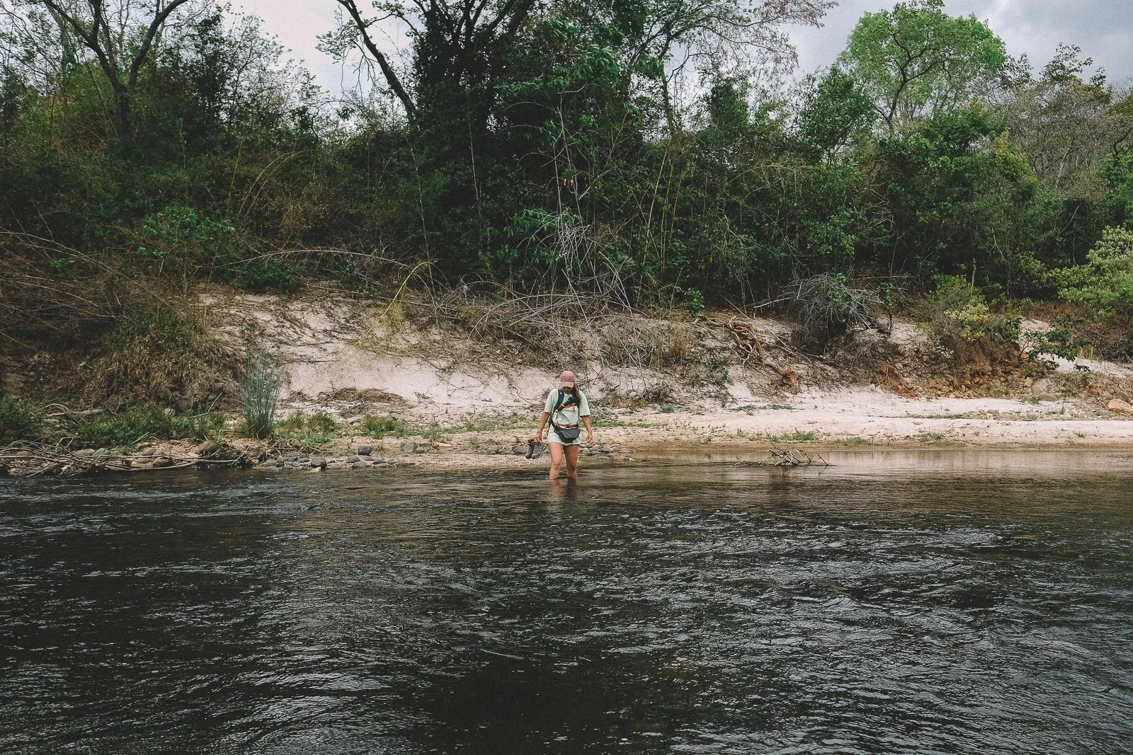
![Crossing the Jequitinhonha river on foot, Serra do Espinhaço]()
Crossing the Jequitinhonha
A chance to touch time
The peaks and parks may draw the eye, but nothing has shaped this region or its fortunes more than the rivers that run through it.
None more so than the Jequitinhonha.
Solemn and dignified, even after centuries of extraction and neglect, its diamond-rich waters once buoyed a distant empire and helped shape a nation. Today, scarred and overlooked, it sustains more than half a million Brazilians living downstream.
In theory, we’ll cross enough rivers, creeks, and streams during the Expedition to become routine. There’s something about standing on the banks of the Jequitinhonha, then stepping into it, that never does.
-
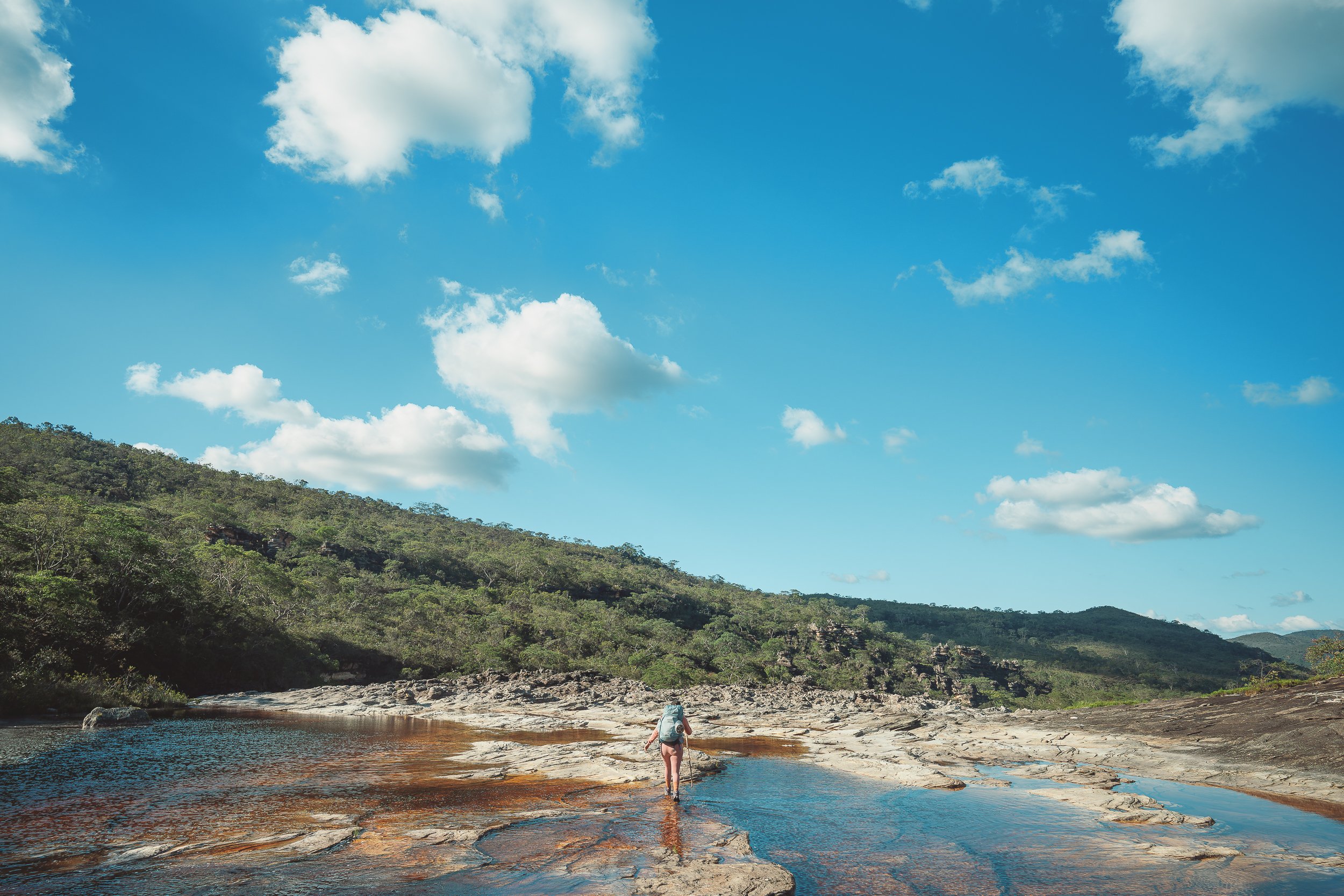
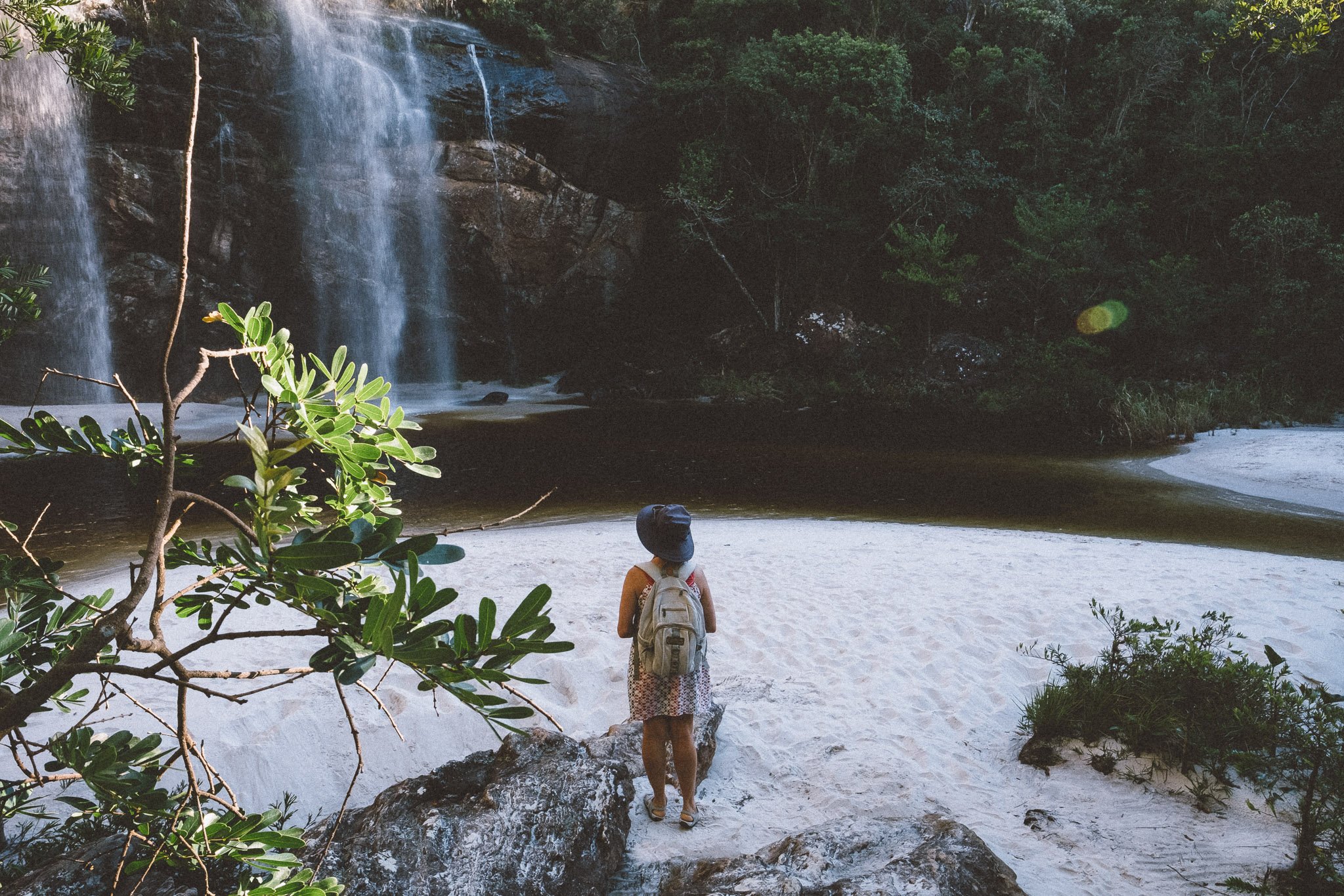
![Trekking in Rio Preto State Park, Serra do Espinhaço]()
Water-Blessed Rio Preto
Across the highlands
Rio Preto State Park was the first conservation unit in the Espinhaço, and it remains among the most beloved.
It protects more than 26,000 acres of pristine Cerrado and some of the range’s most important headwaters, along with fast-moving rivers, white-sand beaches, swimming holes, and afternoon-worthy waterfalls.
We’ll spend three long days (Days 6–8) crossing the Park during the expedition, moving from the high campos of the south into the thick forests of the north through deep canyons, steep escarpments, river crossings, and waterfalls.
The pace softens briefly here. Long swims, cold water, and one of the expedition’s most comfortable stays arrive before the crossing turns west toward Diamantina.
-
![Serra da Maravilha, Serra do Espinhaço]()
A Hidden Sugarloaf
Iconic silhouette. Zero crowds.
Few mountains in the Espinhaço announce themselves quite like Serra da Maravilha.
Rising abruptly above the surrounding highlands and the tiny hamlet below it, the peak’s distinctive profile is visible from surprising distances and impossible to mistake once you’ve seen it.
Despite its striking appearance, the mountain remains little known outside the immediate region—even in Diamantina.
We’ll encounter Serra da Maravilha from several different angles on Day 3. By the end of the day, you’ll understand how it earned its name.
Marvelous, indeed.
-
![View from the summit of Pico Dois Irmãos, Rio Preto State Park]()
Golden Hour, Pico Dois Irmãos
A high point. And a turning point.
Twin peaks rise above the windswept fields at the southern edge of the Chapada do Couto, dividing the Black and Araçuaí river basins in the process.
Known for generations as Serra Grande (“Big Mountain”) by the residents of the valley below—who could only see the taller twin—Pico Dois Irmãos (1,825 m) is one of the highest summits in this part of the Espinhaço and one of its most rewarding climbs.
A day-long approach through valleys and highlands on Day 6 leads to a short, steep ascent and a panoramic view that includes both Itambé and the western lowlands.
It marks the high point of one of the expedition’s most exhilarating days.
-
![Trekking to the summit of Pico do Raio, Serra do Espinhaço]()
Pico do Raio
An early test. And a view that keeps going.
Pico do Raio (“Lightning Peak”; 1,387 m) rises quietly above the highlands and surrounding villages, serving up one of the finest views of Itambé anywhere in the range.
We’ll climb this “little” peak on Day 4 on our way to Capivari. For some, this is where the crossing first begins to feel real.
The trail follows historic paths through marshes, rocks, and high fields of exuberant campos rupestres before descending toward white sand, cold water, and one of the range’s most welcome swimming holes.
We’ll climb higher peaks during the expedition. Few arrive this gracefully.
-
![Caminho dos Escravos in Biribiri State Park, Serra do Espinhaço]()
Biribiri
A vila between two worlds
Just outside Diamantina, Biribiri State Park is the Espinhaço’s most visited conservation unit, and one of its strangest contrasts.
The Park protects more than 42,000 acres of Cerrado surrounding a former textile village that shifts constantly between quiet highland outpost and bustling weekend destination, depending on the day and hour you arrive.
Visitors gather around the waterfalls, roadside bars, and the old village center, while long stretches of trail sit empty just beyond them.
It’s the perfect place to spend our penultimate night (Day 10), and a natural transition back toward Diamantina and the modern world beyond the range.
-
![Walking along the Caminho dos Escravos in Diamantina, Minas Gerais]()
Caminho dos Escravos
A path carved in stone and memory
Many of Brazil’s colonial roads—and nearly all of its stone ones—were built by enslaved Africans. In the Espinhaço, however, the term Caminho dos Escravos (Slave Way) refers specifically to a 20-kilometer stretch of stone road leading north from Diamantina toward the former mining district of Mendanha.
Steep, exposed, and physically demanding, the Caminho once carried diamonds, supplies, miners, armed escorts, bandits, and the enslaved Africans forced to build and move them through the highlands.
Today, it remains one of the country’s most remarkable surviving examples of colonial roadwork, and one of the clearest physical reminders of the systems that shaped Brazil’s interior.
We’ll walk parts of it twice during the expedition: first on Day 10 en route to Biribiri, and again on Day 11, our final day on the trail.
-
![The festivities at a Vesperata in Diamantina, Minas Gerais]()
A Night for the Ages
To life in the Espinhaço
From diamonds and stately architecture to former presidents and legendary Carnaval celebrations, Diamantina has no shortage of claims to fame.
It’s a bit ironic—and perhaps endearing—then, that one of its most beloved traditions is also one of its simplest: the Vesperata, a festive nighttime concert where musicians perform from balconies and windows while the audience gathers in the cobblestone streets below.
We’ll have the privilege of attending a Vesperata on the evening of Day 11. Expect a joyful mix of samba, bossa nova, Música Popular Brasileira (MPB), Beatles covers, and the occasional sing-along wedding-rock tune.
There may be more polished orchestras elsewhere. But there isn’t a place on earth where we’d rather celebrate the final night of the expedition together.


Itinerary
12 days of mountains, miles, and meaning →
-
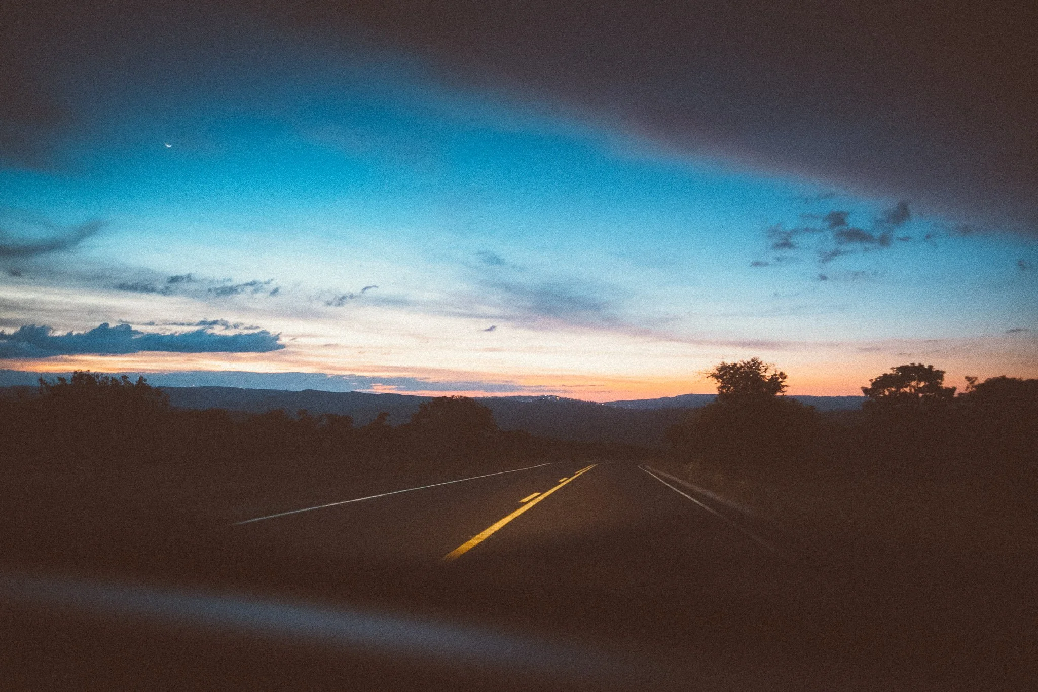
![The road to Diamantina, Minas Gerais]()
Day 1
280 km (overland)
Welcome to Brazil | a scenic transfer | arrival in Diamantina, the gateway to the Espinhaço | pre-trail meetup over dinner & drinks in town -
![Trekking in Pindaíba, Serra do Espinhaço]()
Day 2
21 km (trek) | 1271 m cum. elev. gain + loss
First day on the trail | a mix of front- and backcountry | first glimpses of campo sujo | the Estrada Real | a medicinal waterfall | a former tropeiro capital -
![Trekking to Capão Maravilha, Serra do Espinhaço]()
Day 3
22 km (trek) | 1949 m cum. elev. gain + loss
Four water crossings | an iconic silhouette | first glimpse of Mata Atlântica | a hard-fought ascent | a meal to remember -
![On the trail to Pico do Raio, Serra do Espinhaço]()
Day 4
15.3 km (trek) | 1109 m cum. elev. gain + loss
A gentler day | an approachable summit | a pair of waterfalls | a trail that remembers | our first quilombola homestay -
![Descending the trail from Pico do Itambé, Serra do Espinhaço]()
Day 5
22.9 km (trek) | 2257 m cum. elev. gain + loss
Into the backcountry | campos rupestres | an iconic summit | a waterfall | a long haul to a mountain home -
![Riding a horse on the trail in Mata dos Crioulos, Serra do Espinhaço]()
Day 6
30 km (trek or horseback) | 2018 m cum. elev. gain + loss
Quiet valleys | a long ascent | golden hour views | a night time descent | Mozart’s House -
![On the trail in Rio Preto State Park, Minas Gerais]()
Day 7
18 km (trek) | 1198 m cum. elev. gain + loss
A winding descent through canyon country | a pair of waterfalls | river road | a celebration in the hills -
![Cachoeira dos Crioulos, Rio Preto State Park]()
Day 8
12 km (trek) | 621 m cum. elev. gain + loss
A change of pace | highland quiet | the Espinhaço at its most open | time to soak and reset -
![Street scene at night in Mendanha, Minas Gerais]()
Day 9
25 km (trek) / 1571 m cum. elev. gain + loss
The path turns west | winding dirt roads | back into the frontcountry | a trio of waterfalls | a weathered mining town -
![On the Caminho dos Escravos in Biribiri State Park, Serra do Espinhaço]()
Day 10
17 km (trek) | 1008 m cum. elev. gain + loss
Back into the serra | a trio of waterfalls | timeworn steps | a vila between worlds -
![Descending the Caminho dos Escravos to Diamantina, Minas Gerais]()
Day 11
15.5 km (trek) | 1025 m cum. elev. gain + loss
Signs of return | a path carved in memory | a final waterfall (or two) | the City of Diamonds | an evening of celebration -
![The highway to Diamantina, Minas Gerais]()
Day 12
280 km (overland)
One last café | a fond farewell | the road home | time to reflect


Curious about the route?

Setting
The Highlands
of the Espinhaço
Once the epicenter of the world’s diamond trade, Brazil’s Serra do Espinhaço was largely abandoned and forgotten by the outside world for nearly two centuries.
Today it’s on the edge of wider recognition as one of the most remarkable places on earth.
3 UNESCO Designations
2 Biodiversity Hotspots
19 Conservation Units
3,000+ species of plants (estimated)
7% of Brazil’s total biodiversity
0.8% of Brazil’s national territory
Route
The trail ahead
Total days: 12
Trekking days: 9–10*
Riding / pack animal days: 0–1*
Transfer days: 2
Trail distance: 203 km
Transfer distance: 560 km
Average trail distance / day: 22.5 km
Cumulative elevation gain: 7,009 m
Cumulative elevation loss: 7,318 m
Total elevation change: 14,327 m
Average elevation change per day: 1,433 m
Travelers may choose to trek or ride on Day 6.
Where We Sleep
Home for a night →
-
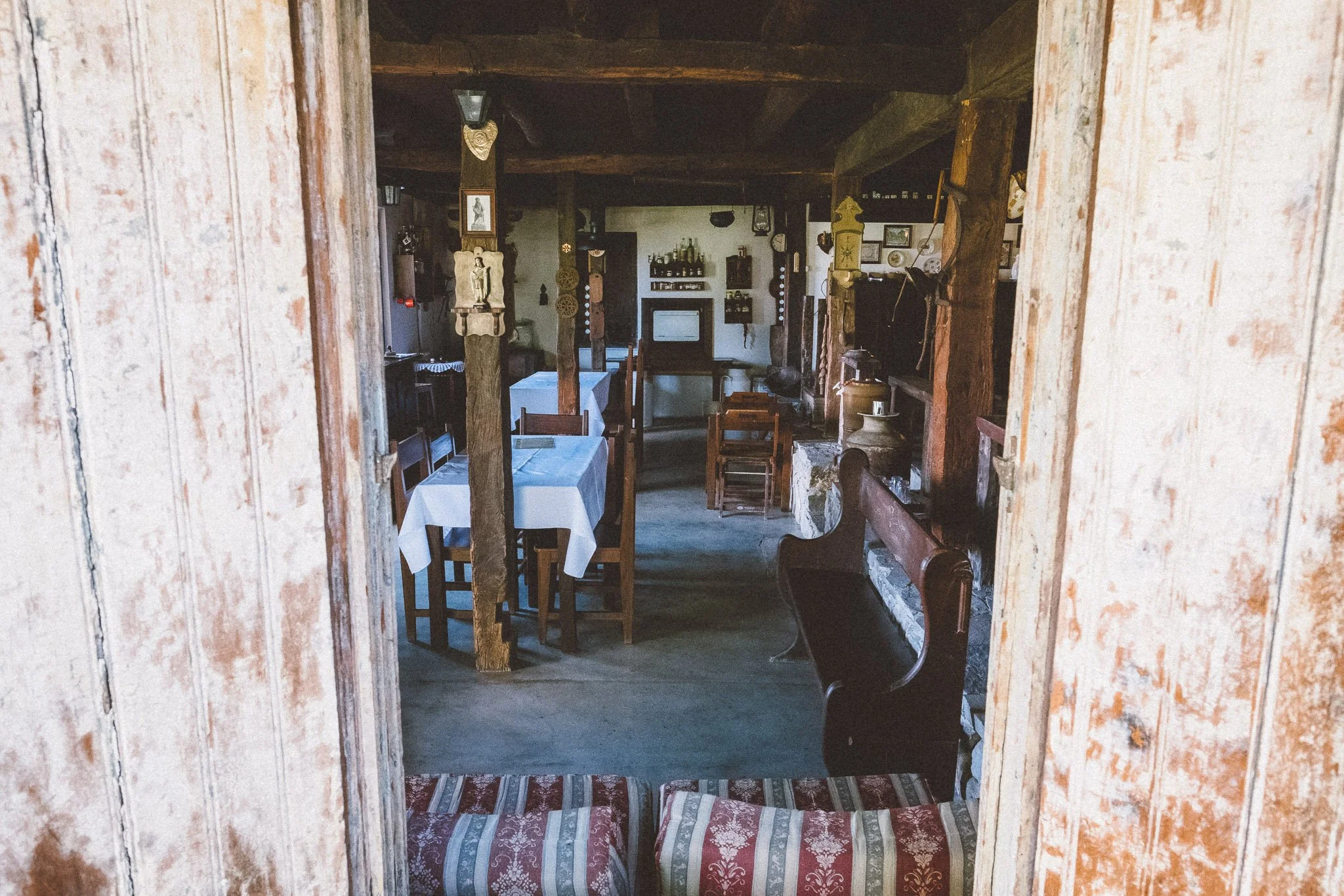
![The dining room of Pousada do Capão in São Gonçalo do Rio das Pedras, Minas Gerais]()
Pousadas (4 nights)
Small, family-run inns are a cornerstone of travel in Brazil.
Some are simple and homey. Others feel more carefully designed or restored. Nearly all reflect the people who built them.
Welcoming hosts, thoughtful details, and cafés da manhã worth waking up for tend to come with the territory.
After a long day on the trail, a hot shower, a soft bed, and freshly baked pão de queijo in the morning is often all the luxury we need.
Bom descanso.
-
![Portrait of Dona Maria and Santo outside their small, colorful rural house in Bica d'Agua, Serra do Espinhaço]()
Homestays (2 nights)
The trail will test us, and the peaks and waterfalls will leave their mark. In our experience, though, it’s the evenings spent breaking bread with local families—sometimes well into the night—that stay with us the longest.
Conditions vary from home to home, but the welcome rarely does. Meals arrive generous and unhurried, and conversation often continues long after plates are cleared.
These households are part of the fabric of the range. Our stays support families whose livelihoods shifted with the decline of mining, and help sustain a culture that still values memory, place, and hospitality.
Years from now, it’s usually the homestays you remember most.
-
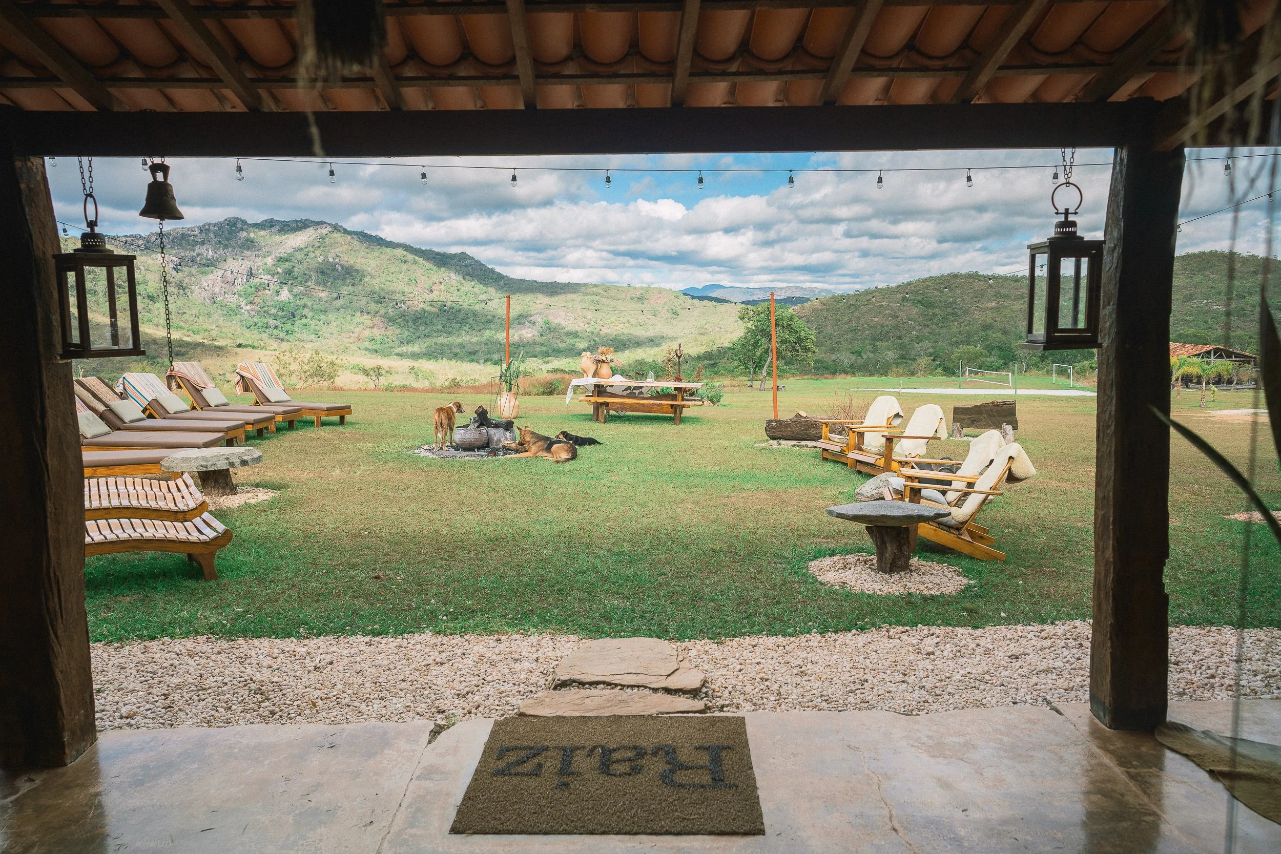
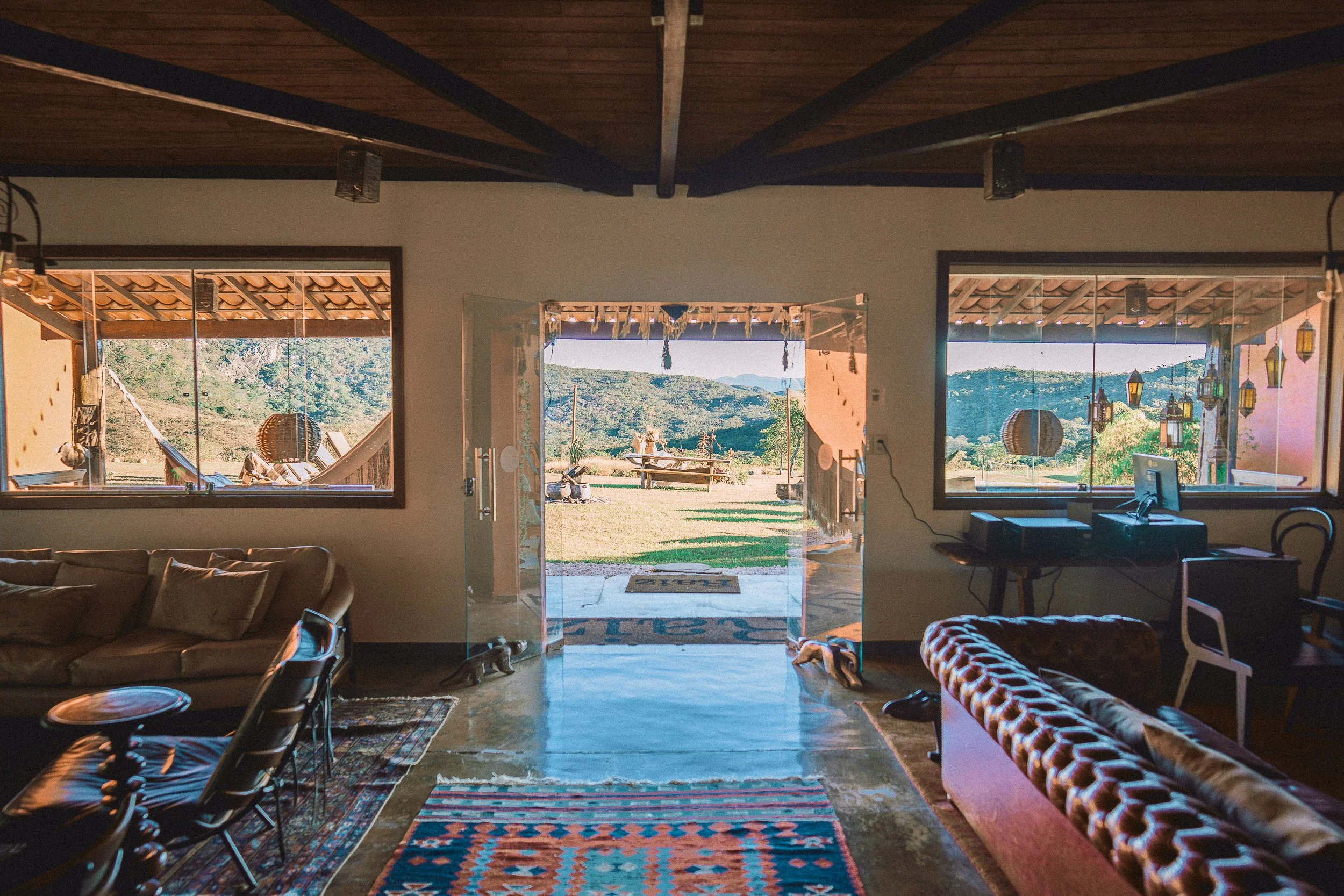
![View of a lush green outdoor patio with lounge chairs at Pousada Raíz Parque in Rio Preto State Park, Minas Gerais]()
The Occasional Contrast (2 nights)
Not every night in the highlands is rustic.
At times, the trail leads us to more refined lodgings built for leisure, wellness, and rest. These places belong to the story too.
Experiencing them in contrast to the backcountry doesn’t dull the senses. It sharpens them.
After days of peaks, valleys, and simple living, a comfortable room, a long shower, and a slow evening have a way of putting the rest of the range into perspective.
-
![A black and white photo of the cozy living room at Elisa's house in Curralinho (Extração), Minas Gerais]()
Private Home (1 night)
Unlike a homestay, this is a place that’s entirely ours for the evening.
We’ll spend the night in a simple village home in Curralinho, settling into the rhythm of one of the smallest communities on the expedition.
There’s something satisfying about arriving under your own steam, closing the door behind you, spreading out a little, and letting the day catch up with you.
Curralinho is small enough that everything worth seeing is just a short walk away, leaving plenty of time to celebrate, reflect, and rest up before the long haul on Day 3.
-
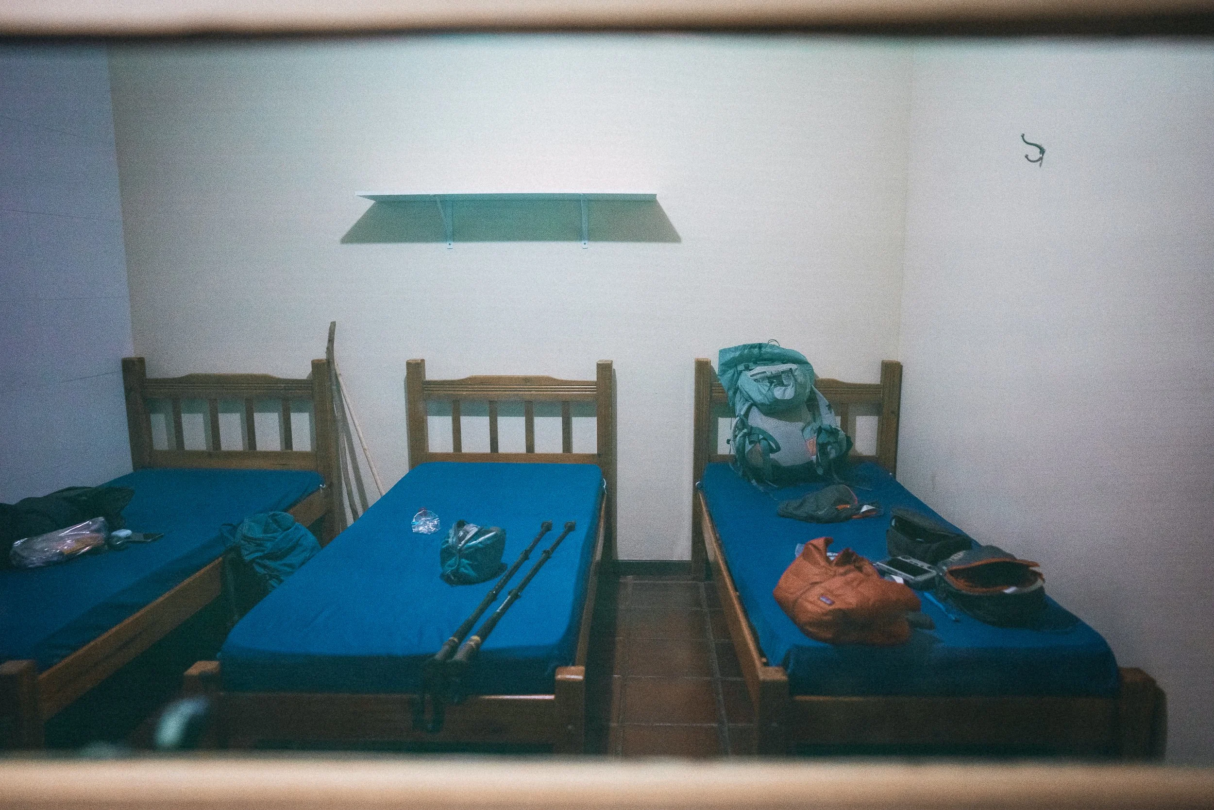
![Wooden beds and mattresses at a chalet in Rio Preto State Park, Serra do Espinhaço]()
Park Lodge (1 nights)
The “chalets” at Rio Preto State Park are simple, practical structures designed for one purpose: putting travelers within walking distance of some of the Espinhaço’s finest rivers, swimming holes, waterfalls, and trails.
The rooms are comfortable, but won’t win any design awards. Fortunately, that’s not why we’re here.
A short walk from your front door lies white sand, pristine pools, waterfalls, and one of the most beloved conservation units in the range.
-
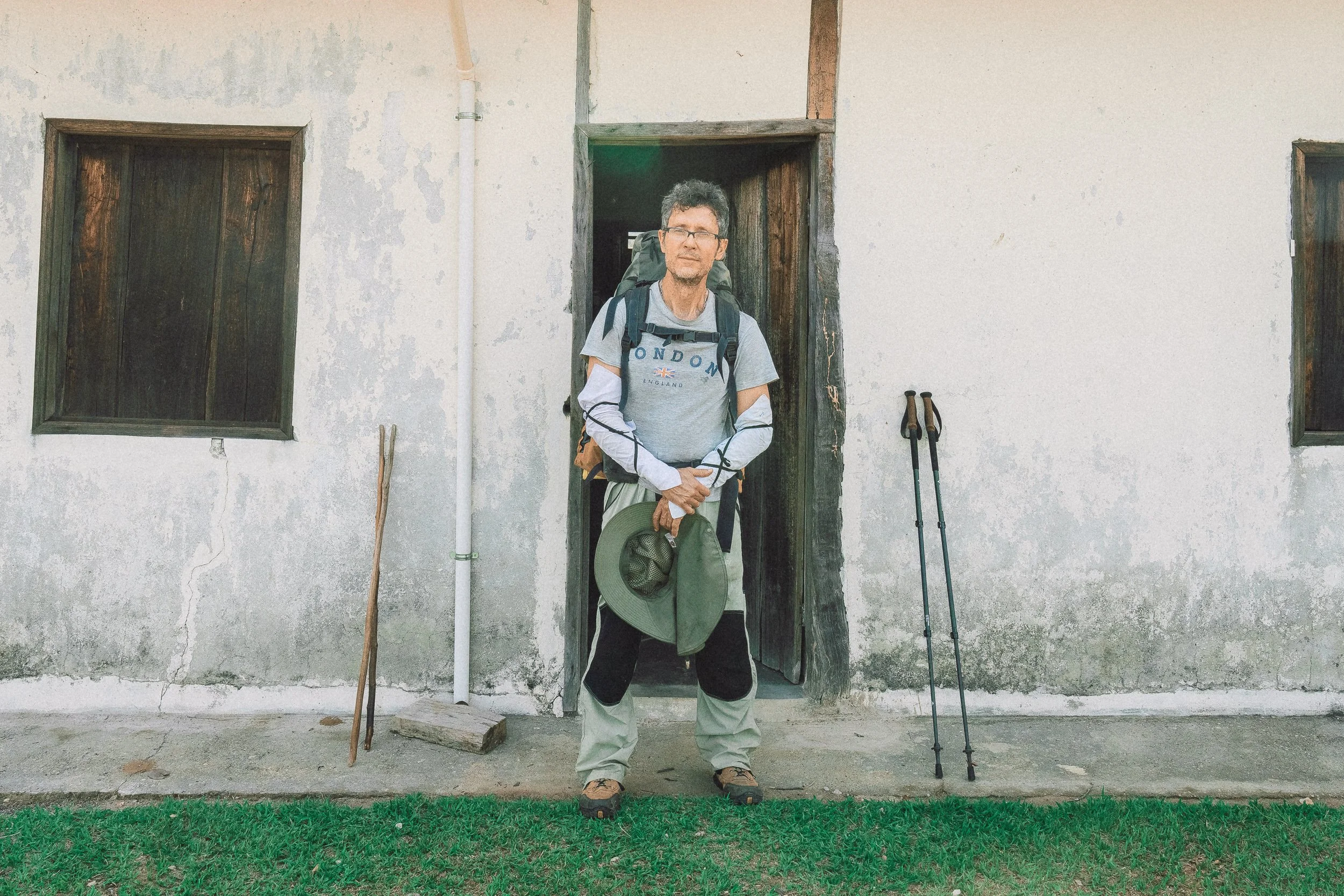
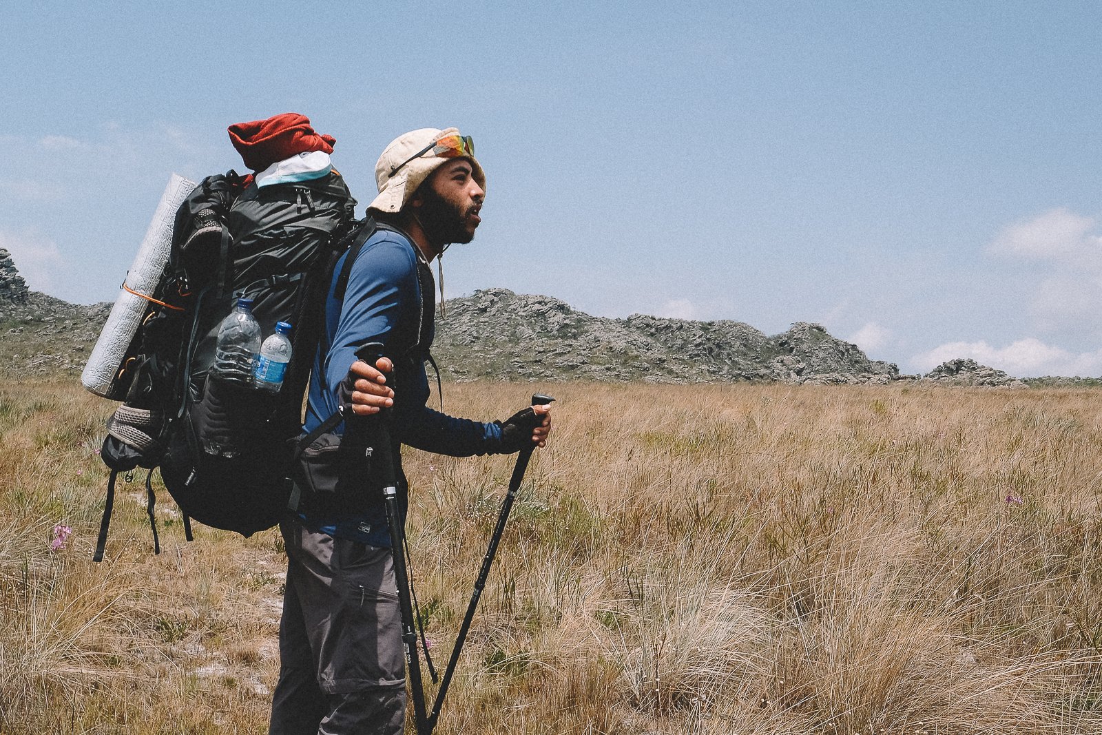
![Portrait of Adriano with his backpack, trekking poles, and hat, at Mozart's house in Rio Preto State Park]()
Wilderness Refuge (1 night)
Some of our favorite places to sleep in the range are also among the simplest.
Following our descent of Pico Dois Irmãos on Day 6, we’ll spend the night at Mozart’s house, a humble ranch home perched atop the Chapada do Couto, one of the most remote stretches of highland in this part of the range.
Long before the surrounding landscape became protected land, the ranch sat at the crossroads of the highlands, receiving miners, flower-pickers, ranchers, and travelers moving between distant valleys and communities. Its owner, Mozart, became something of a local legend in the process.
The house itself is simple: a few rooms, a small kitchen, cold water.
We usually arrive after dark, tired and happy after a long day on the trail.
Location is the luxury at Mozart’s house. Silence comes standard.


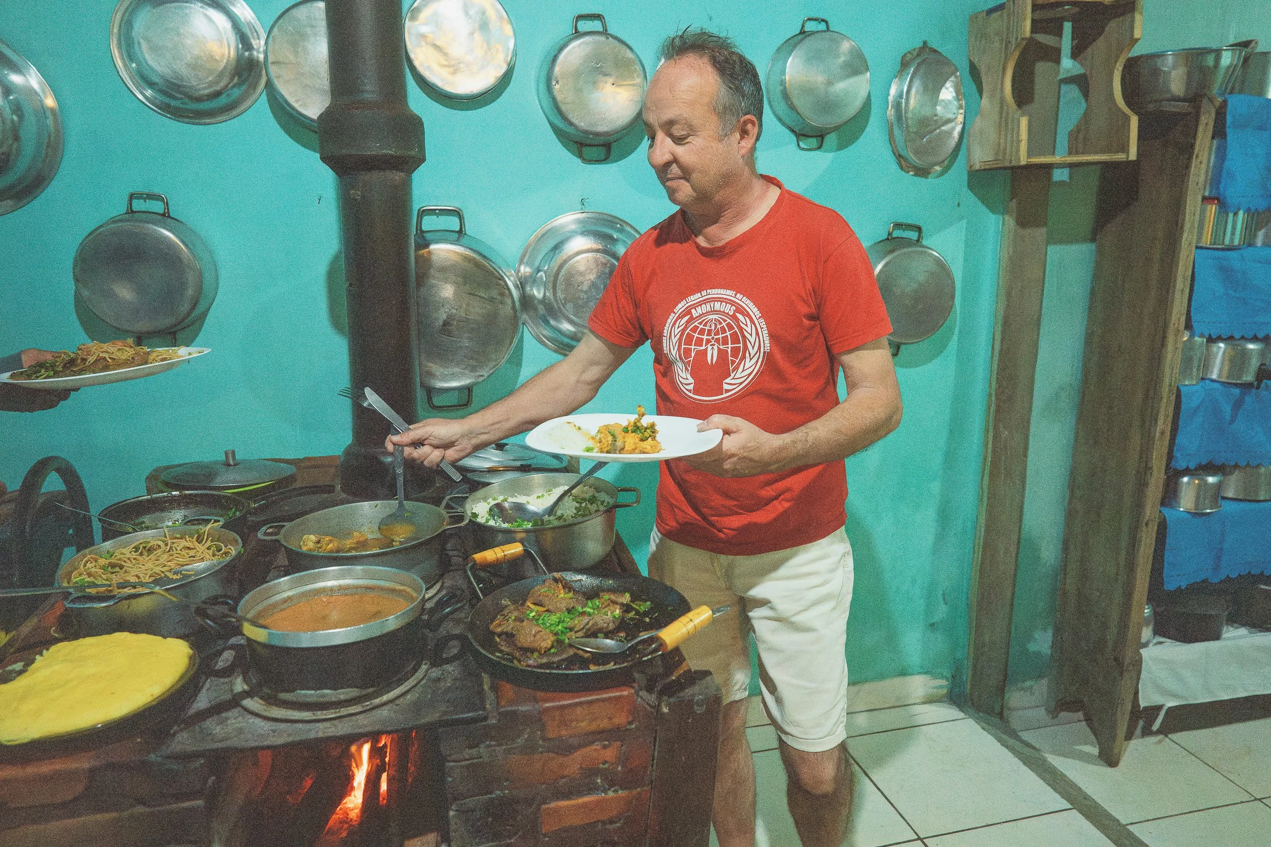
What we eat
Food & Fire
Tropeiro. Torresmo. Frango com quiabo.
If you’re unfamiliar with comida mineira, you will be by the end of the trip—and Brazilians everywhere will be jealous.
Most meals in the Espinhaço are simple, hearty, and deeply tied to the region: rice, beans, and angu sit alongside locally raised meats, fresh vegetables, and homemade dishes prepared in seasoned cast-iron pots over wood-burning stoves.
Breakfasts often bring freshly baked pão de queijo, quitandas, coffee, and local fruits and cheeses to the table.
Some meals are rustic. Others are unexpectedly refined. Nearly all of them are memorable.
Most of us abandon our weight-loss goals early on.
It’s worth it.
Crew
Owls & Masters →
-
![Portrait of Eddie at the summit of Pico Dois Irmãos, Rio Preto State Park]()
Eddie
Expedition Leader + Country Guide + Translator (Full-Time)
The bumper sticker on his ’89 Toyota Bandeirante (Brazilian Land Cruiser) may read “Lost Texan”, but don’t be fooled: Dallas-born Eddie has dedicated himself to the study of Brazilian history, society, and geography since arriving with a surfboard and $800 in 2002.
He first found his way to the Espinhaço in 2018 and has spent the years since documenting its unforgettable characters and labyrinth of forgotten trails.
The only thing he enjoys more than exploring this remarkable and little-known part of the world is bringing it to life for travelers who want to experience and understand it, not just pass through.
-
![Elisa on the trail in Fazenda Santa Cruz do Gavião, Serra do Espinhaço]()
Elisa
Expedition Leader + Country Guide +Translator (Full-Time)
The first time Elisa encountered the daunting “roads” of São Gonçalo do Rio das Pedras during a weekend getaway in 2019, she swore to her mom she would never come back.
These days, she can’t seem to leave the Espinhaço, having spent the better part of her life since then driving all manner of backroads in a gangly leaf-sprung 4x4 named “Gaucha”—usually with various drones, satellite devices, emergency contacts, and communications equipment in tow.
Bringing itineraries of this scope to life in this part of the world requires determination, planning, communication, patience, and the kind of vision that sees adventure where others see obstacles. The rest of us just require Elisa.
-
![Júlio at the base of Pico Dois Irmãos, Rio Preto State Park]()
Júlio
Regional Guide + Naturalist (Full-Time)
The difference between a good guide and a great one is calling. In Júlio’s case, there was never a question.
Deeply knowledgeable, energetic, and committed to the places he works in, he brings both his experience in the mountains and his degree in Geography to every journey.
When the brush is thick, snakes abound, the light is fading, and there are still kilometers ahead, there’s no one we’d rather have beside us.
-
![Xaxau loading bags onto Gaúcha's roofrack in Sempre Vivas National Park, Serra do Espinhaço]()
Xaxau
Overland Driver (Full-Time)
The eldest son of Diamantina’s most celebrated 4x4 family, Xaxau carries himself with a quiet confidence that comes from knowing exactly what he’s doing. One of the region’s most seasoned mechanics and welders, he’s also an expert rider of horses, motorcycles, and—lucky for us—vintage 4x4s.
You’ll see Xaxau and Gaúcha during long overland crossings, but it’s the moments when you don’t see him—driving parallel to our route somewhere out beyond the horizon—that put us most at ease. In the unlikely event of an emergency, there’s no one we’d rather have nearby.
-
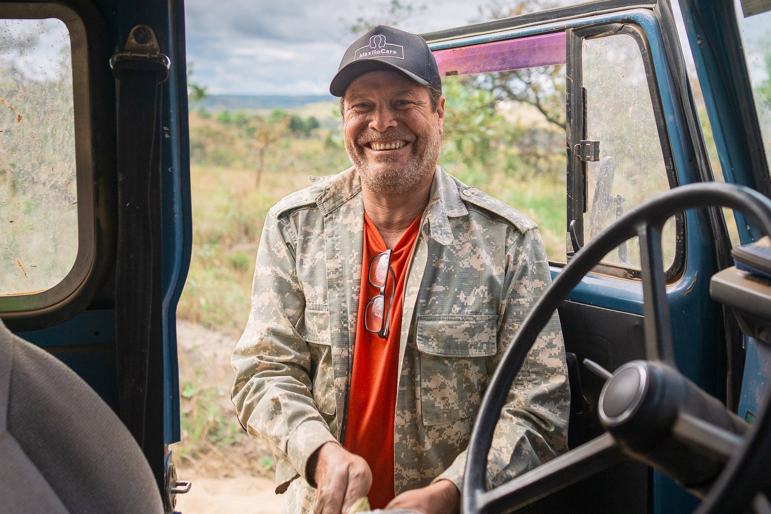
![Perón at Pousada Raíz Parque, Rio Preto State Park]()
Perón
Overland Driver (Full-Time)
Perón drives just about anything that moves—jeeps, trucks, boats, motorcycles—and has spent decades fixing them all. His knowledge of the Cerrado and its inhabitants runs just as deep. He’s also an accomplished fisherman, and (as you might expect) a gifted storyteller.
When Michel first told us about his vivacious, history-loving uncle, we couldn’t wait to meet him. What we found was one of the kindest, most deeply respectful, and most reliable men in the range—and a perfect fit for this crew.
You'll see plenty of Perón throughout the crossing, whether on overland sections, at camp, or waiting for us at the end of a long day.
-
![Michel and Gaúcha near Barão de Guaicuí, Serra do Espinhaço]()
Michel
Support Driver (Full-Time)
A year abroad in Australia showed Michel the power of travel, and convinced him that his hometown of Diamantina deserved to be rediscovered. Since then, he’s become one of the most renowned photographers in the Espinhaço, documenting the region’s people and everyday life.
On our crew, Michel brings that same perspective—along with his fluency in English, his love of cultura mineira, and a natural ability to connect people to the place around them.
There are worse ways to spend a long drive through the backlands than listening to Michel talk about the place he calls home.
-
![André driving Gaúcha near Curimataí, Serra do Espinhaço]()
André
Support Driver (Full-Time)
A soft-spoken motorcycle enthusiast from Diamantina’s most celebrated family of 4x4 mechanics, André combines small-town roots with a love for the wider world. He’s a devoted P.E. teacher in the region, but it’s his instinctive feel for vehicles and terrain—and his dirt bike skills—that brought him onto our crew.
As the motorcycle rescue driver, his presence runs quietly alongside the route. If you see him on the trail, don’t panic. You’re already being taken care of.
-
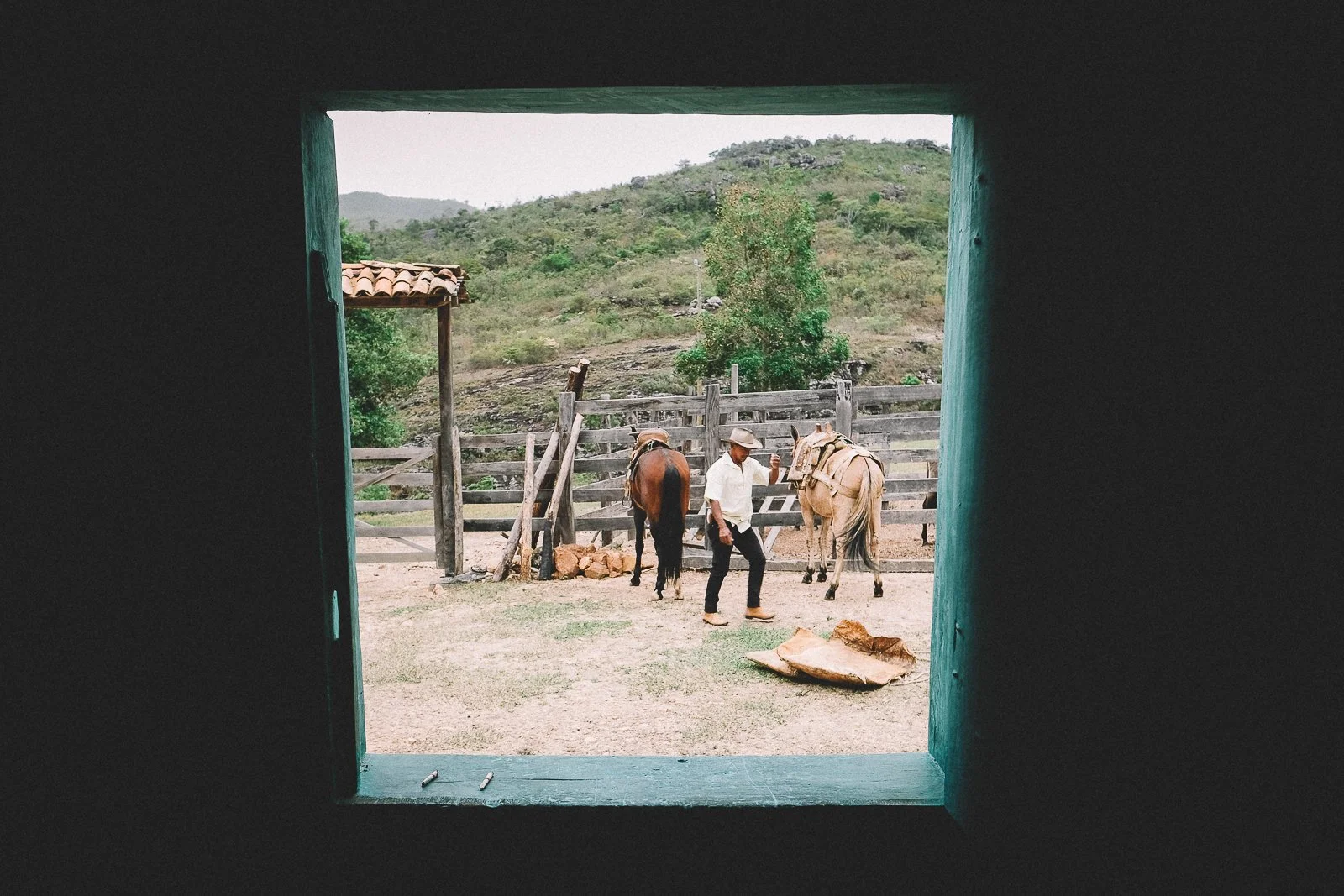
![Santo at his home in Bica d'Agua, Serra do Espinhaço]()
Santo
Local Guide + Mule Driver
A local legend on par with the mountain that towers above his home, Santo spent decades driving mules from the quilombola hamlet of Bica d’Agua to Diamantina and back as one of the Espinhaço’s last tropeiros.
Today, he’s best known for receiving and guiding those who make the crossing from Bica d’Água to Chapada do Couto.
Stoic and hardened, yet soft-spoken and graceful, his backcountry skills are unmatched—and his camp grub isn’t half bad either.
Our crossing through the highlands brings us to Santo’s doorstep, where Dona Maria’s wood-fired stove is the stuff of regional lore.
-
![Portrait of Marcos at a waterfall in São Gonçalo do Rio das Pedras, Minas Gerais]()
Marcos
Herbalist + Local Guide
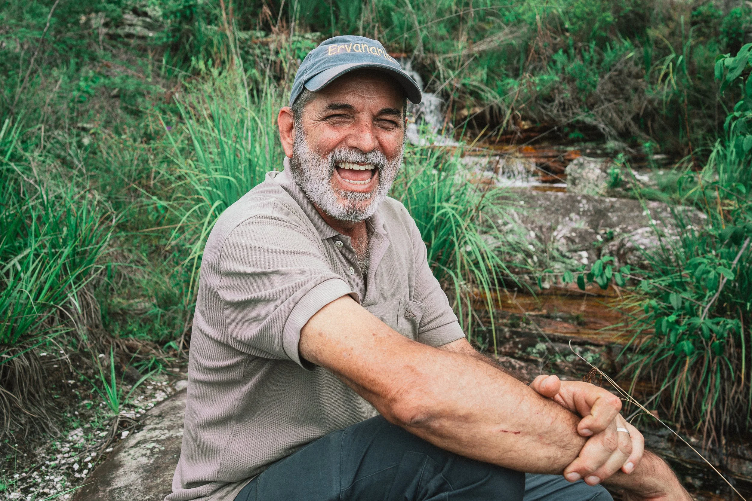
A journalist by training and a farmer by practice, Marcos has spent more than three decades working with medicinal plants.
Despite the depth of his knowledge, he returns again and again to what he calls the “simple”—small practices that, in his experience, remain the most effective.
On the trail, he moves easily between stories and plants, drawing from years of travel through the Cerrado and a lifelong habit of paying attention.
We'll have the privilege of walking alongside him through the serra above São Gonçalo do Rio das Pedras.
-
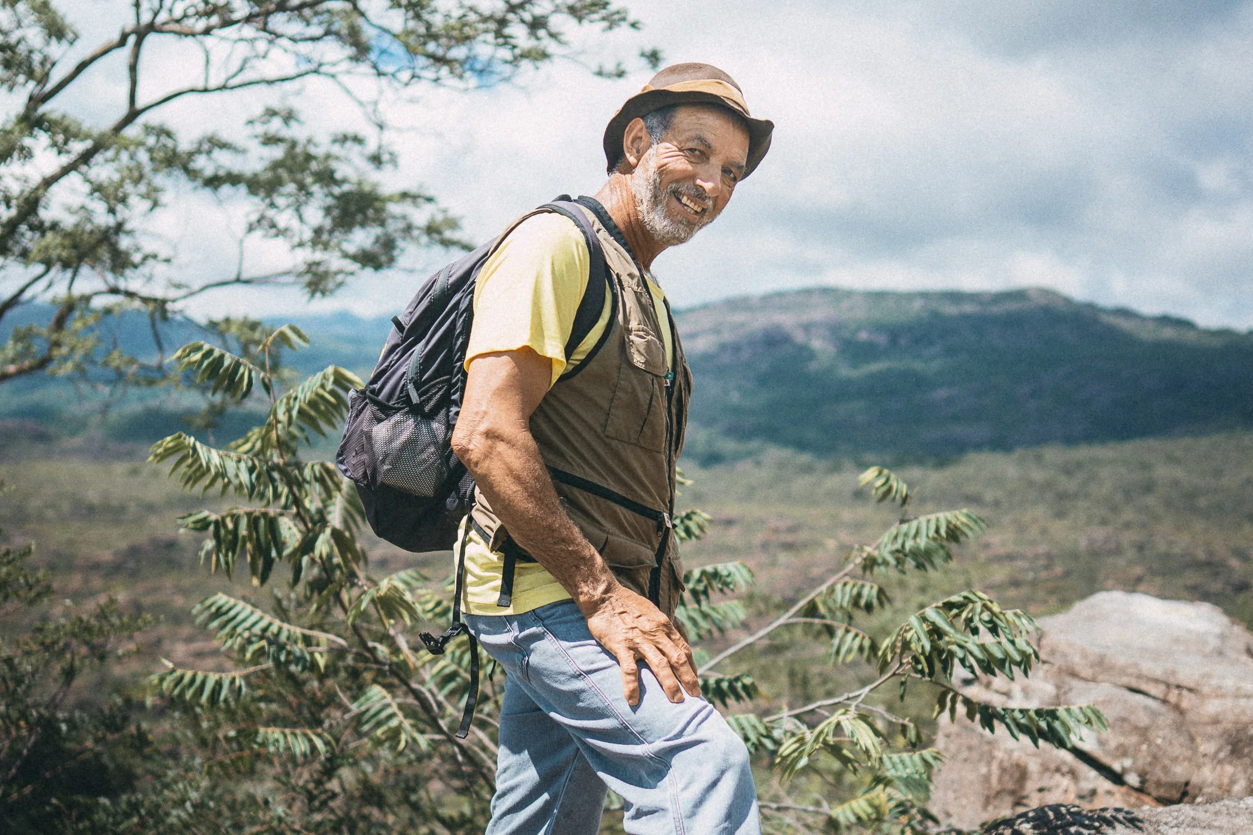
![Genésio during a hike to Pico do Itambé, Serra do Espinhaço]()
Genésio
Local Guide
On expeditions, as in life, you want resilient, kind-hearted people beside you—people who’ve done it themselves and want to see you succeed.
Genésio is one of them.
A Park Ranger from a family of Itambé guardians, he knows the mountain better than anyone. We'll have the pleasure of walking alongside him on the slopes of Itambé.
-
![Deco on the trail in Rio Preto State Park, Serra do Espinhaço]()
Deco
Herbalist + Local Guide
Raised in what is now Rio Preto State Park, Deco knows the landscape in a way that could only come from a lifetime spent inside of it.
A self-taught expert in the flora of the Cerrado, he can name nearly every plant in sight—in Latin—and usually has a story to go with it.
On the trail, he’s all movement and conversation. You'll get to see for yourself as the expedition makes its way through Rio Preto State Park.


Questions? We’re here if you want to talk it through.
What’s Included
Crew, meals, lodging, equipment, and support throughout the expedition.
-
A mix of pousadas, homes, Park lodges, and occasional backcountry stays, with a few more comfortable nights built in along the way.
-
All breakfasts, lunches, dinners, and daily trail snacks are included.
Meals are shared in homes, pousadas, and small-town restaurants along the way—simple, generous, and rooted in the cooking traditions of the highlands.
-
All ground and river transportation within Brazil is included, from arrival to departure.
This includes overland travel, support vehicles, and pack animals where the route calls for them.
-
Each Expedition is led by Elisa and I, supported by a core crew and local specialists who join us along different stretches of the route.
[Meet the Crew →] -
We provide all group and expedition gear, including camping equipment, kitchen setup, water filtration, and safety systems.
You’re welcome to bring your own gear if you prefer—especially items you’re used to using on the trail.
-
All required permits, park entries, and local permissions are included and arranged in advance.
-
We travel with support vehicles, satellite communication systems, first-aid equipment, and an established safety structure for remote travel in the range. Crew members remain in contact throughout the expedition.
-
We’ll help you prepare for the expedition with dedicated calls, planning guidance, and ongoing communication before departure.
-
You’ll receive a detailed expedition dossier before departure, along with a small set of practical items during and after the trip.
Prerequisites
prior trekking and/or outdoor experience is strongly recommended, but not required.
All applicants must undergo a complete physical examination and receive written approval from their physician within 3 months of the Expedition.
Odds & Ends
Travel Insurance
Proof of adequate medical & emergency travel insurance is required before joining the Expedition. Details are available in our Terms & Conditions. We’re happy to talk you through the details if needed.
What’s Not Included
Airfare
Medical & emergency evacuation insurance (minimum required)
Trip cancellation or other travel insurance
Visas
Any meal or activity not outlined in the itinerary
Alcoholic beverages
Gratuities (tips &/or community donations)
getting there & away
We’re happy to recommend travel arrangements to and from our rendezvous point in Belo Horizonte, Brazil. Please note that Gift of Go does not book international flights on behalf of travelers.
CONNECTIVITY NOTES
3G, 4G & 5G signals (in that order) are widely available across the Espinhaço frontcountry, where we will spend the majority of our evenings & mornings. Those signals are sporadic in the backcountry, however, where we’ll spend the majority of our days. Your connectivity will depend largely on your carrier & plan; if you’d like, we can provide you with a Brazilian SIM card upon your arrival. WiFi is available at many of our accommodations during the mornings & evenings of the Expedition.
Additional Reading
A Flower & A Way of Life in Peril — Scientific American
Life on the rocks in Brazil’s Campo Rupestre — the guardian
Explorations of the highlands of Brazil — Sir richard burton
Brazilian Diamonds: A Historical & Recent Perspective — Gems & Gemology, Spring 2017 Vol. LIII
The Espinhaço Range Biosphere Reserve — UNESCO
Globally important Agricultural Heritage System (GIAHS) Proposal — CODECEX
The Meaning in the Miles
Savannah & rainforest. Miners & mule-drivers. Wildflowers, water, and a way of life in transition.
-
The Espinhaço Meridional is at its highest and most sculpted in the southeastern corner. Peaks soar above long, folded ridgelines—the result of ancient tectonic forces that lifted and tilted the range westward like a series of rumpled sheets.
Here, the transition between Atlantic Rainforest and Cerrado is especially visible. Lush river valleys give way to open campos rupestres, where quartzite outcrops, white sand soils, and wind-shaped vegetation define the landscape. Water is everywhere, spilling over escarpments in clear, frigid cascades before descending eastward toward the fertile lowlands.
This is the range at its most exposed. It’s also, in many ways, at its most legible: a place where geology, ecology, and human settlement are layered in plain sight.
-
After a century of relative quiet, the southeastern highlands of the Espinhaço are again changing.
For generations, former mining villages like Milho Verde, São Gonçalo do Rio das Pedras, and their neighbors moved at a quiet, agrarian pace. Dirt roads, seasonal agriculture, small-scale extraction, and family networks shaped daily life. In recent years, improved access (including stretches of fresh asphalt), growing visibility (Instagram), and a steady flow of tourists from places as far as São Paulo and Rio are altering that rhythm.
Some local families see opportunity: paved roads, new businesses, broader markets, and economic stability in a region long defined by scarcity. Others worry about the speed of change: about what is gained, what is lost, and who decides.
This part of the range is large enough to feel like its own world, but small enough to be connected. In some stretches (particularly Mato dos Crioulos), tourism remains modest and largely unstructured—for now. In others (particularly the Milho Verde-São Gonçalo-Capivari corridor), the acceleration has begun. The tension between preservation and development isn’t abstraction; it plays out in conversations about “the road”, zoning, land prices, and the future of small communities.
The Serra Circuit weaves through this landscape carefully. We pass through places that are adapting, negotiating, and redefining themselves in real time.
The Espinhaço’s beauty is undeniable. So are the questions about what comes next. It’s a privilege to experience it at this moment.
-
The Amazon grabs the headlines, but Brazil wouldn’t be the most biodiverse country on earth were it not for its “other” ecological treasures, two of which are found in the Espinhaço: the Cerrado and the Atlantic Rainforest (Mata Atlântica).
Trailing only the Amazon in size, the Cerrado is the most biodiverse tropical savannah on the planet home to:
800+ species of birds
10,000+ species of plants
120 reptiles, 150 amphibians, 1,200 fish, 200 mammals
90,000 species of insects
The Atlantic Rainforest, meanwhile, holds over 20,000 species of plants, 1,000+ birds, 2,000 vertebrates, and 300 mammals, many found nowhere else on earth.
Geomorphologically speaking, the Espinhaço is a tale of these two endangered biomes—a rare, high-altitude transition zone where their systems converge. In that overlap lies the campos rupestres: a rocky, flower-strewn ecosystem found almost exclusively within the range, and considered by many to be Brazil’s most biodiverse habitat.
You’ll get to witness this interplay between grasslands and rainforest throughout our Expedition, especially in Chapter I.
Few places in Brazil reveal this ecological overlap so clearly.
-
The Serra do Espinhaço Meridional harbors a remarkable 19 conservation units, encompassingnearly two million acres of protected land. Combined with the surrounding buffer zones, they span an area roughly the size of New Jersey.
Collectively, these protected lands are known as the Espinhaço Mosaic(Mosaico do Espinhaço), and they represent a remarkable concentration of endemic species.
We’ll trace six of the Mosaic’s conservation units during our Expedition, including:
The State Parks of Biribiri, Rio Preto, and Itambé
The Águas Vertentes State Environmental Protection Area
The Rio Manso Municipal Environmental Protection Area
And the Várzea do Lajeado e Serra do Raio State Natural Monument
-
Getting from Point A to Point B has always been an adventure in the Serra do Espinhaço, and nowhere is this more evident than along the region’s spectacular (and virtually empty) network of historic trails.
While urban footpaths, game trails, dirt roads, old rail lines, and park-administered nature trails each have a role to play in the Espinhaço’s winding logistical labyrinth, three kinds of passages define the backcountry here:
Colonial-era stone paths, built by enslaved Africans to facilitate the diamond trade along the Estrada Real
Winding mule trails, used by tropeiros to transport goods until as recently as the 1980s
Centuries-old smuggler routes, later retraced by European naturalists like Sir Richard Francis Burton and Augustin Saint-Hilaire (among others) during their 19th-century expeditions across the Cerrado
Our team has spent years rediscovering this lost network, documenting its history, geography, and inhabitants while charting our expeditions.
The trails remain largely untraveled.
-
According to the UN, a staggering 89% of Brazilians now live in urban areas (typically defined as population centers with 2,000 or more inhabitants), compared to just 56% of people worldwide.
The Serra Circuit casts a light on the life among the rural 11%.
We’ll pass through more than a dozen communities during our expedition, overnighting in 10 of them. From UNESCO World Heritage city Diamantina (pop. 50,000) to tiny Bica d’Agua, each community on route reflects a distinct history and way of life.
Among the places we’ll visit:
The quilombola communities of Capivari and Mato dos Crioulos
The colonial-era mining districts of Mendanha, Curralinho, and São Gonçalo do Rio das Pedras
The historic vila of Biribiri
The agrarian hamlets of Abóboras and Alecrim
-
Tropeiro. Tutu. Torresmo. Frango com molho pardo.
If you’re unfamiliar with the hearty regional cuisine of Minas Gerais, you will be by the end of the trip—and Brazilians everywhere will be jealous.Still relatively unknown abroad, comida mineira is deeply beloved within Brazil, where it’s celebrated for its timeless preparation methods: traditionally relying on wood-fired stoves and clay or cast-iron cookware, and fresh, minimally processed ingredients.
Locally sourced fruits and vegetables, high-quality dairy, and home-raised pork and chicken are hallmarks, as are salted beef and mandioca (cassava).
Treats unique to the Espinhaço include angu (think: polenta), quitanda (small handcrafted biscuits), samambaia (fern), and queijo do Serro—a semi-cured local cheese that’s won international awards and generated culinary buzz around the Serro microregion.
Finally, a word about that most beloved of Brazilian delicacies, pão de queijo (cheese bread): it was both invented in Minas and perfected in Minas.
You’ll get to judge for yourself throughout the Expedition. -
Traveling on foot changes the nature of arrival. There’s nothing quite like being received graciously by kind souls in “the middle of nowhere” after a day of trekking through the harsh elements.
A village that might feel quiet or unremarkable from a vehicle takes on a different weight when reached after a full day on the trail: the reception is different, the conversation is different, and the evening carries context.
Throughout the expedition, we’ll spend nights in a range of homes and small lodgings, from historic townhouses and adobe farmsteads to family-run pousadas and wilderness shelters. Each reflects the rhythms and realities of its setting.
Our visits aren’t staged. They’re scheduled. Doors opens, meals are prepared, and stories—of the trail we arrived on, the weather, of life wherever it is we find ourselves that evening—surface naturally. Comfort varies, but hospitality does not.
Having the opportunity to experience how folks live in this part of the world is a privilege few know. Sharing a table, washing off the dust of the day, and sleeping in a strange bed are all part of the experience.
Without them, we’d just be walking.
-
Before diamonds, flowers, or tourism (or the lack thereof), the Serra do Espinhaço was a story about water. And in the end, it is water—not gemstones, flowers, or natural beauty—that has protected the region once again.
As the birthplace of several of Brazil’s most economically vital rivers, including the Jequitinhonha, Doce, and São Francisco, the Espinhaço is bursting with tributaries, creeks, streams, marshes, and bogs. Voluminous waterfalls spill from its escarpments in every direction, creating fertile farmland to the east and breathing life into the sertão to the west.
The region can be challenging to explore during the summer months (December–February), due to the frequent threat of rain, lightning, swollen rivers, and muddy terrain. This is also when the vegetation is at its most verdant, and the waterfalls at their most spectacular.
Daily storms typically taper off by early March, making fall (March–May) one of the most beautiful times of year: gushing waterfalls, exuberant vegetation, plentiful springs, and easily crossable rivers.
Winter (June–August) is extremely mild and dry, offering near-perfect trekking conditions, though water levels continue to drop in rivers and waterfalls as the season progresses.
By spring (September–November), the long dry season finally breaks. September, in particular, offers another glorious window to explore the region: the parched savannah landscape bursting with cactus fruit and wildflowers, and gently flowing rivers criss-crossing the landscape.

Last Glance
12 days of mountains, miles, and meaning
199 km on trails and backroads
14,327 m cumulative elevation gain and loss
2–8 travelers
14 communities
12+ waterfalls
3 peaks
2 UNESCO designations
6 conservation units
3,000+ plant species
Few (if any) other travelers on the trail
Calendar & Pricing
The Serra Circuit
May 19 – May 30, 2027 | 12 days
One departure annually
$11,995 per person
Includes all crew, lodging, meals, permits, equipment, support vehicles, pack animals, and ground transportation.
Thinking about joining this departure?
Hold my place →
Prefer to talk it through?
Talk with Eddie →
Considering 2028 or beyond?
Talk with Eddie →
Proofs of Life
Photographs from Past Expeditions →


FAQs
-
We’ve walked long stretches of this trek with enthusiastic first-timers who did remarkably well—and with seasoned hikers who struggled. A lot comes down to mindset, resilience, and how your body responds to day after day on the move.
That said, this is a serious 200-kilometer trek. You should be comfortable carrying a 10–20 lb (5–10 kg) pack for extended days, averaging around 20–25 kilometers with significant elevation gain and loss across varied terrain. The trail is often rugged and sun-exposed, and river crossings are part of the route.
Some travelers grow stronger as the days go by. Others feel the accumulation.
If you’re unsure, speak with your physician or trainer before applying. A signed Bill of Good Health is required.
If you’d like to talk it through, we’re happy to help.
[Talk with Eddie →] -
We travel with a full support structure and stay in constant communication between teams.
If you’re tired or dealing with a minor issue, there are often ways to adjust while remaining part of the crossing.
If something more serious comes up, we’ll get you to the nearest appropriate care quickly and safely.
-
They’re humble, welcoming, and often a highlight of the trip.
On the Serra Circuit, we spend time in a small number of homes along the route, each different in character and comfort, but all safe and memorable.
These are real places, lived in by real people, and often where the expedition feels most human—around the table, in conversation, or in the quiet after a long day on foot.
They’re not polished or curated. They’re simple and sincere, and they have a way of staying with you.
-
Food is part of the story, and part of the pleasure.
Most meals are shared in local homes, pousadas, or small-town restaurants. Expect hearty, traditional comida mineira—simple, generous, and deeply tied to the region.
On a trip like this, the meals tend to linger. Long tables, good conversation, and the kind of evenings that tend to follow long days on the trail.
In certain towns, we’ll also have access to more varied or refined options.
If you have dietary needs, we’ll plan for them in advance.
Learn more about the food we eat during trips. →
-
Signal is available during most mornings and evenings of the expedition—whether in town or at our accommodations. On the trail, it’s limited.
We carry satellite communication equipment for emergencies.
-
Nearly everything.
Accommodations, meals, crew, ground transfers to and from the rendezvous point, transportation within the range, permits, and group trail gear are all included.
Flights, insurance, personal gear, alcohol, and discretionary spending are not.
-
We do, but not within this format.
For shorter or more flexible trips, take a look at our Bespoke expeditions. If you’re traveling solo and drawn to a more open-ended crossing, Journeys may also be a better fit.
-
All Expeditions are booked on a first-come, first-served basis.
With small group sizes and limited departures each year, we recommend reaching out as early as you feel comfortable—especially if your dates are fixed.