Chapter III
The Sertão
Festive cowtowns, mystical railway towns, and far-flung single-family towns. Ice-cold cervejas & hot spring resorts. Legendary waterfalls. Legendary hospitality. And miles (& miles) of open road.
Welcome to the Wild, Wild Lowlands.
Chapter III: The Sertão
16. Pé de Serra – Curimataí
17. Curimataí – Santa Bárbara
18. Santa Bárbara (Rest Day)
19. Santa Bárbara – Conselheiro Mata
20. Conselheiro Mata – Galheiros
21. Galheiros – Santa Rita

Day 16
day 16
Pé de Serra - Curimataí
It’s time to saddle up. Just when we were starting to get “comfortable” with the dense brush & isolation of the Espinhaço hinterlands, we’re changing worlds again. Geographically speaking, the transition from the uplifted campos of Sempre Vivas to the sun-scorched Sertão below couldn’t be more natural, yet the ecological & cultural changes that accompany it are striking. Over the course of the past 2 weeks, we’ve immersed deeply in diamond country & flower country. Today we find ourselves in cattle country.
Curimataí may have its fair share of cowboys, but it sure doesn’t look much like the American Midwest. With its charming bloquette streets & neat rows of colorful, historic homes, it looks more like a Bahian beachtown hiding out in the Sertão mineiro… which, to be honest, draped in green, doesn’t much resemble the stereotypical Sertão of the Brazilian northeast, either. The reason is water. While the classic Sertão prompts images of cracked earth, tortured trees, and misery, Pé de Serra, Curimataí, and our next destination, the tiny hamlet of Santa Barbara, are all situated on a privileged 10-km-wide strip of fertile land, sandwiched between the western escarpment of the Espinhaço and the eastern edge of the (also protected) Serra do Cabral. Voluminous waterfalls line the corridor, and the land bursts with fresh water springs and crystalline streams.
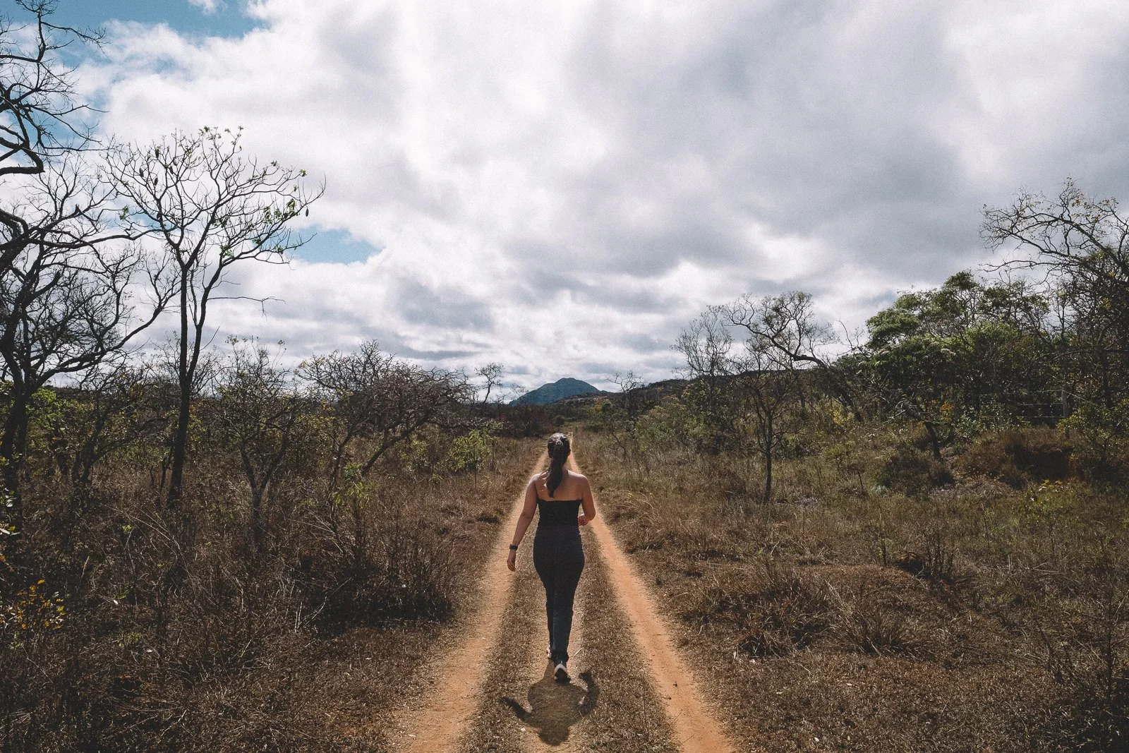
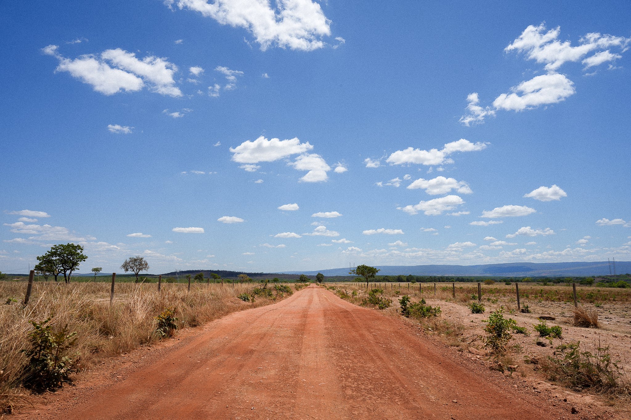
After 14 days along increasingly harsh & technical terrain, the change of scenery is welcome. We have a horizon again; vast open spaces and wide-open dirt roads, interspersed with flowing riparian forests & vibrant communities, with mountains on two sides. The hills are constant, but the gains & losses are subtle; the scenery, while beautiful, is less dynamic, lending a more meditative, pilgrimage-esque feel to long walks.
The logistics of our Expedition embrace this new reality. We are still in a little-visited part of the country, but we are in the front country again, with navigable roads and considerable distances between destinations that often feel world’s apart. We’ll have Andre, Xaxau, and the Bandies with us throughout the entirety of this Chapter, as well as a few new friendly faces to help guide us during stretches. For the next two days, we’ll also have a team of trusty Crioulo steeds at our disposal.
Today’s journey to Curimataí provides us with a good example of the week to come: a 24-km stretch of lonesome dirt road that can be traveled on foot, horseback, or overland—a decision we’ll leave to you (although we ask that you let us know your preference at least 24 hours ahead of time so that we can adjust our crew & logistics accordingly). If you’d like to rest your weary legs, sleep a bit longer, and get to the next destination a little quicker each day, this is the Chapter to do it. If, on the other hand, you’d like to continue to hoof it, we’re delighted to trek alongside of you.
Regardless of how you’d like to make today’s journey to Curimataí, you’ll begin the day with breakfast at Code’s house in Pé de Serra. Those who’d like to trek will need to get off to an earlier start, while travelers going by Bandy can sleep in—or visit one of the local waterfalls—this morning. If you decide to take a horse, you’ll depart Pé de Serra mid-morning with Tau, our host tonight in Curimataí, and an exceptional horseman. André, Xaxau, and the Bandies will be making the drive to Curimataí regardless, so everyone has the option of going light today and putting their big packs in the Bandies. On a related note, you’ll also have access to your travel duffels each day of this Chapter.
Aside from the main square in Pé de Serra (which we visited yesterday), there isn’t much in the way of attractions along our route today. What the route does offer, however, are big sky views, scenic dirt roads, pretty forests, and tranquil, country vibes. Our teams will meet up in Curimataí (official pop. 2,130; actual pop. closer to 400) this afternoon, before the sun begins to set, and have the rest of the day & evening to stroll through town, visit one (or both) of the local waterfalls (each about a 2-km round-trip walk from our accommodations), and/or hang out on the shaded front porch of the immensely pleasant Casa Sempre-Vivas.
Our hosts this evening, Tau & Gilma, reside at Casa Sempre-Vivas, but be there no mistake about it: this is a well-run pousada, not a typical homestay. Gilma is the quintessential hostess, as well as an outstanding chef (we look forward to her all-you-can-eat meals every time we’re in the area), with refined, well-executed takes on down-home Sertão cooking. Meanwhile, Tau plays the front-of-the-house role to a “T”: the conversation flows, the ice-cold beer never runs dry, and gratuitous petiscos & cachaça (aged by Tau, himself) seem to appear on the table at all the right times. For those who’d like to explore the town, there are a handful of butecos in the immediate vicinity of our accommodations, but don’t be surprised if you end up spending at least part of your evening mingling with locals, making use of the pousada’s (good enough) WiFi, and taking in the sights from Gilma’s front porch.
It’s a new Chapter, and we’re just getting started. Vamos aproveitar!
Distance (km): 24 (trek, horseback, or overland)
Elevation Gain/Loss/Cumulative (m): 443/445/888
Waterfalls: 0-2 (Optional; Curimataí, Moinho)
Conservation Units: 1 (Serra de Minas Municipal Environmental Protection Area)
Accommodations: Casa Sempre-Vivas (Inn; Curimataí)
Inclusions: Breakfast, Lunch, Snacks (Trail), Dinner
Connectivity: Sporadic, unreliable 3G/4G/5G on the trail; 3G/4G/5G & (limited, but doable) WiFi at Casa Sempre-Vivas
Street scene, Curimataí
Welcome to curimataí
Day 17
day 17
Curimataí - Santa Bárbara
Aesthetically & logistically, the 25-km journey ahead of us today, to the incomparable Vila de Santa Bárbara, is similar to the one we made yesterday to Curimataí, but our destinations themselves couldn’t be any more different.
First, the similarities: 1) A wide sun-scorched red dirt road, lined with vast tracts of open pastureland and scattered fields of campo sujo, and punctuated by Riparian forests & gently-flowing streams, dominates the foreground, while green mountains & a big country sky backdrop the scene; 2) You can opt to make the journey by “jeep” (in the Bandies), horseback, or foot; 3) We’ll all begin the day with breakfast at our pousada before heading out, and meet up at later this afternoon at our rendezvous point in Santa Bárbara.
Now the differences: 1) Curimataí is a bonafide Brazilian cowtown living its best life, while Santa Bárbara is a bucolic historic site with a commanding waterfall… that doubles as a fashionable hot springs resort town; 2) there are several pretty, swimmable waterfalls on route in between the two communities; and 3) the bountiful, lovingly-prepared breakfast spread at Gilma’s is worth writing home about: freshly-baked breads & cakes, farm-fresh cheeses & eggs, freshly-squeezed & -blended juices, exotic fruits, pão de queijo, raw milk & butter, coffee & honey, and more.
Tomorrow is our second & final rest day of the Expedition, and if you’d like to get an early start on your “resting” (more on that in a moment) and visit a smattering of pretty waterfalls to boot, you’ll want to hop in the Bandies. All said and done, the journey should take about 4 hours, placing you firmly in “rest mode” in Santa Bárbara by early afternoon. Those preferring to go via cavalgada will ride with Tau. Depending on the group’s pace & preferences, there should be plenty of time to visit at least one set of falls (Cachoeira do Brejinho), and potentially more should the day run long.
For those who’d like to save all of their resting for tomorrow, 30 km of scenic dirt road, waterfalls, & trail await us. We may not have as much time to frolic in each of the falls along the way, but aside from being an all-around pleasant trek, our route has the added benefit of leading directly to this evening’s rendezvous point: the natural infinity pool atop a 4th set of falls (Cachoeira Santa Bárbara), also known as the best sunset view in this part of the Espinhaco. (Those who ride in the Bandies or via horseback will need to make the 2.5-km trek to the top of the falls at around 4:30pm to join us).
Santa Barbara is an incredibly unique community, with a unique variety of accommodations to match (we’ll talk more about them in tomorrow’s itinerary). For the next two nights, our Expedition will be renting a handful of neighboring “chalets”—neighboring homes located on the “vila’s” main square (think: AirBnB, but with a formal check-in process and plastic bracelets that let you access the various amenities in the community). Each chalet has its own character & layout, but all feature private bedrooms, shared hot-water bathrooms, common areas, and a kitchen with the basic amenities. Unless we’ve agreed to other arrangements, everyone will have their own private room.
With regards to dinner: for the first time since Diamantina, we have… options(!), including some pretty tasty Brazilian pizza (at a little pizzeria with al fresco dining on the main square) and artisanal burgers, fries, and finger foods (at Dom Raton’s pub, right in front of the pizza place). The rub is that, depending on the season, both establishments may not be open on the same night (so much for options!). We’ll pick up the dinner tab wherever you decide to go, but you’ll have to get out your wallet for drinks. Both establishments accept major credit cards.
Quirky, contradictory, a little unorganized, and more than a little self-important—yet undeniably gorgeous & gostoso, all the same—Santa Bárbara is as much of an experience as it is a place. During our first visit to the vila (on Day 14 of an 28-day exploratory trek in 2021), we were simultaneously mind-blown by the confluence of cultural information and delighted by the creature comforts & surrounding nature. It’s an unmissable and unforgettable place.
Let the resting begin.
Distance (km): 25 (overland, horseback); or 30 (trek)
Elevation Gain/Loss/Cumulative (m): 443/445/888
Waterfalls: 1-5 (Santa Bárbara; Optional: Curimataí, Brejinho, Borges, Veu)
Conservation Units: 1 (Serra de Minas Municipal Environmental Protection Area)
Accommodations: Aguas de Santa Bárbara Resort (Santa Bárbara)
Inclusions: Breakfast, Lunch (Trail), Snacks (Trail), Dinner
Connectivity: 4G & (limited, but doable) WiFi at Casa Sempre-Vivas; unreliable 3G/4G/5G throughout Santa Bárbara; Wi-Fi at the Resort & Pousada)
nighttime adventures, Vila de Santa Bárbara
Pão de queijo, Curimataí

Day 18
day 18
Vila de Santa Bárbara (Rest Day)
It’s been 8 days since our last rest day (in Rio Preto State Park), and we think you’ll agree that it’s high time for another. We also think you’ll agree with our choice of setting—in addition to being a fascinating historic & natural site, Santa Bárbara has… well, hot springs, for starters. And a sauna. And a pool (with a perfect view of the waterfall). And a bar in the pool (with a perfect view of the waterfall). And lest we forget, pizza & burgers & all-you-can-eat resort buffets. There’s even foosball, billiards, and (our personal preference) table tennis. There’s also Cachoeira Santa Barbara and its multiple levels of glorious, sun-kissed swimming holes.
The best part is, the day is yours to do as you’d like. If you’d like to take it easy at the Resort, hang out around the vila with the other guests, or explore the local trails & watering holes on your own, you’re free to do so.
With regards to meals today: similar to our rest day at Rio Preto State Park, all meals are pre-paid at the Resort’s main restaurant (located inside of the Resort; a 2-km walk along asphalt from the vila). This includes a breakfast buffet, lavish lunch buffet, and dinner à la carte (technically, we can’t pre-pay dinner orders, but the Resort will hold the tab for us until the end of our stay). Unlike in Rio Preto State Park, there are a few other options in “town” (the vila), including the afore-mentioned tasty Brazilian-style pizza and artisanal burgers. The rub is that, depending on the season, both establishments may not be open on the same night (so much for options!).
If you’d rather dine in the vila tonight, those meals are not pre-paid, but both establishments accept major credit cards. You’ll also have to pay for any/all alcoholic beverages at the Resort and/or in the vila.
We’ve got a fairly big day ahead of us tomorrow, with plenty of to-do’s on the agenda… but that’s tomorrow. We’re here now, in this incredibly unique, historic, and alluring place, for one last night. We hope you enjoy it.
Distance (km): N/A
Elevation Gain/Loss/Cumulative (m): N/A
Waterfalls: 0-1 (optional; Santa Bárbara)
Conservation Units: 1 (Serra de Minas Municipal Environmental Protection Area)
Accommodations: Aguas de Santa Bárbara Resort (Resort; Santa Bárbara)
Inclusions: Breakfast, Lunch, Snacks (Trail), Dinner
Connectivity: Unreliable 3G/4G/5G in Santa Bárbara; Wi-Fi at the Resort & Pousada)
downtown, vila de santa bárbara
Cachoeira de Santa Bárbara, Santa Bárbara

Day 19
day 19
Santa Bárbara - Conselheiro Mata
It’s back (up!) into the Serra we go. After two full nights in one place, it’s about time—we’re starting to feel like we were born & raised in Santa Bárbara.
We’ll start the day with yet another (quirky, yet plush) breakfast buffet at either the pousada or the Resort, then begin our steep ascent into the western reaches of the Espinhaço, making use of the historic, tunnel-like trail that climbs through the forest hugging magnificent Cachoeira Santa Bárbara. By the time we reach the dirt road turn-off leading south to Cachoeira do Telesforo, we’ll have hiked 6.5 km and gained nearly 800 m in a single 2-hr push.
In the interest of time—and pending road conditions—we’ll take the Bandies from here. While the scenery along the 26.5-km dirt road leading to Cachoeira do Telesforo is certainly beautiful, trekking it would come at the serious cost of prime waterfall viewing in our final destination this evening: the strange (& strangely alluring) Wild West town of Conselheiro Mata.
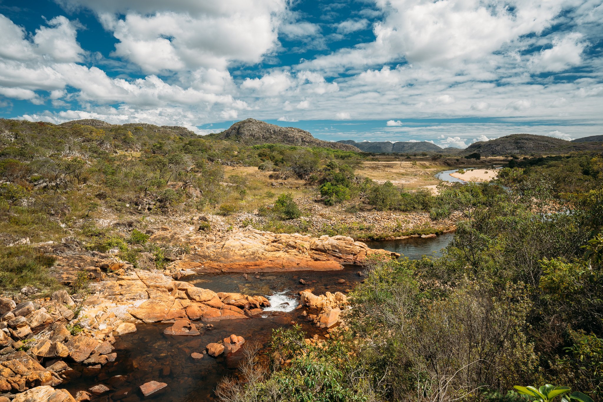
Not that the roadtrip in its place will be boring. Badly cracked earth, big rocks, and small meteor-sized holes all but guarantee a memorable mid-afternoon adventure. As for Telesforo, we’ll just say this: in a region of a thousand waterfalls, it reigns supreme. Road conditions allowing, we’ll have plenty of time to lunch, swim, and take in the gorgeous views of a setting that could—and should—be the 18th conservation area of the Espinhaço Mosaic, before making our way to Conselheiro, where the spectacular Cachoeiras das Fadas, Borboletas, and Usina await.
Conselheiro (pop. 200) is an incredibly fascinating community, with worn, rough edges that belie a kinetic mystical essence. Located at the confluence of the Riberao das Varas and the old railway, the town seemingly straddles the serra & the Sertao, extractivistism & ecotourism, and progressivism & conservatism, all at once. There are battles being fought here, but the surface is all red dirt charm & tranquility.
Similar to Gilma’s house in Curimatai, our accommodations tonight are at a pousada that doubles as a private residence. Simple, homey, and remarkably peaceful, the Pousada dos Cristais has a mysterious way of effortlessly putting us at ease. Dona Raquel & her family, including son Marco Antonio, daughter Analis & nephew Bruno, are friendly but respectful, the perfect hosts for this alluring community.
*** If you’d like to trek the full 33 km to Telesforo, we’re more than happy to oblige (after 2 days of pizzas, burgers, and craft brew, we’re usually a little desperate to shed the pounds, ourselves). Those of us who elect to make the trek will need to leave at dawn in order to rendezvous with the 4x4 group at Telesforo.
Distance (km): 6.5 (trek) + 44.5 (4x4); or 33 (trek) + 18 (4x4)
Elevation Gain/Loss/Cumulative (m): 512/65.5/577.5 or 905/601/1506
Waterfalls: 2-5
Accommodations: Pousada dos Cristais (Conselheiro Mata)
Inclusions: Breakfast, Lunch (Trail), Snacks (Trail), Dinner
Connectivity: Unreliable 3G/4G/5G in Santa Bárbara; Wi-Fi at the Resort & Pousada; unreliable 3G/4G/5G during the day; 3G/4G/5G in Conselheiro; WiFi at the Pousada dos Cristais)
Dona Raquel, conselheiro mata
Road to Cachoeira da Usina, Conselheiro Mata
Day 20
day 20
Conselheiro Mata - Galheiros
For the better part of the 20th century, the Trilha Verde da Maria Fumaça (probably best translated as The Green Line, but literally, The Green Trail of the Smoking Maria) transported passengers & goods daily across the Espinhaço’s 4 major administrative districts (Diamantina included). When it was dismantled in 1973 as part of the federal government’s campaign to eradicate railways nationwide (it’s a long story), it left thousands of residents isolated, spurring migration to Diamantina and beyond, and leaving a number of communities trapped in time.
This morning after a simple homemade breakfast at Pousada dos Cristais and some time to revisit the local waterfalls, we’ll hike 10.5 km west along the railway to a pair of other note-worthy waterfalls, each with its own infinity pool(s): Cachoeira do Tombador and Cachoeira da Raiz. From there we’ll split into two groups: one with folks who’d like to continue trekking (an additional 26.5 km) to our final destination this evening, and one with those who’d like to take the Bandies. The trail is gorgeous, dynamic, and not particularly difficult, given our now-crafted physiques. The old railway was removed long ago, leaving a (mostly) smooth dirt track in its stead. Verdant hills and rocky outcrops backdrop a carousel of Cerrado vegetation that moves quickly between forests and campo sujo to open pastures, and then back again, with scattered country homes dotting the course.
As we approach the scenic “community” of Mendes (pop. 2—but… growing!), trekkers & jeepers alike will be able to view remnants of the mining process as it functions today: there’s an abandoned site just off of the trail where giant, seemingly-flawless blocks of quartzite litter white sand fields like wind-toppled Moai. The Bandy group will stop for lunch at the home of Mendes’s lone residents, Aparecida & “Pinga-Fogo” (literally, Firedrop) before continuing along scenic, washboarded roads to Galheiros. Trekkers will lunch on the trail and beeline for Galheiros.
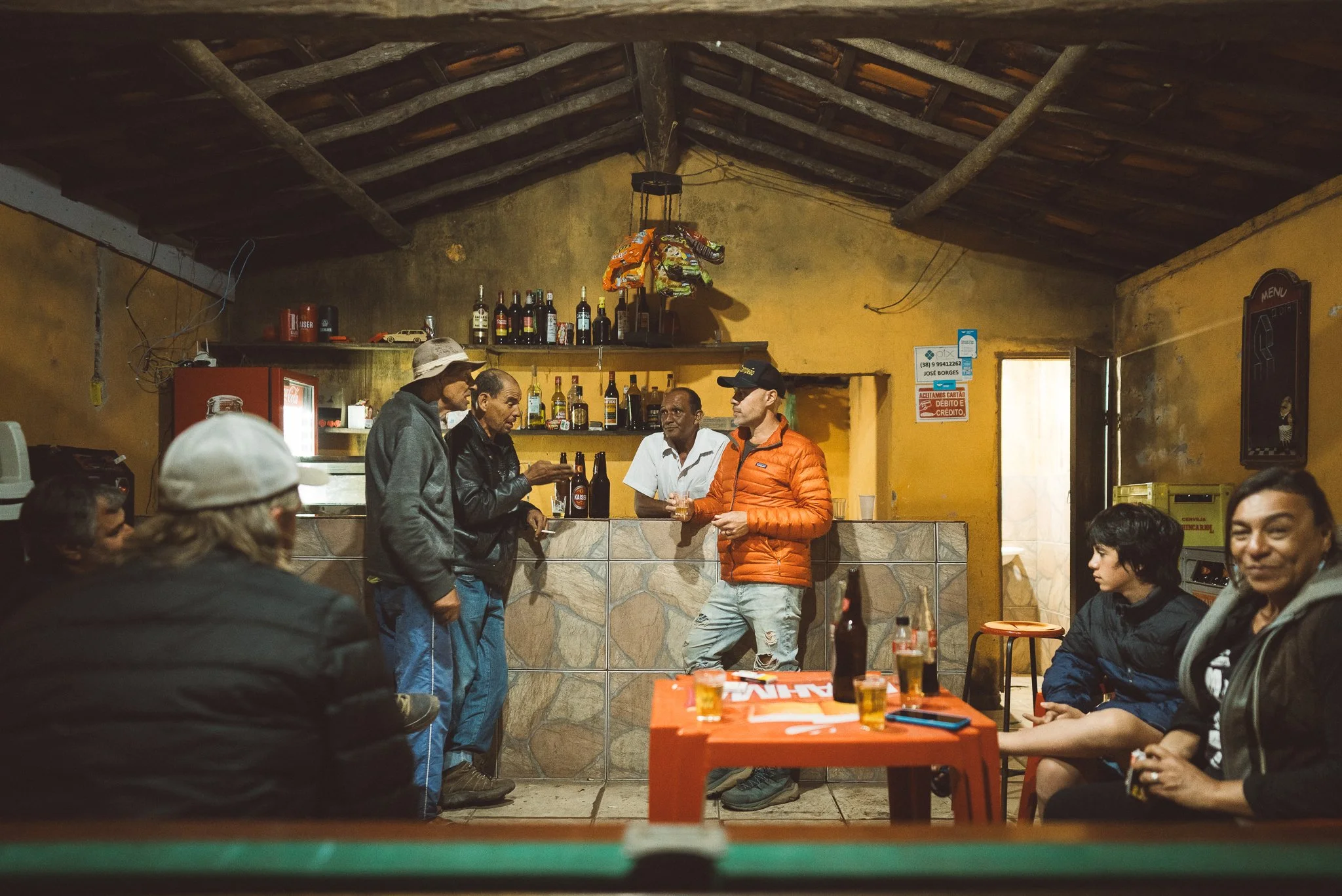
In stark contrast to up-and-coming ecotourism spot Conselheiro (and its seven waterfalls), tonight’s final destination, Galheiros (pop. 25), is what we would call an Espinhaço “deep cut”. Unheralded locally and lacking any semblance of tourism potential, but full of friendly folks, good-ol’ Mineiro culture, and two outstanding (and highly photogenic) dive bars, the community is the perfect place to relax & take in a final night of “civilization” before heading back north towards Sempre Vivas & the final Chapter of our Expedition.
Our accommodations at the picturesque ranch of a pair of recently-relocated Paulistas, Bia & Valerio, couldn’t fit the mood any better. The scenery is tranquil & gorgeous, the ranch house is cute & comfy, and the front patio just begs for good conversation (& perhaps an ice-cold brew) underneath the big sky stars. We’ll chow down on whatever goodness our hosts are serving up, but if its churrasco, we’re in for a treat: Valerio’s grilling skills are unmatched—nay, unheard of—in this part of the country, and Bia makes a mean set of traditional (Brazilian-style) sides.
*** If you’d like to trek the full 37 km to Galheiros, we’re more than happy to oblige. Those of us making the trek will need to leave at dawn in order to rendezvous with the 4x4 crew at Galheiros this evening.
Distance (km): 10.5 (trek) + 26.5 (4x4), or 37km (trek)
Elevation Gain/Loss/Cumulative (m): 183/51/234 or 905/601/1506
Waterfalls: 2-5
Accommodation: Casa da Bia e Valerio (Homestay-Galheiros)
Inclusions: Breakfast, Lunch (Trail), Snacks (Trail), Dinner
Connectivity: 3G/4G/5G in Conselheiro; Wi-Fi at Pousada dos Cristais; unreliable 3G during the day; limited Wi-Fi at Bia & Valerio’s House
Bar scene, Galheiros
The Green Line, mendes

Day 21
day 21
Galheiros - Santa Rita
There’s just something about tiny Santa Rita (pop. <10) that draws us in again & again.
Maybe it’s the adrenaline-filled journey it takes to get there—it doesn’t matter which direction you come from or even how you get there, there always seems to be a moment or two when the question of arrival becomes if, not when. Or maybe it’s the scenery—a string of simple houses, all belonging to a single family, strewn along a series of windswept campos, and a solitary ghost town-like church perched on a hilltop overlooking the serras in Sempre Vivas.
Or maybe it’s something else…
At the end of the day, Santa Rita is a Rorschach test; the kind of place that tells us as much about ourselves—our needs, values, and dreams—as it does about Brazil. Depending on where you stand, there’s either nothing to see or do, or everything, all at once.
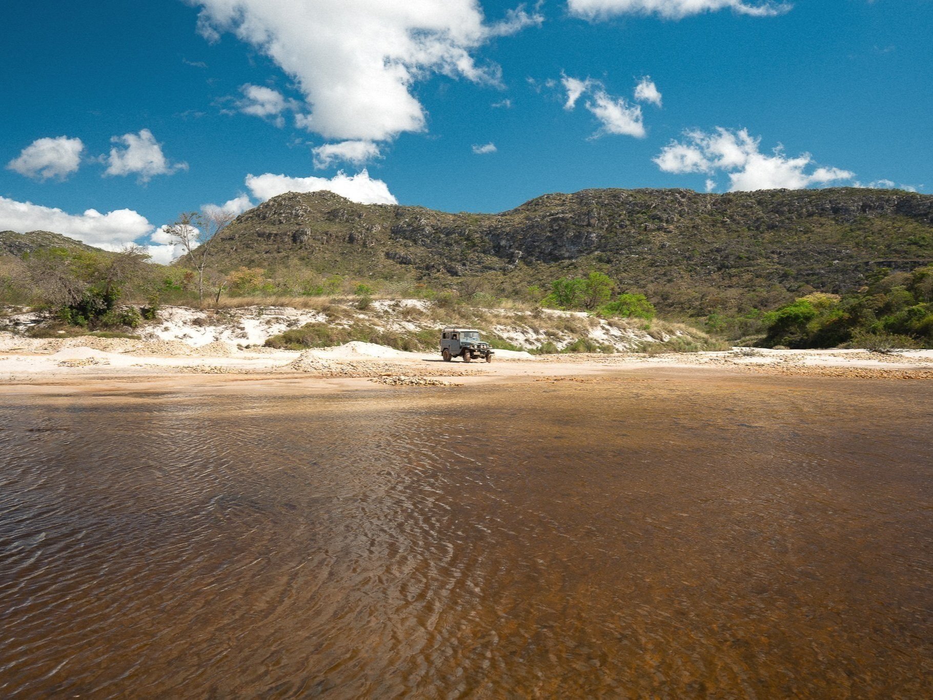
We’ll have plenty of time to reflect on this notion this evening once we get to town, but we’ll have to get there first. To do that, we’ll take the Bandies, first through the dusty, blue-collar mining town of Batatal, then up a hill, then across a river, then up a hill, then another river, then a—well, you get the picture: it’s an over-the-river-and-through-the-woods (or maybe it’s the opposite?) kind of day for us.
We’ll be joined on our roadtrip by “Pe”, our host in Santa Rita this evening, and quite possibly the man who has made the journey from Galheiros the most (literally; he & his wife, Nica, split time living between the 2 communities). We’ll stop for lunch & a café at Sr. Anjo’s ranch in the beautiful, isolated mining community of Buriti along the way. When the rivers are low (as they should be during our trip today), the drive to Sr. Anjo’s from Galheiros takes a bit over an hour and a half. When the rivers are high, the drive can take 6 hours or more, depending on the road conditions.
Santa Rita is just one hour—and about 20 livestock gates—away from Buriti along a scenic dirt road. Pe & Nica’s house is strikingly utilitarian, to the point that it’s charming. Clean, comfy, convenient, and not too much else, with a great shaded front porch for people-watch—er, taking in the views of the surrounding fields—and a cow trail that leads to the town’s “internet station” (you’ll have to see it for yourself). As is the case with just about every square inch of Santa Rita, there’s a great view there, too.
We’re not sure what Nica will be cooking up for us this evening, but we do know this: there are few places on earth where we’d rather be having dinner.
Distance (km): 51 (4x4)
Elevation Gain/Loss/Cumulative (m): N/A
Waterfalls: 1
Conservation Units: 1 (Serra de Minas Municipal Environmental Protection Area)
Accommodations: Casa da Nica e Pe (Homestay; Santa Rita)
Inclusions: Breakfast, Lunch, Snacks, Dinner
Connectivity: Limited Wi-Fi at Bia & Valerio’s House; unreliable 3G/4G/5G during the day; 3G at one very specific spot in Santa Rita

