Chapter IV
The Berço
Dramatic landscapes & thunderous falls. Former slave settlements & decadent colonial-era estates. Wild campsites, intimate homestays, and wood-fired meals over tales of hardship & glory. A slave-built highway cascading gracefully into the City of Diamonds.
Welcome to where our Story began.
Chapter IV: The Berço
22. Santa Rita – Vale do Rio Preto
23. Vale do Rio Preto – Casa Koping
24. Casa Koping – Quarteis
25. Quarteis – Sao João da Chapada
26. Sao João da Chapada – Biribiri
27. Biribiri – Diamantina
28. Diamantina – BH

Day 22
day 22
Santa Rita - Vale do Rio Preto (Sempre Vivas NP)
Our time in the front country has been kind, but just like that we’re back on the outskirts of society. Gone are the Bandies, the horses, the resorts, the ice-cold beers, and—for the next couple of days—the folks, too. Today, we’re heading back into Sempre Vivas National Park for a few more days of pristine cerrado, rocky serras, glorious hinterland hiking, and one breathtaking cachoeira.
The bad news it’s that you’re going to need to put your snake gaiters back on. The good news is that we’re going to be going (mostly) downhill.
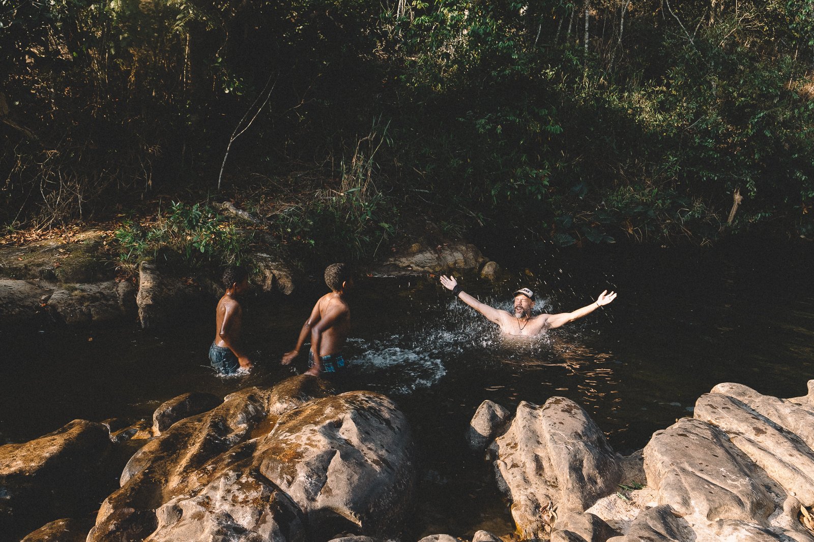
First, we’re going to need to bid ciao to Santa Rita. We waxed poetic about this strangely alluring community yesterday, but the sentiment rings just as true this morning: there are few places on earth we’d rather awake than in Santa Rita. After a simple breakfast of cake, bread, biscuits, and cafe com leite at Pe & Nica’s, we’ll head north along 2 km of gorgeous backcountry roads, past the old church, in the direction of Cachoeira Santa Rita—the future postcard of Sempre Vivas NP and, in our humble opinion, a worthy challenger to Telesforo for the title of “Most Spectacular Waterfall in the Espinhaço”. Pristine, majestic, and appropriately daunting to get to, the falls also mark our grand entrance back onto Park land.
Until recently, only a handful of folks knew about the existence of the waterfall. Since then, the lack of a defined trail & a rope has managed to keep all but the heartiest adventurers at bay. There is a brief (25 meters-ish) section of exposed free-climbing necessary during the descent, and you’ll certainly have the option to not do so. For those who’d like to continue to the bottom, we’ll take an hour or so to swim, lunch, and enjoy the view at the base of the waterfall before climbing back up the canyon walls and beginning our hours-long descent through the Vale do Rio Preto.
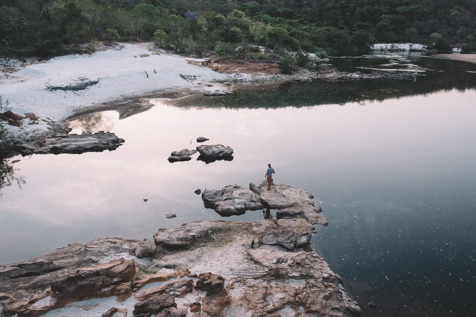
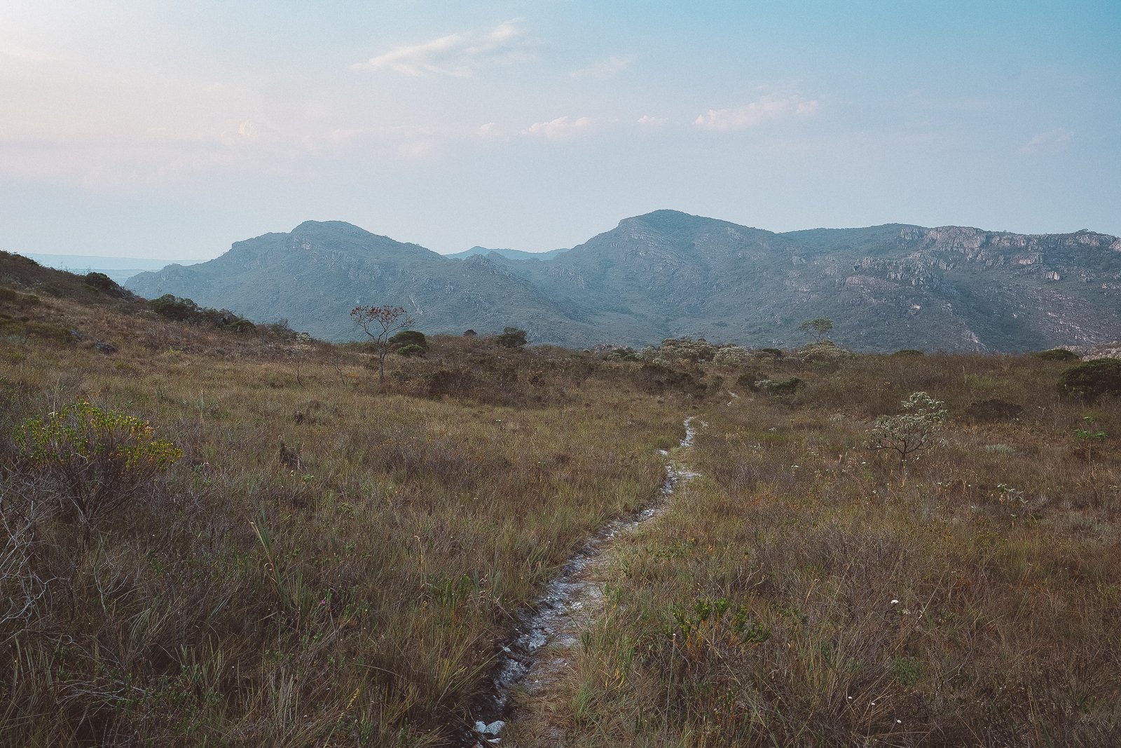
Much of Sempre Vivas is, simultaneously (and perplexingly; it’s a long story) privately-owned, and for much of the day, we’ll be trekking through Pe’s family’s sprawling former ranch, which… is also currently, well, a working ranch. The scenery is as Tolkienesque as this part of the world gets: a frost-tipped cola-colored river winding lazily through grassy hills and rocky cliffs, backdropped by imposing, ever-taller mountains in the distance.
Our destination tonight is the ramshackle, cowboy-style bunkhouse belonging to Pe’s brother, “Lu”, and Lu’s wife Priscilla. Rather than try to make the tiny house work for our group, we’ll make camp on a nearby patch of white sand alongside the river. Tonight’s churrasco is a group effort: we’ll need plenty of firewood, some willing dish-washers, and a few good story-tellers. If we’re lucky, we’ll see every star in the Southern Hemisphere and no creepy-crawlies (or big cats).
There’s no place like Sempre Vivas. Welcome back.
Distance (km): 14.5 (Trekking)
Elevation Gain/Loss/Cumulative (m): 333/501/834
Waterfalls: 1 (Santa Rita)
Conservation Units: 2 (Sempre Vivas National Park; Serra de Minas Municipal Environmental Protection Area)
Accommodations: Lu’s shack (Wild Campsite; Vale do Rio Preto)
Inclusions: Breakfast, Lunch (Trail), Snacks (Trail), Dinner (Trail)
Connectivity: Weak & unreliable 3G at one very specific point in Santa Rita in the morning; no reliable connectivity thereafter
vale do rio preto #1
Vale do Rio Preto #2
Day 23
day 23
Vale do Rio Preto - Casa Kolping (Sempre Vivas NP)
The first time we traversed the Rio Preto River Valley during an exploratory trek in October 2021, we knew we had just done something special. In a land with thousands of km of beautiful trails, this alluring stretch somehow manages to be something more—a secret carousel of raw & lush dreamscapes over engaging & technical terrain with a story-book ending, the journey lingers on the mind more like a wild & urgent ride than a trek in a Park.
So perhaps we shouldn’t have been surprised when the Brazilian copy of Go Outside magazine recently named it one of the 5 most beautiful treks in the country, alongside iconic traverses in some of Brazil’s most-visited National Parks (including a pair of deservedly world-famous treks in Chapada Diamantina & Mount Roraima).
Awaking on the white sand shores of the pristine, cola-colored Rio Preto is a good way to start any day, and a particularly fitting way to start this one. We’ll get a fire going & cook up a simple breakfast while we pack our things & clean the site around us. If you’d like to take a bath, this is a good time, and the river awaits. Today’s a long day, but there’s no rush—much of Chapter 3 was about destinations; the next couple of days are all about the journey.
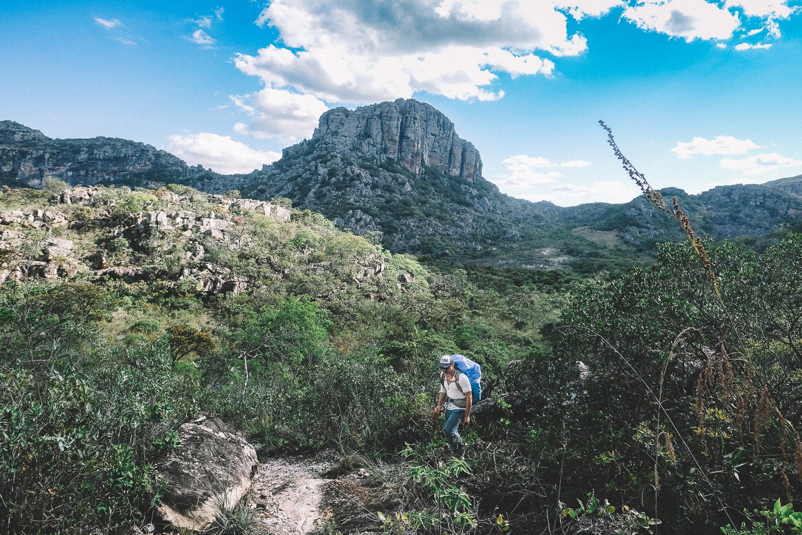
Over the course of our 14 km, we’ll traverse messy peat bogs & marshes, dirt trails & neglected pastures, cactus groves & riparian forests. We’ll pass through a handful of abandoned ranches, cross a number of small streams, and, towards the end of the afternoon, climb further into the serra. By nightfall, we’ll find ourselves back on breezy, open, white sand trails, with a flat, moonlit final 5 km to our final destination.
Once upon a time, the Fazenda Kolping was a working ranch. Today, it’s an unofficial safe haven within the Park, its main house serving as the bunkhouse for the Park’s lone team of bombeiros (firemen). It’s a tough job, with hazardous work, rustic living conditions, demanding schedules (most of the men work 2-week shifts), and strikingly little in the way equipment, but it’s a prestigious one (openings are filled via a lottery system available only to men from the communities bordering the Park), and a source of great pride for those chosen to serve. Short-term work contracts mean that the faces on the team change often, but the men are usually delighted to receive us—its not every day that they get visitors, let alone travelers who’ve spent a week exploring the hinterlands where they are called to fight fires.
We’ll sleep in the bunkhouse tonight, or make camp on the grounds outside of it if necessary. There are usually copious amounts of carbohydrate-rich, canned good-inspired camp grub (pasta, rice, beans, etc.) on hand, but tonight we’d like to cook up a special feast for our hosts. Full bellies, good conversation, starry skies, and a little cachaça (also usually on hand) set the stage for what promises to be a once-in-a-lifetime conclusion to yet another epic day in Sempre Vivas.
Distance (km): 21 (Trekking)
Elevation Gain/Loss/Cumulative (m): 639/373/1012
Conservation Units: 2 (Sempre Vivas National Park; Serra de Minas Municipal Environmental Protection Area)
Accommodations: Casa Kolping (Park Station-Sempre Vivas NP)
Inclusions: Breakfast (Trail), Lunch (Trail), Snacks (Trail), Dinner (Trail)
Connectivity: N/A
fording the rio preto, SEMPRE VIVAS NP
Rio Preto Trail, Sempre Vivas NP
Day 24
day 24
Casa Kolping (Sempre Vivas NP) - Quarteis
Rambling northwestwardly from the lush Indaia groves of Macacos, in the south, to the dusty lowlands of Curimatai, in the west, and fit for very selected vehicular travel (winch required), the Park’s main road is arguably as beautiful as any other trail in the campos. In fact, were it not for the Toyota Hilux tire tracks running through Campos Domingos (a sign that our bombeiro friends have been making their rounds), we’d probably call it a trail.
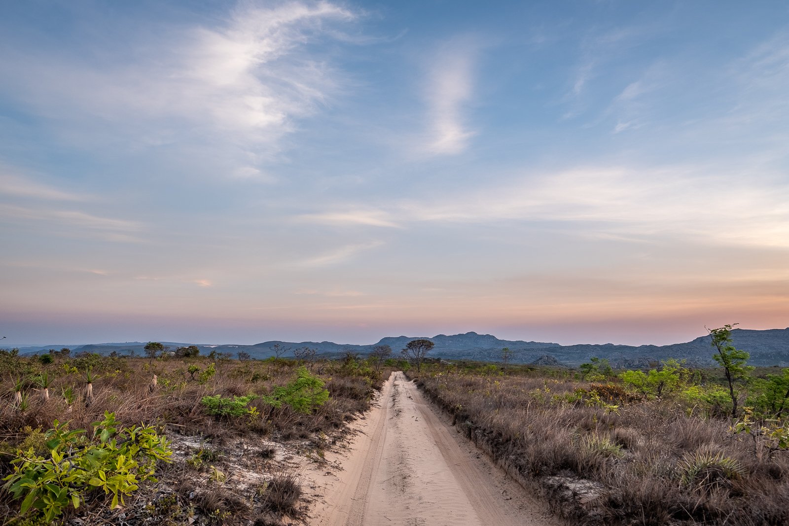
Arising in Macacos as a defiant red dirt mess, the road climbs quickly into the Park over large rocks & shabby wooden bridges, eventually becoming a double track of marshy white sand, then beachy golden sand, then foreboding piles of sharp rocks, as it ascends ever further into the flower-rich highlands where we’ll begin our journey today. It’s an off-roader’s dream, but just part of the regular commute for the bombeiros, as well as the men & women who come from nearby Macacos to pick flowers each season.
We’ve spent 5 full days in Sempre Vivas National Park without coming across the main road and, while we don’t usually get too excited by the prospect of walking on thoroughfare fit for vehicles, this one is a notable exception. Breezy, lined with gorgeous campo sujo, and backdropped by giant views of the surrounding serras (you can even see Diamantina at times), it makes for an incredibly pleasant trek, and becomes a venerable dreamscape during dawn & dusk.
We’ll have the pleasure of walking 10, mostly downhill km along the road en route to the Park’s southern entrance in Macacos (pop. 25), a bucolic colonial-era settlement that served as a barracks & lookout point for Portuguese soldiers during the region’s diamond-mining heyday. After a hearty lunch at local flower-picker Erica’s house, we’ll turn westward and trace the Park’s lush southern border to another former barracks & lookout point, the enchanting quilombo of Quarteis do Indaia.
At the risk of creating expectations it never asked to fill, “Quarteis” (pop. < 25) is the type of unique destination capable of overshadowing even the most memorable journey to get there. Tranquil, exotic, picturesque, and full of soulful vibes, with little to do besides live, it’s the type of place that punches well above its weight in terms of allure (if we were to take another Rest Day during our journey, Quarteis, Santa Rita, and Galheiros would be the obvious candidates, and for this reason).
Our accommodations tonight at the enchanting Maquemba Eco-Chalet include two stand-alone kitchenettes (good for 1 couple each) and an impressive 3-bedroom house that doubles as the hamlet’s oldest structure. There are steamy hot water showers on site, as well as a blissful garden & patio area (replete with fire pit) for downtime. We should have plenty of time upon arrival to organize our packs and get cleaned up before tonight’s dinner appointment at Sinara’s house, just a few (very cute) doors down.
Visiting with Sinara and her family is a highlight of any trip in the region, and her cooking (heaping portions of wood-fired comida Mineira) never ceases to hit the spot. If our calculations are correct, you’ll be stuffed & just about ready to call it a day by the time we make our way onto the softly-lit dirt road outside her door, but tomorrow is a relatively easy day (you can sleep in), and the night is still young. If you’d like to extend the evening a bit, there’s a highly photogenic speak-easy stocked with cachaças and (you guessed it) ice-cold beer just steps away from our front door.
Our journey is winding down, but there are still plenty of moments to be had. Here’s to making each one count.
Distance (km): 17 (Trekking)
Elevation Gain/Loss/Cumulative (m): 330/643/973
Conservation Units: 1 (Sempre Vivas National Park)
Accommodations: Maquemba Eco-Chalet (Historic Home; Quarteis)
Inclusions: Breakfast (Trail), Lunch (Trail), Snacks (Trail), Dinner
Connectivity: No connectivity at Casa Kolping; sporadic 3G/4G on the trail; limited 3G/4G in Quarteis.
Maquemba Chalet #1, quarteis
igreja, quarteis

Day 25
day 25
Quarteis - São João da Chapada
The winding 10-km trail that separates the sister communities of Quarteis and São João da Chapada is short & sweet (albeit a bit vertical), but today’s journey is about much more than the trail. Historic, little-visited, and largely ignored by the powers that be in Diamantina, the two communities we’ll be traversing today epitomize the essence of both this Chapter and the deep heart of this region.
Broken but beautiful, São João (pop. 1,581) is striking: tattered historic homes, terrible roads, visibly poor residents, and very little in the way of commerce. Despite the town’s theoretically privileged location along the only dirt road between Diamantina (just an hour away) and Sempre Vivas, there are no touristic trappings here. In fact, given its relatively large population, there aren’t many non-touristic trappings either: a lone, barebones family-run grocery store populates the main square, there are no restaurants or hotels, and butecos seemingly outnumber all other establishments—a stark & nightly reminder of the town’s economic plight since its heyday during the diamond days.
Looks can be deceiving, though, and what São João lacks in charm & approachability, it makes up for with deep soulfulness, a storied legacy, and a profoundly unique air. Not since Mendanha & Inhai (back on Day 10) have we visited a colonial mining town, but unlike those communities, whose residents have the luxury of asphalt nearby, the road to São João is all but forsaken, effectively isolating it. Bucolic Quarteis, just 9 km away, feels a world away, and yet that sentiment couldn’t be further from the truth: the two communities are inextricably linked on this island, with common grievances & ways of life tying families together for centuries.
We’ll start our day with breakfast at Sinara’s house in the verdant, rural hamlet of Quarteis. After a simple, but delicious breakfast of homemade cakes, coffee, and juice, we’ll have the morning to wander the town & enjoy the local swimming holes, including 2 small “waterfalls” and a plethora of scenic riverscapes. There are a handful of young, fun-loving kids in the community, many of whom get curious & excited about visitors. Parents (& chores) allowing, they may decide to join us for a swim, which is always a treat.
At around midday, we’ll head back to Maquemba for a quick lunch, pack our things, and meet up with Poliana, the industrious mother of several of said fun kids. Together, we’ll begin our winding, 3-hour climb up the hidden backcountry trail to São João, stopping occasionally at streams & to take in big views of the valley below. It’s an incredibly pleasant little hike, made even better by the company we find ourselves in.
Our accommodations in São João this evening will be at the lovely, low-key elegant residence of Dona Sueli, a soft-spoken local who has seen the town’s fortunes change in recent decades and has stories to tell. The rooms are spacious & comfortable, there is piping hot water (from the wood-fired furnace) for baths, and the house’s downtown location feels much more tranquil & tucked away than it should. We’ll have plenty of time to chat with Sueli and get cleaned up before making our way over to Dona Maria’s house for dinner.
As far as we can tell, there are no formal restaurants in São João, but Dona Maria has been serving up mammoth portions of flavorful down-home comida Mineira to researchers visiting the Park for decades. A former flower-picker, she’s walked this part of the region as much as anyone, and has plenty of her own stories to tell. With dozens of kids & grandkids living within walking distance, Dona Maria’s house (& cooking) gets popular in the evenings, so don’t be surprised if dinner turns into something of an event. For those who’d like to mingle with the locals afterwards, there are a number of rustic butecos in town that serve cachaça & ice-cold cerveja into the night.
In what can only be considered a delightful plot twist, given its altitude, São João hosts many of the region’s cellular towers, and consequently possesses arguably the best 4G signal in the entire region.
Distance (km): 9 (Trekking)
Elevation Gain/Loss/Cumulative (m): 459/21/480
Waterfalls: 0-2 (optional; names unknown)
Accommodations: Casa da Sueli (Homestay; São João da Chapada)
Inclusions: Breakfast, Lunch (Trail), Snacks (Trail), Dinner
Connectivity: Limited 3G/4G in Quarteis; strong 3G/4G/5G in São João da Chapada
local guides, Quarteis
local watering hole, Quarteis
Day 26
day 26
São João da Chapada - Biribiri
Just a century ago, the myriad vista-blessed trails between São João da Chapada and what is now known as the Vila do Biribiri (or simply Biribiri) would have been littered with travelers: miners bound for newly discovered sites at Rio Pardo & Campo Sampaio (near Macacos), tropeiros from the sertão bound for Diamantina, school children from Pinheiros & the surrounding valleys coming to & from São João, and textile merchants bound for Biribiri. Today, save for a handful of brave dirt bikers and the heartiest of rural locals, the vast network of trails in this part of the region are empty, a testament to both the transformative effect of the automobile and the end of the diamond era.
There are no boring ways to get to Biribiri from São João. Situated atop a rocky high plateau some 1,400 m above sea level, with wide open views of Sempre Vivas (to the north) & Biribiri State Park (to the east), São João is the highest district in all of Minas Gerais, and an exemplar of the campos rupestres ecosystem responsible for so much of the Espinhaço’s biodiversity. Meanwhile, Biribiri, some 20 km to the southeast and 400 m below, is a bonafide wonderland of cerrado forest.
Following a simple but nourishing breakfast at Sueli’s house, we’ll descend steep urban trails from São João to the rocky pastures of Formiga. We’ll then continue our eastward descent along a mixture of historic trails & little-used backroads, through increasingly-forested vegetation, to the lush Pinheiro River Valley, where we’ll stop for lunch on the beautiful pebble-strewn shores of a once-prolific, but now little-visited mining site-turned-swimming hole called Lavrinhas. From Lavrinhas, it’s just 6 km across the river and along scenic dirt roads to our final destination this evening, the postcard-perfect vila of Biribiri.
One of three major textile mills to have flourished in the region in the early 20th century (the others being the Fábrica de Santa Barbara & the still-functioning Fábrica São Roberto, in nearby Gouveia), the now-inactive Fábrica de Biribiri was once a pioneering social enterprise, providing employment, housing, and “rehabilitation” to as many as 300 employees at the height of its operation at the turn of the 20th century. The mill’s majority-female, all-Catholic workforce included hundreds of spinners, weavers, kitchen maids, cooks and office assistants, with men serving as carpenters, mechanics, blacksmiths, drivers, and (in a sign of the times) managers. The substantial workforce, combined with the mill’s relative isolation, eventually necessitated a church, school, market, barbershop, and other social trappings, turning the vila into a full-fledged community.
Today, Biribiri functions as a sort of gated weekend community for Diamantina’s wealthier classes (the vila was sold to a developer following its closure in the 1970s), who come to bask in the waterfalls of the surrounding State Park and kick back cold craft brews at the local pub. It’s also become something of a hotspot for mountain bikers, who come from across the state to pedal the scenic double track… and kick back cold craft brews at the local pub.
Tonight, we’ll be staying at the community’s lone pousada, mere steps from said pub. Rooms are simple but spacious, the showers are hot, and there’s a backyard patio that’s great for hanging out after hours. There is a good selection of comida Mineira on the menu, and (of course) cold craft brews, as well.
It’s easy to pass time in Biribiri. Historic yet modern, urban yet rural, rustic yet comfortable, and surrounded by agua, serra, and cerrado. It is, almost inarguably, the best possible place to spend the penultimate night of our journey, and our final evening on the trail together.
Tomorrow we’ll complete our transition back to civilization. Tonight is ours to celebrate how far we’ve come together.
Distance (km): 19.5 (Trekking)
Elevation Gain/Loss/Cumulative (m): 415/805/1220
Waterfalls: 1 (Lavrinhas)
Conservation Units: 1 (Biribiri State Park)
River Crossings: 1 (Pinheiros)
Accommodations: Pousada do Vila do Biribiri (Historic Inn; Biribiri State Park)
Inclusions: Breakfast, Lunch (Trail), Snacks (Trail), Dinner
Connectivity: Strong 3G/4G/5G in São João da Chapada; unreliable 3G/4G on the trail; weak Wi-Fi at Pousada Vila do Biribiri
Vila do biribiri, biribiri state park
Fingerfoods & Craft Beer, Biribiri

Day 27
day 27
Biribiri - Diamantina
There’s nothing like arriving in big city lights after 4 weeks on the trail; no place like Diamantina during a Vesperata; and no better way to conclude a journey in the Serra do Espinhaço than by descending the surreally gorgeous, awe-inspiring Caminho dos Escravos.
Not that there’s anything ordinary about the rest of our journey today. Located just a dirt road (& a wild hair) away from 50,000 residents, Biribiri State Park may be the most visited conservation unit in the Espinhaco, but the vast majority of the visitors stick to the road & roadside waterfalls, meaning there’s a good chance we’ll be able to enjoy one last day of empty trails before descending into the throngs of jubilant revelers in downtown Diamantina this evening.
We’ll get things started with the breakfast buffet at our pousada in the vila before strapping on our packs one last time. Well-kept trails, pristine cerrado, and a pair of picturesque waterfalls (often humming with local traffic on Saturday) await, as does a perfectly-situated lookout point atop the serra, from which we’ll be able to view, for the first & only time during the Expedition, our entire journey in panoramic fashion. Following a very momentous lunch (and obligatory photo session) at the lookout point, we’ll cut through fields of campo limpo along trails maintained by the Universidade Federal dos Vales do Jequitinonha e Mucuri (or UFVJM, for short; the local university) and begin our descent in the direction of the Caminho dos Escravos.
Even for fiercely independent, non-touristy types, the Caminho is can’t-miss material. Hundreds of thousands of large stones, stacked several layers deep and arranged in mind-numbingly perfect fashion, line the steep southern face of the serra as it cascades towards Diamantina; a red carpet to the City of Diamonds, built by slaves. As of writing, there is talk of installing handrails along the Caminho, but even over-the-top touristic trappings would do little to spoil the spectacle.
As if to make the whole experience more memorable, the final stretch of trail, in Diamantina, appears as painstakingly unplanned as the top section was planned: at around the 1 km mark, the glorious Caminho completes its reverse-metamorphosis into a nondescript urban trail (replete with beer cans, broken glass bottles, & kite string), before ending in Diamantina’s only favela.
We’ll pile into the Bandies near the end of the trail and ride back to the UNESCO World Heritage city center, where our accommodations await, and where the Vesperata festivities will begin at 8pm. We’ll be sleeping in style this evening, at Pouso da Chica, a gorgeous historic mansion tucked away on a cobblestone street just 100 m from where tonight’s action will be. We’ll also be dining in style, at nearby Relicario (reservations at 6pm), home of Diamantina’s most celebrated chef, whose sophisticated takes on comida Mineira will provide you with a completely different perspective of the state’s cuisine.
The Vesperata begins at 8pm & lasts until 10:30pm, and our group has a table reserved right in the middle of it. You can stick around throughout the show, or you can leave once you get the gist of it (the people-watching never stops, but some might find the scene a bit repetitious) and explore the bustling bohemian becos of Diamantina on your own. It’s been an unbelievable journey, and there’s not a better place on the planet we’d rather celebrate it.
It’s Saturday night! The city is yours to enjoy. You’ve been here before, but tonight, we guarantee you’ll see it with new eyes. Aproveitem!
Distance (km): 15.5 (Trekking)
Elevation Gain/Loss/Cumulative (m): 612/413/1025
Waterfalls: 2 (Cristais, Sentinela)
Conservation Units: 1 (Biribiri State Park)
Accommodations: Pouso da Chica (Historical Inn-Diamantina)
Inclusions: Breakfast, Lunch (Trail), Snacks (Trail), Dinner
Connectivity: Weak Wi-Fi at Pousada Vila do Biribiri; 3G/4G/5G throughout Diamantina (tends to be a bit slower in the historic center); Wi-Fi at Pouso da Chica
Vesperata, diamantina
Vesperata, Diamantina

Day 28
day 28
Diamantina - Belo Horizonte
We’ve chased the ghosts of prolific 19th-century naturalists down centuries-old trails pioneered by miners, slaves, smugglers, and tropeiros; ventured deep into one of the wildest stretches of high savanna in the country; ridden with cowboys (and lounged like nobles) in the dusty sertão; and traversed the forgotten corner of the Espinhaço, where it all began.
We’ve climbed Itambé; navigated Inhacicão; swam in Telesforo & Santa Rita; and slept in all manner of places, in all types of communities.
We’ve broken bread together a hundred times, stretched our limits at least that many times, and celebrated countless more.
We’ve dived deeply into the Story of Brazil, discovered a lot about ourselves & the world around us, and left households & communities better than we found them in the process.
It’s been a journey. By our calculations, we trekked 436.5 km in the Espinhaço, and overlanded another 411 km to this point. There are just 267 km (around 7 hours, including stops) left to Confins International Airport, and two ways to get there (backcountry trails not included).
We’ll take the scenic route, along the Estrada Real—through São Gonçalo do Rio das Pedras and Milho Verde, Diamantina’s sister city Serro, and wondrous Serra do Cipó National Park—and say our good-byes at the terminal in Confins.
It’s time to rest weary feet, upload photos, and reflect. The next chapter is yours to write. Wherever your path may take you, we hope you’ll see it with new eyes. We believe you will.
That’s the gift of go.
Distance (km): 267 km (Overland)
Inclusions: Breakfast, Lunch


